

Aerial photos of Tucson, Pima County, in 1980
Much of the development and road improvements of the 1980s were on the outer limits of Tucson's metro area.
The rural feeling of places like Swan and Sunrise and Ina and Oracle began to fade as housing and retail developments ate up open desert.
Photos © Arizona Daily Star or Tucson Citizen, where applicable
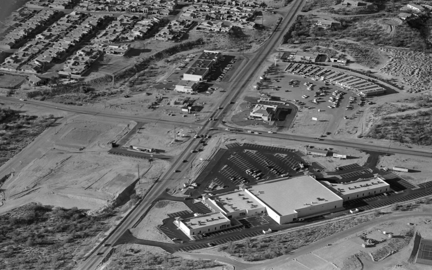
Swan Road and Sunrise Drive in February, 1980. The new Safeway Plaza is bottom right. Catty-corner from the Safeway, a Burger King restaurant is under construction. Across the street, land bladed for a Valley National Bank (now Chase Bank), a restaurant, retail and apartments. The old Rural Metro fire station is behind the street mall at top right.

Oracle Road (left to right) and Ina Road in February, 1980. There were gas stations on three corners of the intersection. All have been demolished. The venerable Casas Adobes Plaza is lower right, now anchored by Whole Foods. The open land at upper right is now the Safeway Plaza. The bank on the corner is still there, but the existing buildings to the right were demolished to make way for parking for the new plaza. Lower left is the property for the Haunted Bookshop, now Tohono Chul Park.

Oracle Road and Magee Road north of Tucson in February, 1980. Plaza Escondida is at right, now anchored by Trader Joe's. The open land at bottom of the photos is now the large retail plaza anchored by Kohl's, Sprouts and Summit Hut. The Circle K (sitting alone, upper left) is now a ballroom dance studio. Note the new asphalt on Oracle Road. In 1977, the state approved a project to widen Oracle Road (a state highway) to six lanes from Ina to Calle Concordia. That may be the last time the road was paved.

Tucson Medical Center in February, 1980. The intersection of Grant and Craycroft roads is at bottom left.

O'Reilly Chevrolet (cluster of cars), then Park Mall (center left) and Broadway Road in February, 1980. The open land at top left is now Williams Centre.

The FICO pecan orchards, bisected by South Nogales Highway, looking north to Sahuarita Road in February, 1980.

Tanque Verde Road (bottom left to upper left) and Wrightstown Road in February, 1980, before the City of Tucson constructed the grade-separated interchange. The first units of the Tanque Verde Apartments are lower left. The Circle K facing Wrightstown at the intersection is now Pair-A-Dice Barbers. The large parking lot and building to the left of the Circle K was the O.K. Corral Steakhouse, which was established in 1968. It closed in 2008. It's now Borderlands Trading Company.

Corona de Tucson Baptist Church, lower right, on Houghton Road south of Sahuarita Road in February, 1980. With exception of some infill housing and a few more trees, the neighborhood looks pretty much the same.

IBM (International Business Machines) on south Rita Road, looking north to the Santa Catalina Mountains in February, 1980. In 1988, IBM began phasing out data storage products manufacturing in Tucson, resulting in the loss of nearly 2,800 workers in Tucson, part of a $600 million consolidation plan.
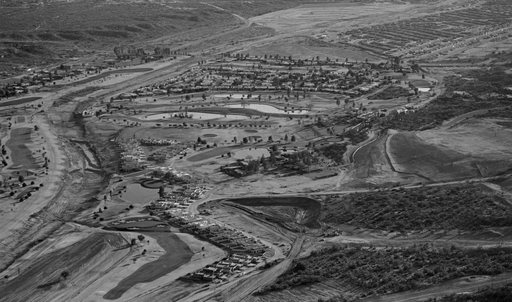
Tucson National Golf Course north of Tucson, looking south, in February, 1980. The Cañada del Oro Wash is at left. Magee Road goes left to right at the top of the photo. Shannon Road curves to the left at top of the photo. That open land is now home to Pima Community College and the YMCA.

Rick Wiley
Photo editor

No family is ever asked for pay for their stay.

Aerial photos from the archives of the Arizona Daily Star/Tucson Citizen. The latest finding from the archive is eight photos from 1975.

Dr. Cara Christ said there has been a sharp drop in the number of people in the state seeking out vaccines.

For Star subscribers: The average price of a new home in the Tucson market has reached an eye-popping amount not seen here before.

For Star subscribers: As the price of single family homes continues to soar, condos are making a comeback in Tucson as alternatives or investments.

For Star subscribers: The local housing shortage means drops in rent are unlikely, but increases are expected to be smaller.

The new signage will encourage drivers to donate to nonprofits instead of giving cash to panhandlers.

The Tucson City Council has appointed former council member Karin Uhlich to fill the city’s Ward 3 seat, which was left vacant following the resignation of Paul Durham.

Every single day, I get emails from readers that say things like this: “My wife and I are getting SSI. And we would like to ask you some quest…

The organization offers a full slate of virtual activities in April, kicking off with a celebration of World Autism Awareness Day on Friday, April 2.

The Senate president is denying that the CEO of one of the firms has links to election conspiracy theories, despite his now-deleted tweets.

Starting this fall, those in Tucson's 520 area code, and 480 and 928 elsewhere in Arizona, will have to dial the area code to make local calls.

Tucson host Garret Lewis interviewed GOP Chair Kelli Ward, inflaming intra-party conflict. Also, a Southern Arizona candidate starts campaign for AG, and U.S. senators voice guarded support for TPD Chief Magnus.
A judge ordered a halt to the Senate's audit of 2.1 million ballots, citing questions about security and secrecy. But it was contingent on the Democratic Party posting a bond to cover potential costs of a delay. The party said no.

Staci Burk alleged widespread fraud and improper tallying by voting machines.
PHOENIX — A group of largely unidentified individuals is asking the Arizona Supreme Court to void the 2018 and 2020 election returns, ranging …

Secretary of State Katie Hobbs says Maricopa County can no longer use the election equipment that the Senate subpoenaed and turned over to Cyber Ninjas. The replacement cost will be substantial.

Director Farhad Moghimi and his supporters at the Pima Association of Governments cite laws and precedents to fend off demands for change. But the agenda for Thursday's board meeting shows change is in the wind.

It will likely take until at least until next spring for the state to reach peak employment levels seen before the pandemic, officials said.

Republican legislators forced Rep. David Cook to vote "no" on their budget proposals at the Capitol while his house was threatened by a wildfire near Globe. His vote made the Democrats' point of view count for something.