Two “adopted” trail segments on either end of the Santa Catalina mountains have expanded outdoors opportunities for mountain bikers, equestrians and hikers, while new trail segments expand wilderness hiking options on the Catalinas' front and a “backside” ridge.
La Milagrosa Trail on the southeast side of the range and parts of the Fifty-Year Trail complex in the northwest foothills have been officially “adopted” by Coronado National Forest, federal and county officials and trail group officials confirmed.
Both were high-priority projects in the Santa Catalina Final Trails Plan released in June 2023.

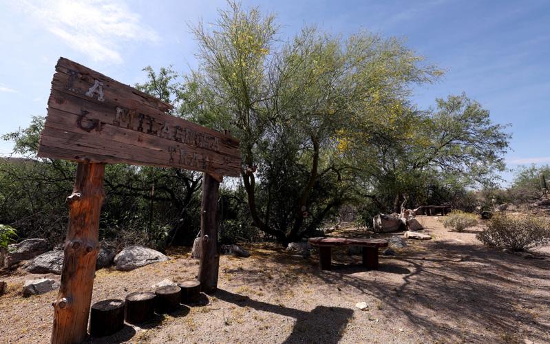
La Milagrosa Trail access, 4996 N. Avenida De Suzenu. The trail on the southeast side of the Catalinas range has been officially “adopted” by Coronado National Forest. La Milagrosa is a popular mountain biking and hiking route. The trailhead starts at the end of a paved private road through the Agua Caliente neighborhood. A homeowner there put up stone and wooden benches shaded by trees near the trailhead along with the carved wooden sign.
La Milagrosa is a popular mountain biking and hiking route about two miles east of the Santa Catalina Highway, linking part of the Bellota Trail (a section of Arizona Trail, or AZT) to the Agua Caliente neighborhood off Snyder Road on Avenida de Suzenu. (Some cyclists ride up and back; others make a loop by riding up the Catalina Highway, taking the AZT east from Molino Canyon over the ridge and dropping down to West Spring, where La Milagrosa departs.)
People are also reading…
The trail, which climbs steeply up a ridge between Milagrosa and Agua Caliente canyons with many rock drop-offs, is the “hardest trail on the mountain for riding bikes,” said Nick Giovanni, president of Tucson Outdoor Recreation Cycling Association (TORCA), a major partner to the Forest Service in bike trail improvement.
“Adoption” means trails created by users are now part of the National Forest system allowing maintenance. “This trail is beloved for its rowdy character,” according to the TORCA website, “so TORCA’s plans primarily are to keep the corridor free from spikey plants and doing tread work as necessary to keep the alignment in place.”
A hiker makes their way to the La Milagrosa trailhead, 4996 N. Avenida De Suzenu. Tucson Outdoor Recreation Cycling Association, or TORCA, a major partner to the Forest Service in bike trail improvement, says, “This trail is beloved for its rowdy character so TORCA’s plans primarily are to keep the corridor free from spikey plants and doing tread work as necessary to keep the alignment in place.”
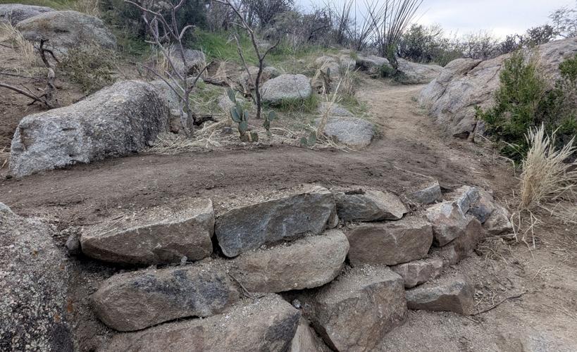
With the trail made official, TORCA members were able to replace a potential safety hazard on the fast descent. La Milagrosa meets a barbed wire fence line about 0.8 miles below the AZT-Bellota junction, Giovanni said. TORCA volunteers replaced a hard-to-see fence and gate with a rollover cattle guard. An anonymous donor provided funds, Bauer Built Trails constructed the rollover; Giovanni and others drove Bellota Ranch Road, then “walked” the heavy metal guard to the site for installation.
The trailhead for La Milagrosa starts at the end of a 0.9-mile paved private road through the gated Agua Caliente neighborhood. Users must park outside on the east side of Avenida de Suzenu or along Snyder Road. An entrance sign from Agua Caliente Homeowners Association asks users not to park in front of the gate, to stay on the road and to pick up pet waste. At road’s end, a wooden trail sign and benches under palo verde trees welcome visitors.
A homeowner from the neighborhood put up the stone and wooden benches shaded by trees near the trailhead, along with a carved wooden “La Milagrosa” sign, said Alacia Sooter, president of the Agua Caliente Homeowners Association.
Sooter and her husband are cyclists, and she said most of the 30 homeowners in Agua Caliente are cyclist- and hiker-friendly. “Probably two-thirds of our neighbors are out on the trail every morning,” she said. “Nobody minds the hikers and bikers coming through; everyone is so nice and friendly.”
The HOA installed the entry sign about eight years ago, when use picked up on Milagrosa and users were parking in front of the gate. “We were concerned about safety,” Sooter said. “We also had noticed people would get here and were confused about which way to go.” The sign directs users to the trailhead and national forest land up the road.
She said safety is why Pima County limits parking to the east side of Avenida de Suzenu. If vehicles park on both sides of the narrow road, it blocks access for residents and potentially for Rural Metro Fire officials or Southern Arizona Search and Rescue in case of emergencies.
Weekend parking can be problematic as there is only space for 10 vehicles along Suzenu, with the overflow on Snyder. A parking lot would be ideal, but could only happen if a landowner donates land for a conservation easement, since all land in the area is private, said Patrick Goodnight, trails program manager with Pima County Land and Resources. Right after the trailhead, La Milagrosa Trail crosses a small segment of Pima County land, but mostly is on national forest.

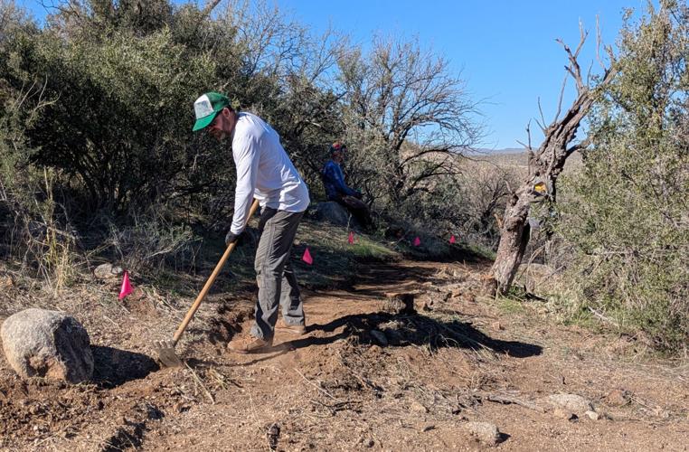
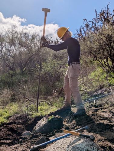
Jesse Stephen does work on the Stone Cactus trail. Stone Cactus Loop will combine parts of the existing Baby Jesus and Cow Pie trails with some new construction along the national forest boundary called Middle Gate Trail. Eric Rulijanich of Outslope Solutions called the work on the trail an “all hands on deck” project with both professional and volunteer trail crews at work
“I am always on the lookout for land in the area,” Goodnight said. “It would be nice to have an easement all the way from forest land to parking.”
Goodnight asked the Pima County Department of Transportation to erect signs on Suzenu stating that parking is allowed from 6 a.m. to 6 p.m., consistent with county park and trail hours. He wants to ensure users stay safe and also respect residents of the area.
The Forest Service also adopted 18 miles of user-created “unauthorized” trails routes and roads on national forest land north of Catalina State Park, all part of the 50 Year Trail system, according to Adam Milnor, recreation staff officer for Coronado National Forest.
Adopting this system was the project most often suggested in public comments on the Santa Catalina Draft Trails Plan. It’s called the 50-Year Trail because state lands along the trails are protected by a 50-year lease agreement between Arizona State Parks and Trails and Arizona State Land Department, which expires in 2038.
Users were concerned because state land could be sold for development after the lease expires. Working groups of forest staff, trail professionals, equestrians, and mountain bikers have helped develop plans for a trail system which avoids archaeological sites, reroutes around steep washes, and offers better connections.

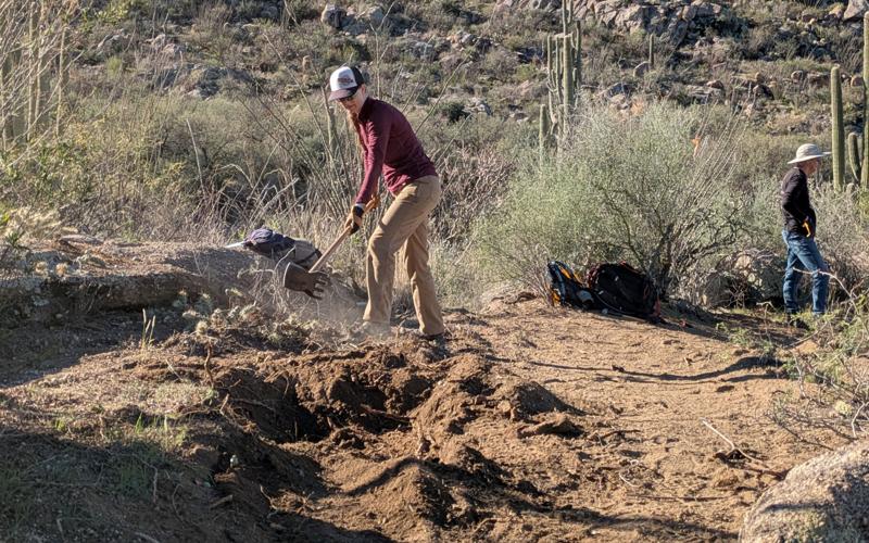
Kristina Giovannucci does work on the Stone Cactus trail. Tucson Outdoor Recreation Cycling Association is sponsoring a monthly volunteer work day on Stone Cactus, often drawing up to 20-25 people doing tread work, moving rocks, and removing brush. Sonoran Desert Bikers has also hosted work days there.
An intended 9-mile loop among the spaghetti system of roads, routes and trails has been named “Stone Cactus Loop” and already shows up on some All Trails posts. It will combine parts of the existing Baby Jesus and Cow Pie trails with some new construction along the national forest boundary called Middle Gate Trail. Eric Rulijanich of Outslope Solutions called the work an “all hands on deck” project with both professional and volunteer trail crews at work.
Rulijanich designed the loop route and is working with his crew on key reroutes of rougher steeper sections of the existing Baby Jesus trail. He said an American Conservation Experience crew will use mechanized equipment (a small excavator) to build a new middle gate boundary section that will complete the loop on national forest land.
TORCA is sponsoring a monthly volunteer work day on Stone Cactus, often drawing up to 20-25 people doing tread work, moving rocks, and removing brush. Sonoran Desert Bikers also hosted work days last October and November, TORCA’s Giovanni said.
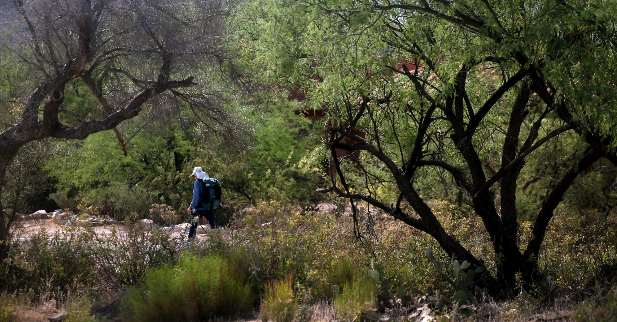
Hikers also gained a new loop on the Santa Catalina front range last February when the Pontatoc connector trail was completed. It’s a 2-mile segment connecting Finger Rock and Pontatoc canyon trails at Linda Vista saddle, offering a 7-mile loop or longer 12-mile trip with out-and-back to Mount Kimball. Much of the hike is in Pusch Ridge Wilderness. Hikers may prefer to hike up Finger Rock and down the gentler Pontatoc addition.

Art White does work on the Stone Cactus trail.
The segment was constructed by Outslope Solutions and WildArizona trail crews in December 2024 and January 2025 with National Forest Foundation funding. For an area trail guide, check out tucne.ws/trails. Rulijanich said his crew will rebuild and reroute a few steep sections of bedrock slab on the Finger Rock Trail this spring.

Technical stone work that was completed this January on Baby Jesus trail, which is to become part of Stone Cactus Trail.
The Outslope crew has also reopened a two-mile section of Samaniego Trail from the Mount Lemmon Trail to Walnut Spring at the base of Samaniego Trail, Rulijanich said. It provides the best view of Oro Valley of any Catalina trails, he added.

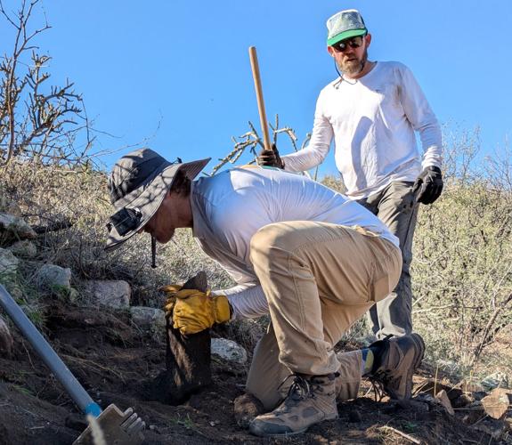
Nick Giovannucci and Jesse Stephen do work on the Stone Cactus trail.
The trail, unmaintained for some time, was heavily burned in the Bighorn Fire which raced up that ridge. “It was nearly impassable,” Rulijanich said. “It took me days to even find the basic alignment.” The crew spent three weeks in October cutting brush, rebuilding the trail, and replacing cairns. “I hope people will get out and hike the trail so we can keep it open,” he said. Southern Arizona Hiking Club and National Forest Foundation funded the project.
Walnut Spring is no longer viable due to fire damage but located in a nice grove of oak trees. Rulijanich said it’s a nice “shoulder season” hike, maybe not good for summer as it requires a 4-mile uphill hike back up to Mount Lemmon. The 0.3 distance to Samaniego Peak has no trail, so “that will be a bit of a scramble for the adventurous.”
Take a trip up to the top of Mount Lemmon with drone footage showcasing breathtaking spots along the way.
Mount Lemmon, with a summit elevation of 9,159 feet, is the highest point in the Santa Catalina Mountains. It is located in the Coronado National Forest north of Tucson.