

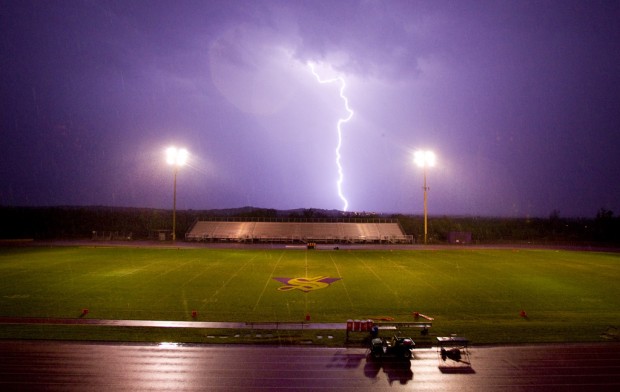
The monsoon was sopping wet this year, but it seemed as if most of the moisture fell from our sweaty brows and not from the clouds.
The seasonal wind shift to southerly, which brings half our yearly precipitation from the mountains in Mexico and the oceans that flank it, did its job quite well.
The skies were laden with rain potential for most of the summer, but actual rainfall in the Tucson area was slightly below normal.
"It was really moist, some of the highest dew-point temperatures we've ever seen," said Chris Castro, assistant professor of atmospheric sciences at the University of Arizona.
The monsoon begins on June 15 and ends on Sept. 30, by National Weather Service declaration, but amateur and professional weather watchers hereabouts still keep an eye on dew-point temperatures to mark the onset of the summer thunderstorm season.
People are also reading…
Dew point, the temperature at which moisture condenses into rain droplets, reached a rain-triggering 54 on July 9 this year but no rain fell on Tucson until the 15th.
The dew-point temperatures then stayed above 54, often well above, until Sept. 9. It was far more humid than normal.
The potential for a very wet summer was there, said UA climate scientist Mike Crimmins, but the other elements never came together for the Tucson Basin.
On some days, clouds left over from storms to the south of us kept our mountains from warming enough to produce thunderheads.
On other days, the mountains were prodigious cloud factories but a lack of steering winds kept those storms from blowing over the valley, Crimmins said.
That's pretty much how the monsoon works, said Erik Pytlak, science officer at the National Weather Service Tucson office.
A lot of elements need to come together to produce rain, with humidity being just one of them.
"It was a pretty humid summer. That's what people are going to remember," said Pytlak, "but the rainfall was average."
The official National Weather Service rain gauge at Tucson International Airport received 5.45 inches of rain - 10 percent below the 6.06-inch average.
Some areas did quite well with rain totals, Pytlak said. "Certainly down toward Sierra Vista and Cochise County in general. The south side (of Tucson) had a couple rip-roaring storms," he said.
On Aug. 24, the south-side Tucson airport gauge received 1.21 inches of rain. Power lines were toppled, cars were stranded in washes and lightning-caused fires in Reid/Randolph Park.
On the northeast side of town, rainfall early in August flooded 20 homes along Tanque Verde Wash.
Just last week, a lunchtime cloudburst dumped more than half an inch of rain on a narrow swath of midtown Tucson, while the rest of the city waited in vain for a promised 80 percent chance of rain from moisture associated with Tropical Storm Georgette.
That's the monsoon - erratic, not democratic, Pytlak said.
"It really was pretty average, with the typical 'my neighborhood got it and not yours.' "
In Southern Arizona, there was an east-west divide, Pytlak said. East of Tucson, rain fell generously. The western deserts, usually dry, were even drier.
Crimmins, an extension scientist, regularly visits ranchers and land managers in southeastern Arizona. It was a good year for summer grasses. The cows and the ranchers are quite content, he said.
The same cannot be said for Crimmins' east-side neighborhood, where rainfall was below normal. He said he's miffed, like many Tucsonans, that he sweated so much this summer for such scant reward.
Contact reporter Tom Beal at tbeal@azstarnet.com or 573-4158.


