


Since incorporating in 1977, Marana has seen its town boundaries stretch in nearly every direction, going from a small patch on the west side of Interstate 10 to a sprawling community that resembles a cartoon speech bubble when you look at on a map.
Along the way, though, Marana's growth has hopped, skipped and jumped over a handful of areas that, for whatever reason, did not fit into the town's expansion plans at the time.
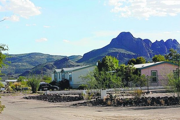
Known as "county islands," these pieces of land show up as white spots on maps that use color shading to indicate incorporated towns, but though they aren't officially part of a town or city, the people who live there often use the services of the town surrounding them.
"They go to our schools, they attend our churches, they are active in the community," Marana Mayor Ed Honea said. "I consider them Marana residents."
People are also reading…
Most of Marana's annexations have resulted in the town's borders expanding as it seeks out land on its edges that fits in with the town's future plans. Those acquisitions usually entail land that has existing or future commercial development, which would generate sales-tax revenue, or land ripe for residential development where impact fees could be imposed before homes are built.
The last annexation of an island came in 2003 when Marana added a triangle-like section south of West Avra Valley Road on the west bank of the Santa Cruz River. That acquisition actually turned one large county island into two smaller ones.
The town continues to explore possibilities to move its borders outward, but there is also a renewed emphasis on trying to fill in many of the unincorporated parcels on the interior.
"We do have a lot of people who are interested in being annexed into the town, but our priority is on the islands," Town Manager Mike Reuwsaat said.
Getting an area to be part of Marana takes more than just identifying land to annex and then pulling it in. Annexations require signatures from a majorityt of the property owners in an area, as well as owners who make up a majority of the area's total property value.
That means, oftentimes, trying to persuade the people within an area — but not if it means causing too many headaches.
"We're not looking at hostile annexations. We'd just like to make our boundary whole." Marana Planning Director Kevin Kish said. "Historically and typically the (town) council looks for . . . at least 70 to 75 percent of people wanting to come in."
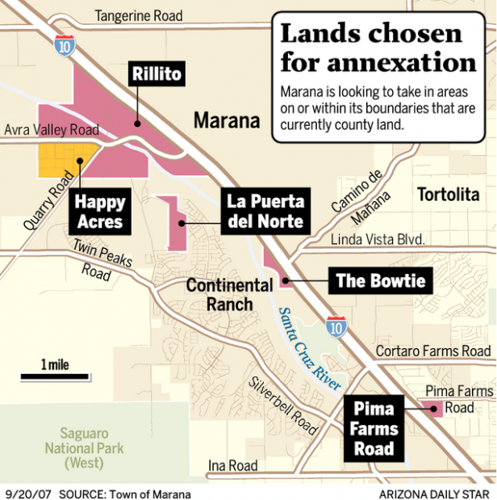
THE BOWTIE
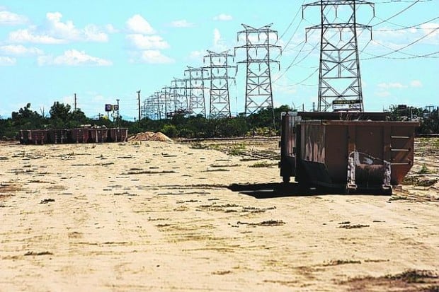
This small stretch of land — known commonly as "the bowtie" because of its shape — is along the eastbound I-10 frontage road north of West Cortaro Road. It is home to more than a dozen small businesses such as Marana Feed and Supply, Linda Vista Rent-All and Cutler Landscaping.
Soon, though, most if not all of those operations will be moved out to make way for the planned Twin Peaks freeway interchange.
"We are going to be in the way," said Scott Anderson, manager of the Pioneer Landscaping Materials facility that lies smack-dab in the middle of where West Twin Peaks Road will come through to connect with and cross over I-10.
"We would have liked to have stayed here, which was our initial hope, and just move part of our business to another location, but that wasn't possible."
Anderson said Pioneer is working with a local right-of-way relocation company to find a new spot for its business, and it would like to stay close to its existing property because it feels the area will become a prime commercial district once Twin Peaks comes through.
That's just how Marana sees this land, which town Planning Director Kevin Kish said is certain to be a target for annexation once all the plans for the road project are finalized.
"There's some pretty good prime real estate that's going to pop up there," Kish said.


