


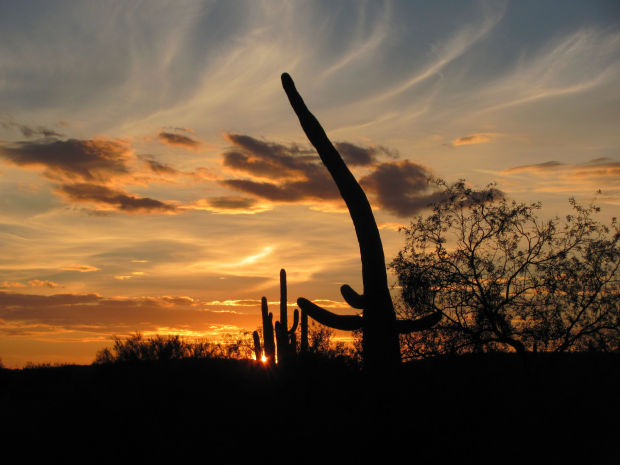


A hawk soaring high over Sabino Canyon gets a grand overview of the world below: walkers who appear barely bigger than ants, visitor shuttles looking like Tinker Toys on the canyon road, and Sabino Creek winding in a glistening ribbon past sticklike saguaros.
Hikers experience a similar bird’s-eye view as they ascend the Phoneline Trail etched into slopes above the popular canyon northeast of Tucson.
“Wow! The views! This trail is absolutely gorgeous,” said Andree Dupont who hiked the trail recently with Dave Pillmore. “And it’s wonderful to have that water” flowing in Sabino Creek far below the trail.
HIKERS HAVE OPTIONS
The Phoneline Trail — once the route of a no-longer-operating telephone line — extends about 5.5 miles, including connecting segments, from the canyon visitor center to the upper end of the canyon road.
People are also reading…
A round-trip trek up and down the trail totals about 11 miles. Another option is to hike up the trail and return to the visitor center along the 3.9-mile canyon road — a somewhat shorter round-trip hike.
It’s always possible of course just to hike part of the way up the trail — a mile or two perhaps — and then return for a less-strenuous hike.
And hiker Joan Cooney suggests another option: “We take the tram (visitor shuttle) to the top of the road and then walk downhill on the Phoneline Trail” back to the visitor center.
WALK THIS WAY
A hike, or run, on the Phoneline Trail includes stretches that are flat, steep, wide, narrow, low, high, dry, wet, easy and a bit challenging.
In other words: lots of variety.
Hikers start at the southeastern corner of the Sabino Canyon parking lot and follow a flat, road-width trail heading east. That trail segment, which is part of the Bear Canyon Trail, extends 0.4 of a mile to the Bear Canyon Road. After turning right on the road, hikers follow it another 0.4 of a mile — over a stone bridge across Sabino Creek — to the signed beginning of the Phoneline Trail.
So much for the flat terrain.
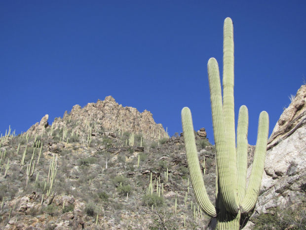
The Phoneline Trail ascends — gradually and sometimes not so gradually — through grand stands of saguaros and other desert vegetation for a mile to a junction with the Phoneline Link Trail.
This is your first opportunity to excuse yourself from continuing the upward march, which gains roughly 1,000 vertical feet over the length of the trail. Simply follow the Link Trail downhill to a connection with the main canyon road, which will lead you back to the visitor center. Nice short hike. Nice scenery. No sweat.
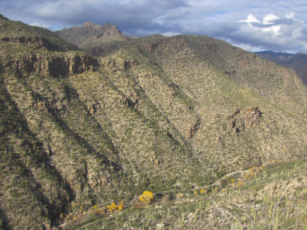
Those who continue on the Phoneline get ever-more-expansive views of deeply cut Sabino Canyon and higher reaches of the Catalina Mountains.
“Magnificent!” said hiker Janice Lefkowitz, a visitor from Michigan.
“We don’t have access to mountains where we live, so we find this pretty challenging,” said Lefkowitz’s husband, Paul.
The trail winds and climbs — passing below the cliffs of Saddleback Ridge and the knob of Thimble Peak.
Now and then a trail runner — the route is popular with these aerobic animals — will trot past those who are moving at a hiking pace.
Finally — thankfully, in the view of many hikers — the Phoneline reaches a junction with the Sabino Canyon Trail that leads to Sabino Basin. Unless you’re looking to extend your trek, pass on the Sabino Basin option and follow the Sabino Canyon Trail a half-mile downhill to the upper end of the main canyon road.
DOWN THE ROAD
If you seek more of the bird’s-eye experience, simply turn around when you reach the road and follow the trails back the way you came.
For a more riparian return, follow the road downhill back to the starting point and parking lot. You’ll likely encounter quite a few walkers and some canyon shuttles — no longer looking like Tinker Toys — as you walk down the road, but you’ll savor a stream-side experience as the road follows Sabino Creek for much of the way.
CAUTIONS
Some sections of the trail pass above fairly steep slopes. Stay well back from the edge and keep a close eye on younger members of your hiking party.
In a few spots along upper reaches of the route, the trail is somewhat narrow. Move carefully in these areas and watch your footing.
GET TO THE TRAILHEAD
Sabino Canyon is at 5700 N. Sabino Canyon Road. The U.S. Forest Service charges a $5 per vehicle parking fee.
The trail begins at the southeastern corner of the parking lot.


