

Fotos: El Río Santa Cruz en Tucsón
The Santa Cruz River was the lifeblood of Tucson for early Native Americans, the Spanish Conquistadores and early American settlers. It languished for years and became dry most of the year as the water table dropped. It also became a neglected trench and trash heap. City leaders envisioned something better. By the early 1970s, the Army Corps of Engineers was studying the feasibility of channeling the river and creating a park. In 1977, work began. It is now a lush part of downtown and an integral part of The Loop bicycle and pedestrian trails.
Santa Cruz River
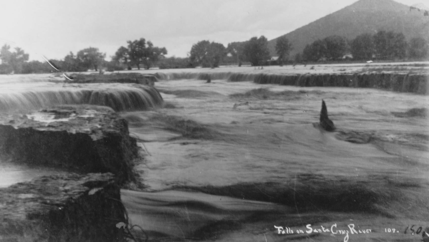
Waterfalls on the Santa Cruz River in 1889 near Sentinel Peak in Tucson.
Santa Cruz River

Girls in Santa Cruz River,1889-1890.
Santa Cruz River
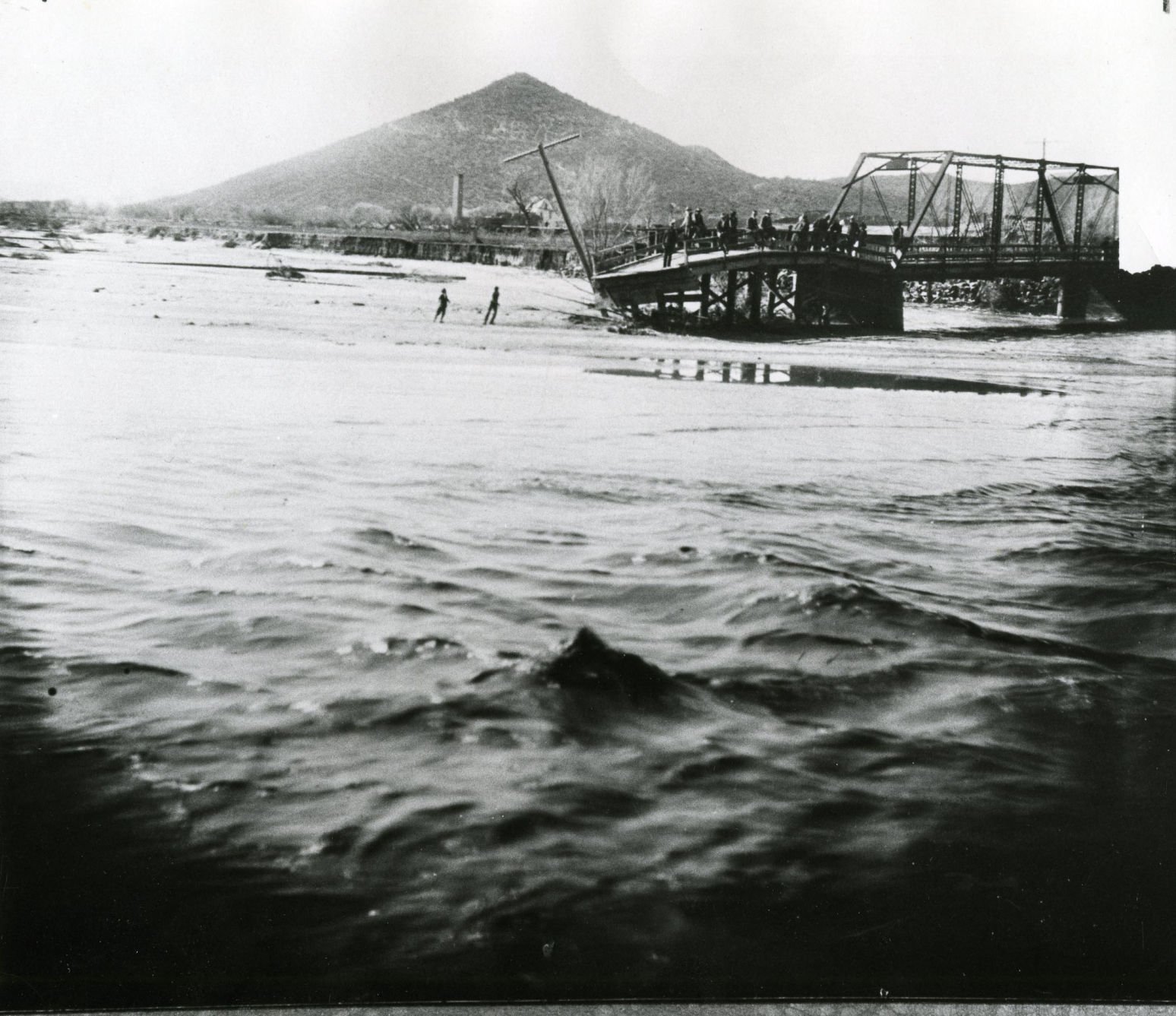
A bridge over the Santa Cruz River near Sentinel Peak in Tucson washed out during flooding in 1915.
Santa Cruz River
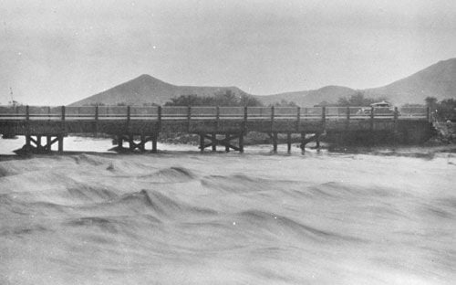
Santa Cruz River at St. Mary's Road bridge in 1931.
Santa Cruz River
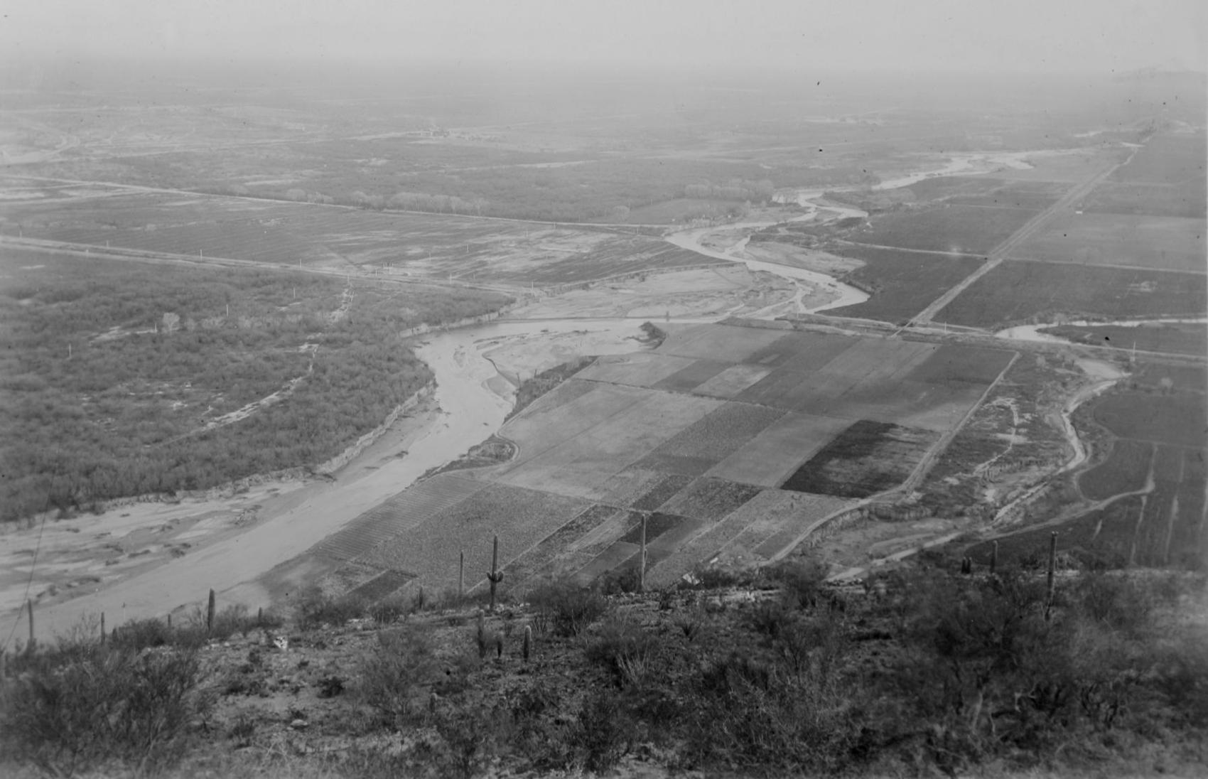
The Santa Cruz River flows north as seen from Sentinel Peak in Tucson in the early 1900's.
On July 4, 1776, the birthplace of Tucson was 'under Indigenous control'
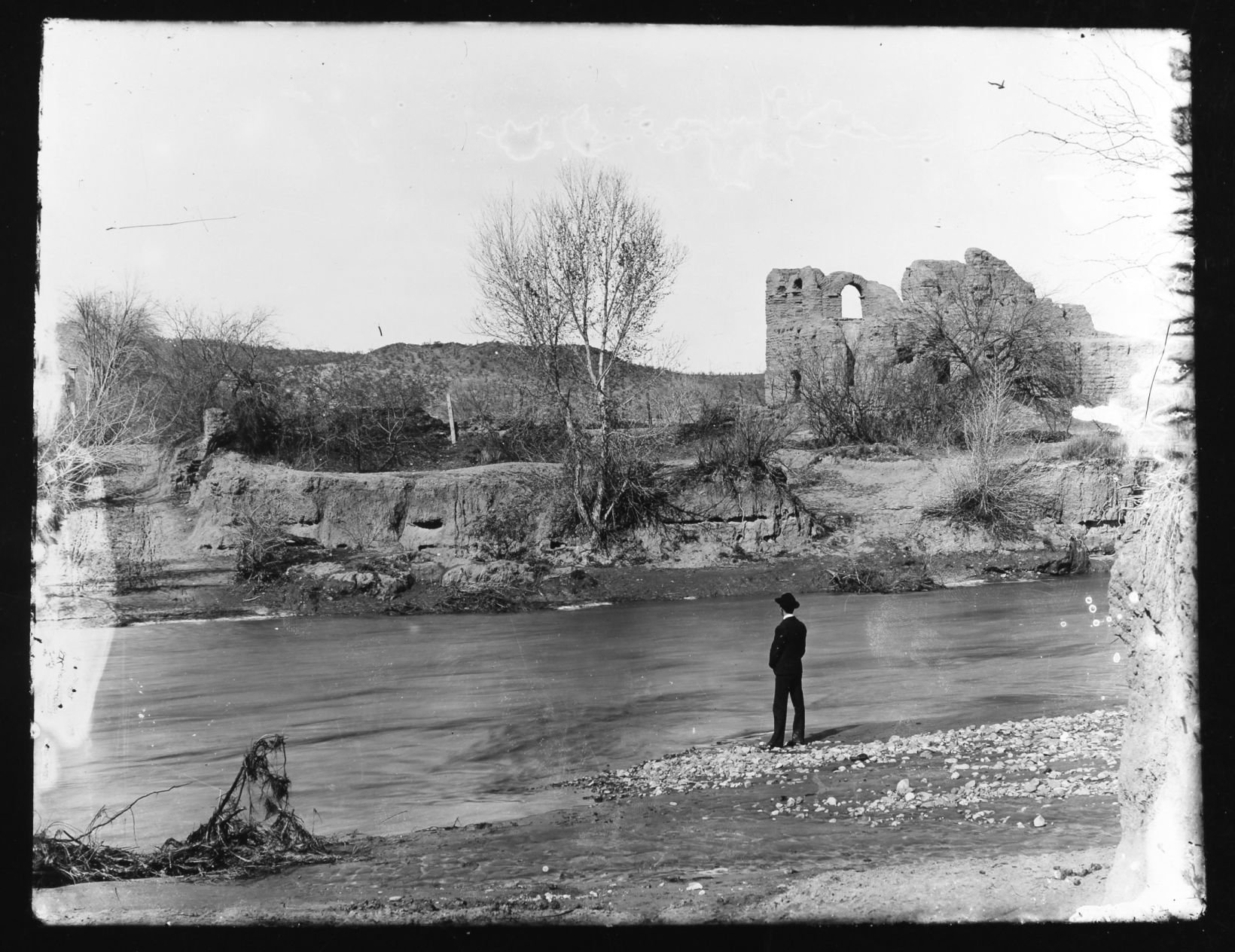
Ruins of El Convento along the Santa Cruz River, circa 1910. The adobe structure was part of a Franciscan mission complex built here at the end of the 18th century.
Santa Cruz River
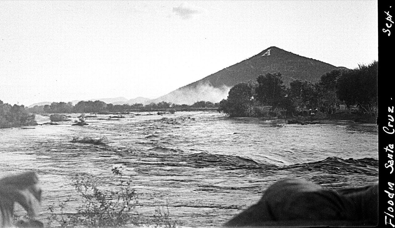
Flooding of the Santa Cruz River, Tucson, in September, 1926, from “Letters from Tucson, 1925-1927” by Ethel Stiffler.
Santa Cruz River
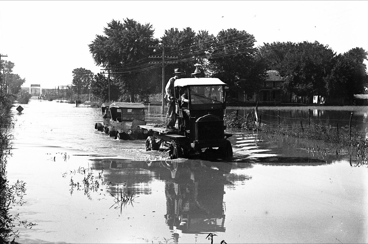
Flooding of the Santa Cruz River, Tucson, in September, 1926, from “Letters from Tucson, 1925-1927” by Ethel Stiffler.
Santa Cruz River in Tucson

Aerial view of the Santa Cruz River as it winds its way through Pima County north of Cortaro Road in 1953. The county was considering a bridge at several locations, but had to contend with the ever-changing course of the river.
Santa Cruz River in Tucson

The Tucson Citizen wrote in 1970, "The Santa Cruz River is a garbage dump" and "even marijuana grows in it." City leaders were pushing to upgrade and beautify the channel. The U.S. Army Corps of Engineers was studying the possibility.
Santa Cruz River in Tucson
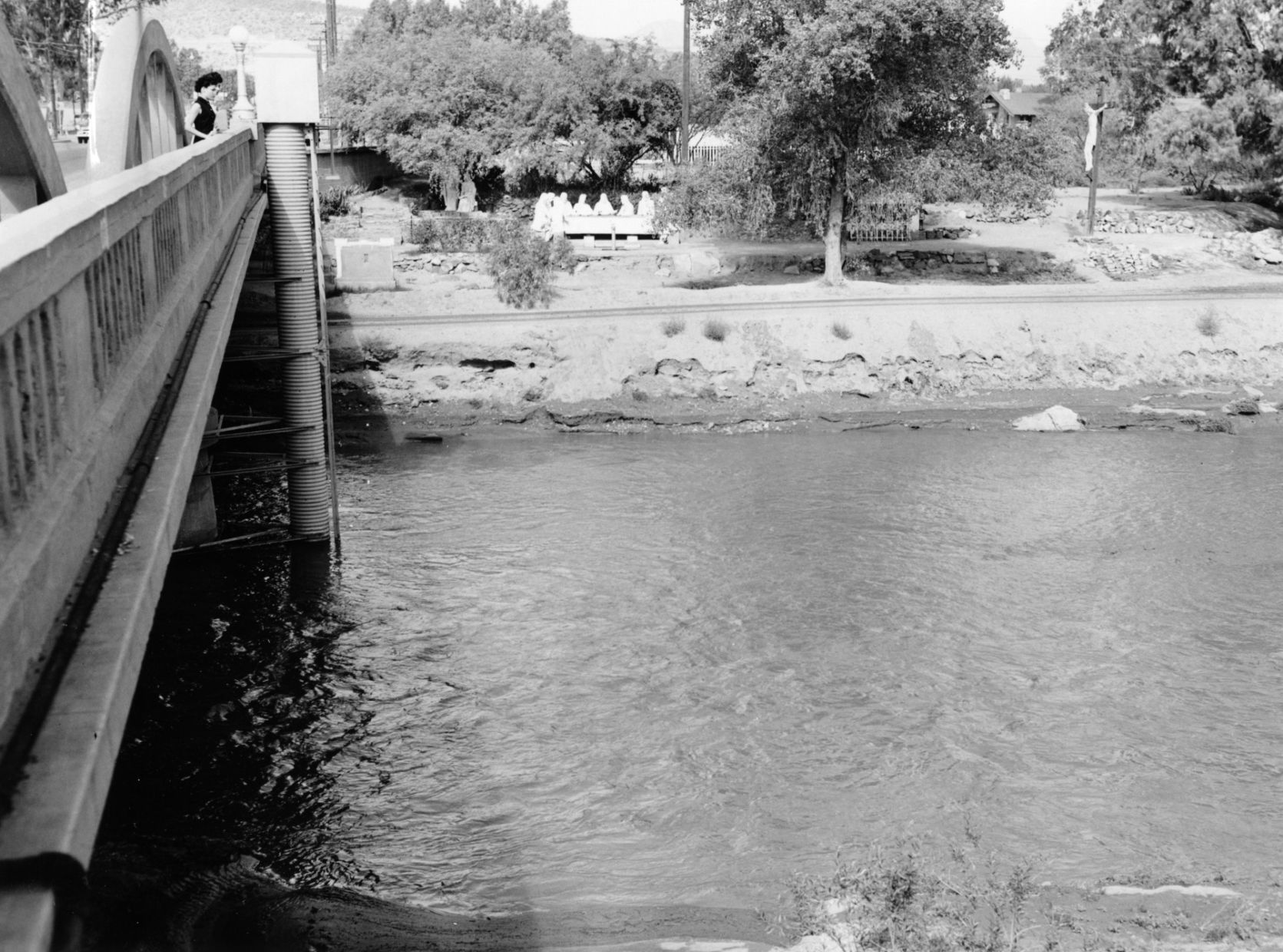
The Santa Cruz River flowing under the Congress Street bridge in August, 1952. The Garden of Gesthemane is in the background.
Santa Cruz River in Tucson

Drought in June, 1974, turned the Santa Cruz riverbed into crunchy chunks of dried mud.
Santa Cruz River in Tucson

The Santa Cruz River flowing under Silverlake Road in August, 1970.
Santa Cruz River in Tucson

Children play in the Santa Cruz River near Speedway Blvd in August, 1970.
Santa Cruz River in Tucson
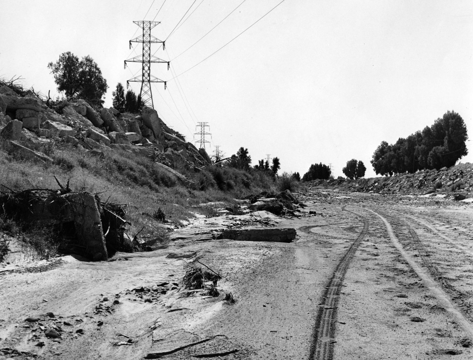
The Santa Cruz riverbed at Congress Street in November, 1967.
Santa Cruz River in Tucson

After years of waiting, crews began clearing debris and channeling the Santa Cruz River in November, 1977, and constructing what would become a 14-mile river park. The Speedway Blvd. bridge is in the background.
Santa Cruz River in Tucson

After years of waiting, crews began clearing debris and channeling the Santa Cruz River in November, 1977, and constructing what would become a 14-mile river park.
Santa Cruz River in Tucson

The Santa Cruz River looks peaceful flowing underneath Speedway Road after days of flooding in October, 1977.
Santa Cruz River in Tucson

Adalberto Ballesteros rides along the Santa Cruz River west of downtown Tucson in 1980.
Santa Cruz River

Junked cars and trash spill into the Santa Cruz River, looking south, just south of Grant Road in July, 1974.
Santa Cruz River in Tucson

Road graders scrape the Santa Cruz River channel between Speedway and Grant roads during bank stabilization construction in May, 1991.
Santa Cruz River

Flooding in Marana after the Santa Cruz River overflowed its banks in Oct. 1983.
Santa Cruz River

A bridge on the Santa Cruz River northwest of Tucson washed out during flooding in October 1983.
Santa Cruz River

Residents watch the surging Santa Cruz River rush past West St. Mary's Road on January 19, 1993.
Santa Cruz River

Tucson firefighters are standing by and waiting for two kids floating in the Santa Cruz River on some type of object during flooding in July, 1996.
Santa Cruz River

As crews work on the still under construction bridge over the Santa Cruz River, other crews from Pima County work to the last minute to get the new traffic signals at Sunset Rd. and Silverbell up and running just before opening the road to drivers, Tuesday, February 14, 2017, Tucson, Ariz. Kelly Presnell / Arizona Daily Star
Santa Cruz River

Surprising amounts of green abound in the washbed underneath the Speedway Boulevard bridge along the Santa Cruz River west of Interstate 10 on Sept. 7, 2017, at in Tucson, Ariz. Vegetation and sediment build-up along the river may prove disastrous for some vehicle bridges between Grant Road and 22nd Street.
Santa Cruz River flood risk

A cyclist heads south on the Santa Cruz River Park path at the Silverlake Road bridge on Sept. 7, 2017, in Tucson, Ariz.
Santa Cruz River

Sediment accumulates against the concrete bridge supports of Starr Pass Boulevard along the Santa Cruz River west of Interstate 10 on Sept. 7, 2017, in Tucson, Ariz. Vegetation and sediment build-up along the river may prove disastrous for some vehicle bridges between Grant Road and 22nd Street.
Santa Cruz River

Runner, cyclists and motorists alike pass over and under the Silverlake Road bridge at the Santa Cruz River west of Interstate 10 on Sept. 7, 2017, in Tucson, Ariz.
Santa Cruz River

Traffic heads west over the St. Mary's Road bridge along the Santa Cruz River west of Interstate 10 on Sept. 7, 2017, in Tucson, Ariz. Vegetation and sediment build-up along the river may prove disastrous for some vehicle bridges between Grant Road and 22nd Street.
Santa Cruz River flood risk

Tall vegetation under the Silverlake Road bridge in the Santa Cruz River west of Interstate 10 on Sept. 7, 2017, in Tucson, Ariz. Vegetation and sediment build-up along the river may prove disastrous for some vehicle bridges between Grant Road and 22nd Street.
Santa Cruz River flood risk

Vegetation and sediment along the Santa Cruz River as seen north of Silverlake Road on Sept. 7, 2017, in Tucson, Ariz. Vegetation and sediment build-up along the river may prove disastrous for some vehicle bridges between Grant Road and 22nd Street.
Santa Cruz River

A cyclist bikes the Santa Cruz River Park path at the Silverlake Road bridge west of Interstate 10 on Sept. 7, 2017, in Tucson, Ariz.
Santa Cruz River flood risk

Sediment buildup in the Santa Cruz River near Silverlake Road west of Interstate 10 on Sept. 7, 2017, in Tucson, Ariz. Vegetation and sediment build-up along the river may prove disastrous for some vehicle bridges between Grant Road and 22nd Street.
Santa Cruz River flood risk

The bike/walking path underneath the Speedway Boulevard bridge is crowded with vegetation along the Santa Cruz River west of Interstate 10 on Sept. 7, 2017, in Tucson, Ariz. Vegetation and sediment build-up along the river may prove disastrous for some vehicle bridges between Grant Road and 22nd Street.
Santa Cruz River

A makeshift memorial on the banks of the Santa Cruz River near Congress Street west of Interstate 10 on Sept. 7, 2017, at in Tucson, Ariz.
Big Jim: Santa Cruz River sand trout

El tucsonense Mike Svob da clases de español en la Biblioteca Himmel en Tucsón. Escribió esta columna con una afortunada mezcla de información e inspiración sobre el sendero El Loop, que conoció gracias a la cuarentena.