
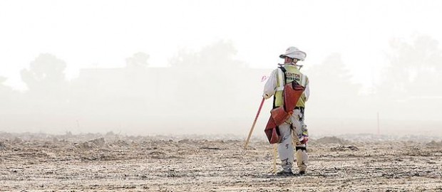
In 2008, Tucson and Southern Arizona got warmer and cooler and drier and wetter.
How is that possible?
It depends on whether one looked at short- or long-term weather patterns.
Last year's average temperature was the coolest since 2004 but continued a 10-year streak of being warmer than the 30-year average.
It was Tucson's 14th-warmest year since records started being kept here in 1894. The warmest year was 1989.
The National Weather Services expects more warm weather this year, too. For all of 2009, above-normal temperatures are forecast.
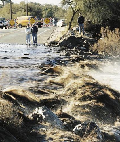
Precipitation-wise, last summer's monsoon rainfall came close to matching the seasonal average. And the year ended with the wettest December in a decade, and the first December in that period with normal precipitation.
People are also reading…
Because of that, the National Weather Service now reports that the region is not suffering from a short-term drought.
But for the entire year, rainfall at Tucson International Airport — the city's official measuring site — was below normal for the eighth consecutive year. The city recorded its lowest total rainfall in the last four years.
Rainfall stations across the region varied widely in their 2008 totals, from 6 to 16 inches on the valley floor and 25 to 40 inches in the surrounding mountains, compared with the 8.67 inches at the airport.
The long-term drought continues. "We have almost a 2-foot rainfall deficit in the last 10 years," said John Glueck, a weather service meteorologist in Tucson.
And in 2009, who's to say? There's just as much chance of above-normal rainfall for the year as there is for below-normal rainfall, the weather service says.
Statistics suggest an optimistic short-term picture for runoff of snowpacks into reservoirs and aquifers, which is good news for our water supply.
Lake Powell at the Utah border, which like Lake Mead stores water for the Central Arizona Project that serves Tucson, had been dropping dramatically through much of this decade. But it has risen significantly in the past three years.
Snowpack levels are above normal this winter in the Wasatch, Uinta and Rocky and other mountain ranges of the Colorado River's Upper Basin. Federal forecasters predict normal spring runoff into Powell.
In Arizona, snowpack is above or well above normal in the Gila River watershed in Central and Southern Arizona, and in the Mogollon Rim and in the Salt and Verde river watersheds supplying the Phoenix areas. The reservoirs serving Phoenix are expected to fill.
That optimistic prognosis — announced Friday by federal weather and reclamation officials — is based on heavy snowfalls in December, following dry weather in October and November. A month ago, the upper basin's snowpack was barely half normal.
If the weather dries in January and February, runoff forecasts could drop, said Brenda Alcorn, a senior hydrologist for the Natural Resources Conservation Service in Salt Lake City.
Many of the state's main reservoirs are registering high levels or at least better levels than in recent years.
However, Lake Mead at Hoover Dam dropped last summer to its lowest level since the mid-1960s and is now barely above that.
With Lakes Mead and Powell still low, the entire state remains in a long-term drought, said Nancy Selover, the state's climatologist.
"Since we are in our second decade of lower-than-average annual precipitation statewide, it will take several years of above-average precipitation to end the long-term drought," Selover said.
On StarNet: Take a poll on climate change and see a slide show of weather photos from 2008 at the StarNet Editors Blog: go.azstarnet.com/starnetblog
rainfall totals, temps
Tucson temperatures
Average temperature 2008: 70 degrees compared with a 30-year average of 68.7. Average high temperature 2008: 83.7 degrees compared with a 30-year average of 82.5. Average low temperature 2008: 56.2 compared with a 30-year average of 54.8.
The 2008 average temperature was the 14th warmest on record. Three of Tucson's 10 warmest years have occurred since 1999. 2007, meantime, with an average temperature of 70.5 degrees, was the eighth warmest in Tucson since records started being kept in 1894
Tucson rainfall
Total 2008 rainfall: 8.67 inches, 3.5 inches below the 30-year average and the 23rd driest year on record. 2007 rainfall: 9.78 inches and the 39th-driest year on record. Three daily rainfall records were set in 2008, including a 1.73-inch rainfall on July 11 that was nearly twice that day's previous record set in 1919. Tucson rainfall was below normal for nine of the past 10 years.
Statewide rainfall
Phoenix, 9.58 inches in 2008 compared with an average of 8.29 inches and 5.05 inches in 2007. Flagstaff, 18.85 inches in 2008 compared with an average of 22.91 inches and 17.46 inches in 2007. Yuma, 4.69 inches compared with an average of 3.4 inches and 2.27 inches in 2007.
Levels in reservoirs providing some of Tucson's drinking water
Lake Mead, at 1,111 feet above sea level today, is at 48 percent capacity, and this year reached its lowest levels since June 1965. Lake Powell, at 3,618 feet above sea level, is 55.9 percent full and has risen from 33 percent full in spring 2005.
Snowpack levels
100 to 110 percent of normal in the Gila River watershed, which supplies Southern and Central Arizona. 108 percent of normal in the Upper Basin of the Colorado River, which supplies Powell and Mead. 150 percent of normal in the Mogollon Rim watershed, which supplies the Phoenix area.
Runoff forecasts
Near normal into Lake Powell for April through July.