

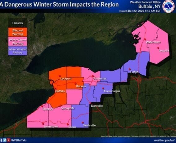
Just before 4 a.m. Thursday, the National Weather Service office in Buffalo issued a rare alert: a "Blizzard Warning" for Erie, Niagara, Genesee and Orleans counties beginning at 7 a.m. Friday.
Meteorologists are careful about using the term "blizzard."
While many use the word to describe a big snowstorm, an actual blizzard must meet specific criteria:
- Sustained winds or frequent gusts to 35 mph or greater;
- Considerable falling and/or blowing snow that reduces visibility to less than a quarter mile;
- And the conditions are expected to prevail for three hours or longer.
"True blizzard conditions are rare in Western NY," the weather service said in its updated forecast Thursday morning, "and it's unusual to even consider blizzard headlines this far in advance of a storm. However, the magnitude of this storm justifies this consideration."
People are also reading…
The weather service said that the worst conditions will be downwind of Lake Erie starting Friday afternoon and lasting into Saturday night.
"Expect the combination of lake-effect snow and very strong winds to produce blizzard conditions across the Niagara Frontier," the weather service said.
So the approaching storm will more than meet the benchmarks for a blizzard.
The forecast as of Thursday morning calls for snow accumulations of 3 to 7 inches during the day Friday with another 4 to 8 inches overnight, sustained winds approaching 50 mph with gusts as high as 70 mph. Those conditions are expected to diminish slightly Saturday night but still be within blizzard conditions.
The conditions will make driving extremely difficult if not impossible.


