

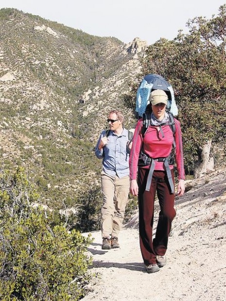
Lucio Castellini traveled up a long, steep stretch of the Bug Spring Trail one day recently without showing the slightest sign of hiking fatigue.
That's because 7-month-old Lucio made the ascent in the comfort of a child-carrier backpack lugged by his mom, Sistine.
Sistine and her husband, Randy Castellini — both of whom are quite fit — nevertheless were breathing a bit deeply by the time they and their infant passenger reached a ridge about half a mile into the hike.
Little wonder. That first half-mile from the route's upper trailhead is what is known in not exactly technical terms as a "steep grunt."'
Ah, but a very rewarding grunt. The 4.6-mile Bug Spring Trail, which links two points on the Catalina Highway northeast of Tucson, is mostly downhill and splendidly scenic once you reach the ridge after the initial climb.
People are also reading…
Hiking the trail in the opposite direction — starting at the lower trailhead — involves lots more uphill hiking, with a steep downhill stretch at the end.
Either way, the route offers a rich mix of vegetation and terrain. Near the lower trailhead, at an elevation near 5,000 feet, tall grasses and open landscapes lend a sort of "high desert" feel to the trek. Farther up the way, the trail passes through a canyon environment before topping out at about 6,000 feet amid ponderosa pines and other mountain vegetation.
Get to the trailheads
Take Tanque Verde Road to the Catalina Highway and follow the highway about 4.5 miles to the base of the mountains. Mile markers begin there.
Watch for the lower trailhead at a parking lot between mileposts 7 and 8. The upper trailhead is between mileposts 11 and 12 — just past the Middle Bear Picnic Area. You'll pay a $5 fee on the highway.