

(Updated 7:55 a.m. Sunday)
The National Weather Service replaced the blizzard warning with a winter storm warning for Erie, Genesee, Wyoming, Chautauqua and Cattaraugus counties.
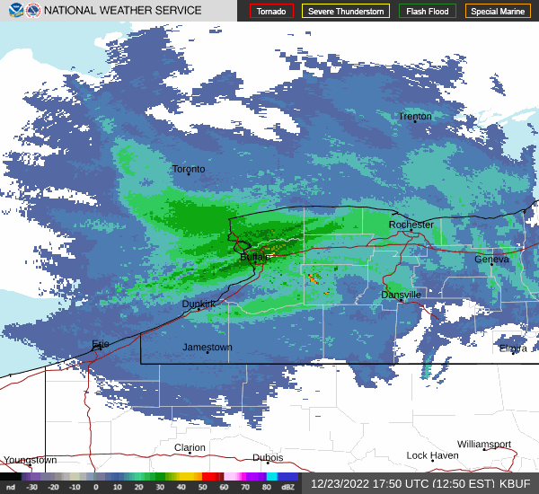
The 10- to 15-mile-wide band of heavy lake-effect snow is south of Buffalo, and is expected to stay there throughout the day.
"It's going to stay down that way today and it will start to weaken this afternoon, and then tonight what's left of that lake-effect snow is going to lift north, but it's going to be in a much weakened state by then," said National Weather Service meteorologist Jon Hitchcock.
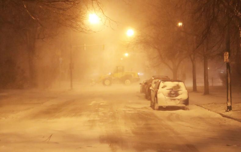
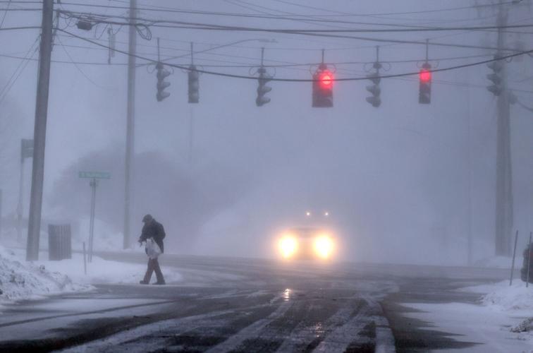
The driving ban remains in effect in Erie County.
"There are numerous vehicles stranded on the roadways with many roads impassable. Do not attempt to travel in this band," the weather service said.
People are also reading…
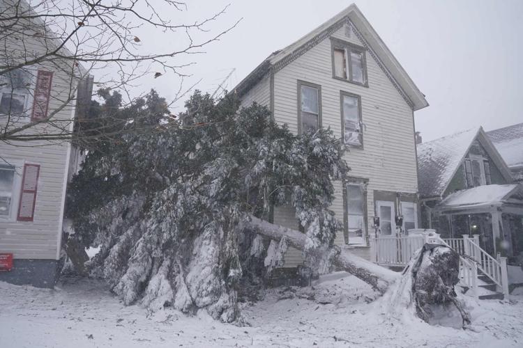
But even if you're not in the thick of the band, visibility is difficult. Although the winds are gradually diminishing, they remain fierce and still are gusting to more than 40 mph.
Forecasters have raised estimated storm snowfall totals for some areas in metro Buffalo, including eastern and northeastern suburbs, to between 4 and 5 feet of accumulation through Sunday night.
Surrounding areas could see a total of 1 to 3 feet of snowfall by the end of the storm.
"Wind chills as low as 15 below zero could result in hypothermia if precautions are not taken," the weather service said.
Here's what to expect:
High winds blow snow outside of Highmark Stadium, home of the Buffalo Bills, on Friday, Dec. 23, 2022.
Christmas morning
The winter storm warning remains in effect until 4 a.m. Monday for Erie and Genesee counties, and until 1 a.m. Monday for Chautauqua, Cattaraugus and Wyoming counties.
Additional accumulations of 1 to 2 feet are expected in the most persistent snow bands. Eight to 16 inches of snow are expected in Wyoming and Cattaraugus counties.
"Greatest additional accumulation will be across southern Erie County including the towns of Eden, Hamburg, Orchard Park and East Aurora," according to the National Weather Service. The largest accumulation in Chautauqua County will be by the Lake Erie shoreline, with much less further inland.
Christmas afternoon
While the storm continues south of metro Buffalo, it will continue to be breezy throughout the area, with sustained winds at 22 to 24 mph, gusting as high as 40 mph.
It will be a little warmer than Saturday, with a high in the low 20s.
Overnight
The lake effect band of snow wanders north again.
"It will come back north across the city late tonight and tomorrow morning, but it's not going to add much additional accumulation at all," Hitchcock said. "Tomorrow morning there might just be a coating to an inch in Buffalo."
Monday
There may be a coating to an inch of snow in Buffalo by Monday morning. It will be mostly cloudy, with a high in the low 20s as the snow tapers off.
"There's one more minor shot of snow coming Monday night, Tuesday morning," Hitchcock said.


