

Here's a clue about what to expect when you hike the Vault Mine Trail in Madera Canyon south of Tucson: The U.S. Forest Service online trail guide lists it as the Very Stee\n\nVault Mine Trail.
Take heed.
The trail climbs 1,400 vertical feet in one segment of just 0.6 of a mile — and that's only part of the overall elevation gain of about 2,000 feet.
But here's the thing: The short, steep climb on the Vault Mine Trail is well worth the effort when you combine it with segments of two other trails for a rewarding 6.5-mile loop hike.
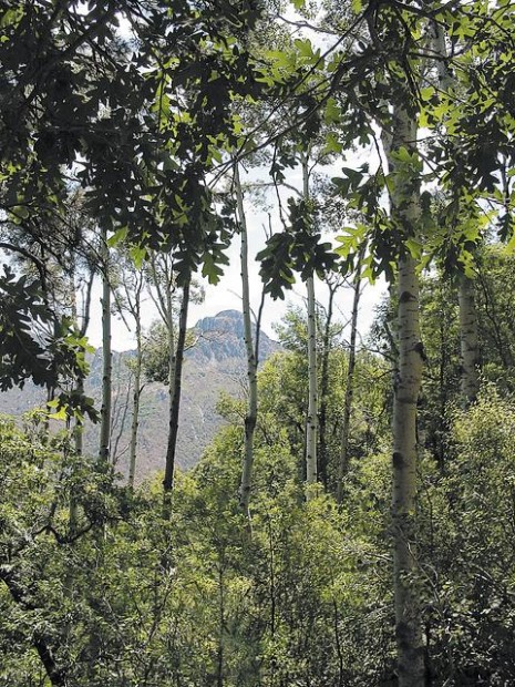
One of those segments, a 2.2-mile stretch of the Agua Caliente Trail, is mostly flat or downhill. It takes hikers through verdant oak and pine forests and a shady grove of aspens — with big views all along the way. The other segment, on the Old Baldy Trail, is also 2.2 miles and downhill. Get to the trailhead
People are also reading…
From Tucson, drive south on Interstate 19 to Green Valley and get off at the Continental Exit. Follow signs southeast about 13 miles to Madera Canyon and park at the 5,450-foot trailhead at the end of the main canyon road. You'll pay a $5 parking fee. Trek the loop
Start by walking up a broad path 0.3 a mile to a junction. Continue past this junction on the route for the Vault Mine Trail and hike about a half-mile to another junction marked with a metal sign. Take the right fork, which is the Vault Mine Trail.
Follow the trail past an old mine site, up its steep switchbacks for about 1.3 miles to a T-junction with the Agua Caliente Trail. To continue on the loop, go left and follow the Agua Caliente Trail to Josephine Saddle. Pick up the Old Baldy Trail there and follow it downhill to the trailhead.