

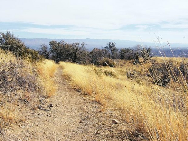
Now is probably the best time to hike the Cody Trail — for a couple of reasons.
First, its low elevation in the foothills of the Santa Catalina Mountains near Oracle and its limited shade could make for an uncomfortably warm trek in the summer.
Second, the hills are covered with long, bone-dry grass, and it's easy to imagine a brush fire torching the area again this summer, as the Oracle Hill Fire did in 2002 and the Aspen Fire threatened to the following year. The day of our hike, a front-page newspaper headline screamed "102 days without rain."
The Cody Trail is a 3.7-mile segment of the Arizona Trail, the nearly completed 800-mile footpath that crosses the state from Mexico to Utah. It's named for William F. "Buffalo Bill" Cody, the 19th-century Army scout and Wild West performer who later in life invested in a couple of gold mines in these hills.
People are also reading…
The trailhead is at about 4,300 feet on Mount Lemmon Road four miles southeast of Oracle. Drive about one mile beyond where the pavement ends, bearing right where the road forks. There are large signs identifying the Arizona Trail on either side of the road, just before the American Flag Ranch. The Cody Trail winds west from the road.
The path switchbacks uphill right from the start for a short time, then dips down into a small canyon and follows the bank of a wash before climbing again. From here, the climbing is nearly continuous, though not terribly steep, until the turnaround point at its junction with the Oracle Ridge Trail at about 5,500 feet.
A sign near the beginning of the hike warns that you are entering a burn area and that "portions of the trail are damaged or blocked with debris," but that is not the case now. The trail is well-groomed (recently, by the look of it) and easy to follow, with nothing blocking it.
The charred trees from the 2002 fire and the large boulders strewed over the grassy foothills add fascinating texture to the landscape.
From the upper portions of the trail, the two towering smelter stacks of the San Manuel copper mine and the Galiuro Mountains behind them are visible to the east.
At the trail's end, a T-intersection where it meets the Oracle Ridge Trail, one can look down on Biosphere 2 and even see Picacho Peak to the distant northwest.
Clip 'n' go
Cody Trail
Drive: Take Oracle Road (Arizona 77) north into Oracle. Turn right at American Avenue, then right at Mount Lemmon Road. Go about one mile beyond where the pavement ends (bear right where the road forks), and park at the large Arizona Trail sign.
Hike: The trail is 3.7 miles one way, with an elevation gain of about 1,200 feet. There is no restroom or available water.
Cost: Free
Et cetera: For more information about the Arizona Trail, go to www.aztrail.org, the Arizona Trail Association's Web site.