

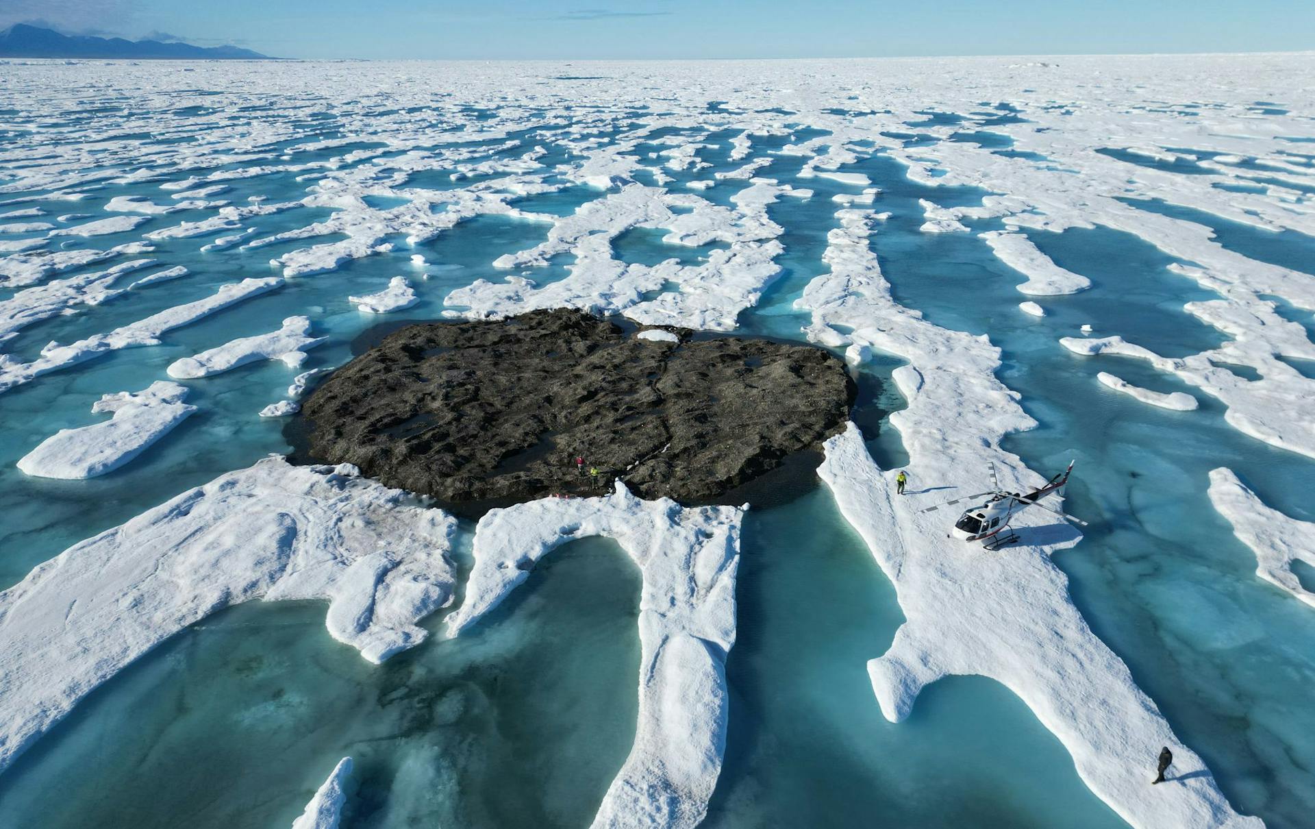
 These 'islands' are on the move. Martin Nissen
In 2021, an expedition off the icy northern Greenland coast spotted what appeared to be a previously uncharted island. It was small and gravelly, and it was declared a contender for the title of the most northerly known land mass in the world. The discoverers named it Qeqertaq Avannarleq – Greenlandic for “the northern most island.”
But there was a mystery afoot in the region. Just north of Cape Morris Jesup, several other small islands had been discovered over the decades, and then disappeared.
People are also reading…
Some scientists theorized that these were rocky banks that had been pushed up by sea ice.
But when a team of Swiss and Danish surveyors traveled north to investigate this “ghost islands” phenomenon, they discovered something else entirely. They announced their findings in September 2022: These elusive islands are actually large icebergs grounded at the sea bottom. They likely came from a nearby glacier, where other newly calved icebergs, covered with gravel from landslides, were ready to float off.
This was not the first such disappearing act in the high Arctic, or the first need to erase land from the map. Nearly a century ago, an innovative airborne expedition redrew the maps of large swaths of the Barents Sea.
The view from a zeppelin in 1931
The 1931 expedition emerged from American newspaper magnate William Randolph Hearst’s plan for a spectacular publicity stunt.
Hearst proposed having the Graf Zeppelin, then the world’s largest airship, fly to the North Pole for a meeting with a submarine that would travel under the ice. This ran into practical difficulties and Hearst abandoned the plan, but the notion of using the Graf Zeppelin to conduct geographic and scientific investigations of the high Arctic was taken up by an international polar science committee.
The airborne expedition they devised would employ pioneering technologies and make important geographical, meteorological and magnetic discoveries in the Arctic – including remapping much of the Barents Sea.
The expedition was known as the Polarfahrt – “polar voyage” in German. Despite the international tensions at the time, the zeppelin carried a team of German, Soviet and U.S. scientists and explorers.
Among them were Lincoln Ellsworth, a wealthy American and experienced Arctic explorer who would write the first scholarly account of the Polarfahrt and its geographical discoveries. Two important Soviet scientists also participated: the brilliant meteorologist Pavel Molchanov and the expedition’s chief scientist, Rudolf Samoylovich, who performed magnetic measurements. In charge of the meteorological operations was Ludwig Weickmann, director of the Geophysical Institute of the University of Leipzig.
The expedition’s chronicler was Arthur Koestler, a young journalist who would later become famous for his anti-communist novel “Darkness at Noon,” depicting totalitarianism turning on its own party loyalists.
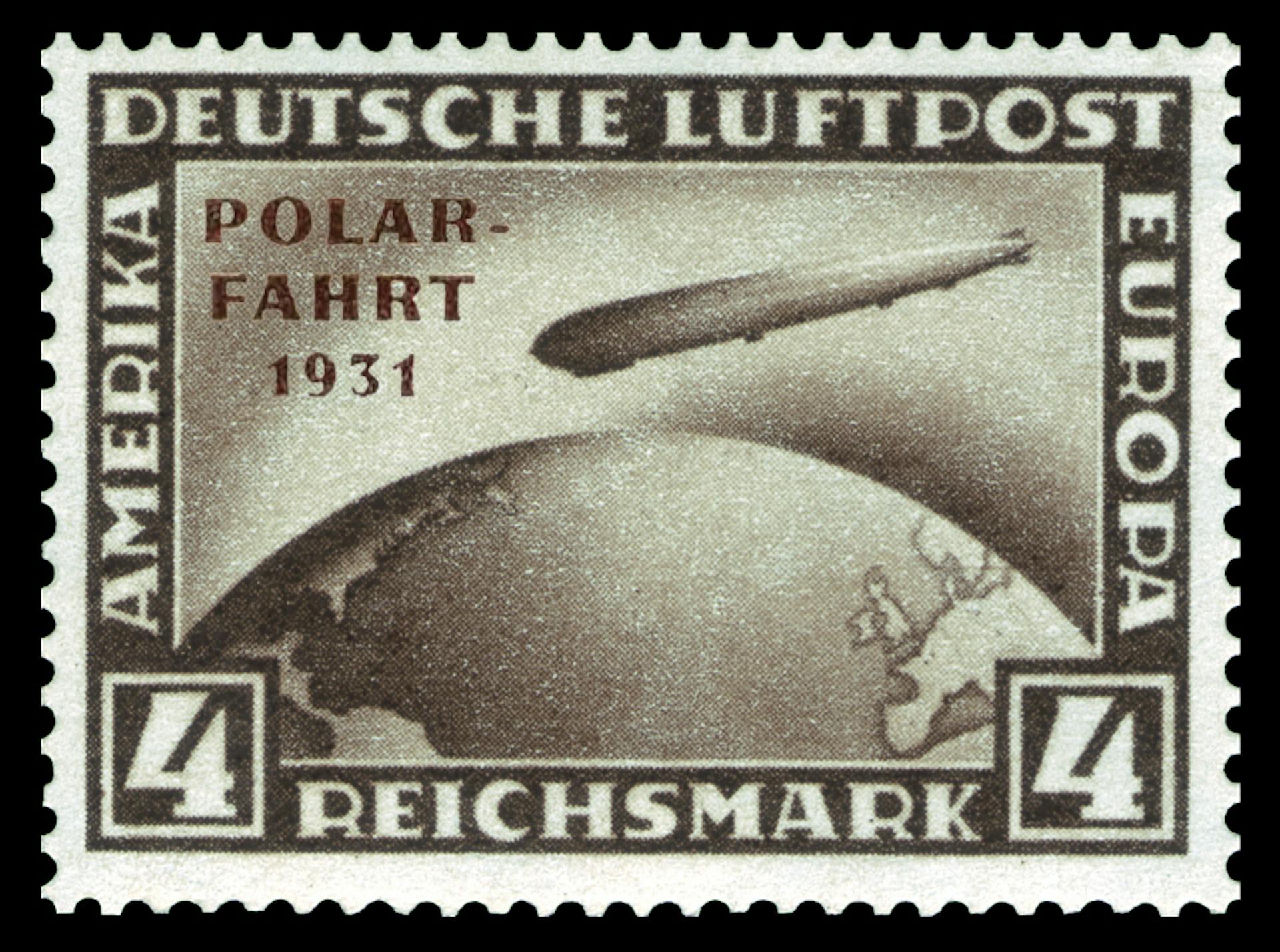 Built in 1928 and longer than two football fields, the Graf Zeppelin was normally used for ultra-luxurious commercial passenger transportation. Financing for the science mission came in part from the sale of postcards with stamps specially issued by the postal authorities of Germany and the Soviet Union. Wikimedia
The five-day trip took them north over the Barents Sea as far as 82 degrees north latitude, and then eastward for hundreds of miles before returning southwestward.
Koestler provided daily reports via shortwave radio that appeared in newspapers around the world.
“The experience of this swift, silent and effortless rising, or rather falling upwards into the sky, is beautiful and intoxicating,” Koestler wrote in his 1952 autobiography. “… it gives one the complete illusion of having escaped the bondage of the earth’s gravity.
"We hovered in the Arctic air for several days, moving at a leisurely average of 60 miles per hour and often stopping in mid-air to complete a photographic survey or release small weather balloons. It all had a charm and a quiet excitement comparable to a journey on the last sailing ship in an era of speed boats.”
‘The disadvantage of not existing’
The high latitude regions the Polarfahrt passed over were incredibly remote. In the late 19th century, Austrian explorer Julius von Payer reported the discovery of Franz Josef Land, an archipelago of nearly 200 islands in the Barents Sea, but initially there had been doubts about Franz Josef Land’s existence.
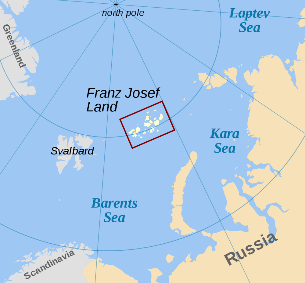
The Polarfahrt confirmed the existence of Franz Josef Land, but it would reveal that the maps produced by the early explorers of the high Arctic had startling deficiencies.
For the expedition, the Graf Zeppelin had been outfitted with wide-angle cameras that allowed detailed photography of the surface below. The slowly moving Zeppelin was ideally suited for this purpose and could make leisurely surveys that were not possible from fixed-wing aircraft overflights.
“We spent the remainder of [July 27] making a geographical survey of Franz Josef Land,” Koestler wrote.
“Our first objective was an island called Albert Edward Land. But that was easier said than done, for Albert Edward Land had the disadvantage of not existing. It could be found on every map of the Arctic, but not in the Arctic itself …
"Next objective: Harmsworth Land. Funny as it sounds Harmsworth Land didn’t exist either. Where it ought to have been, there was nothing but the black polar sea and the reflection of the white Zeppelin.
"Heaven knows whether the explorer who put these islands on the map (I believe it was Payer) had been a victim of a mirage, mistaking some icebergs for land … At any rate, as of July 27, 1931, they have been officially erased.”
The expedition would also discover six islands and redraw the coastal outlines of many others.
A revolutionary way to measure the atmosphere
The expedition was also remarkable for the instruments Molchanov tested aboard the Graf Zeppelin – including his newly invented “radiosondes.” His technology would revolutionize meteorological observations and led to instruments that atmospheric scientists like me rely on today.
Until 1930, measuring the temperature high in the atmosphere was extremely challenging for meteorologists.
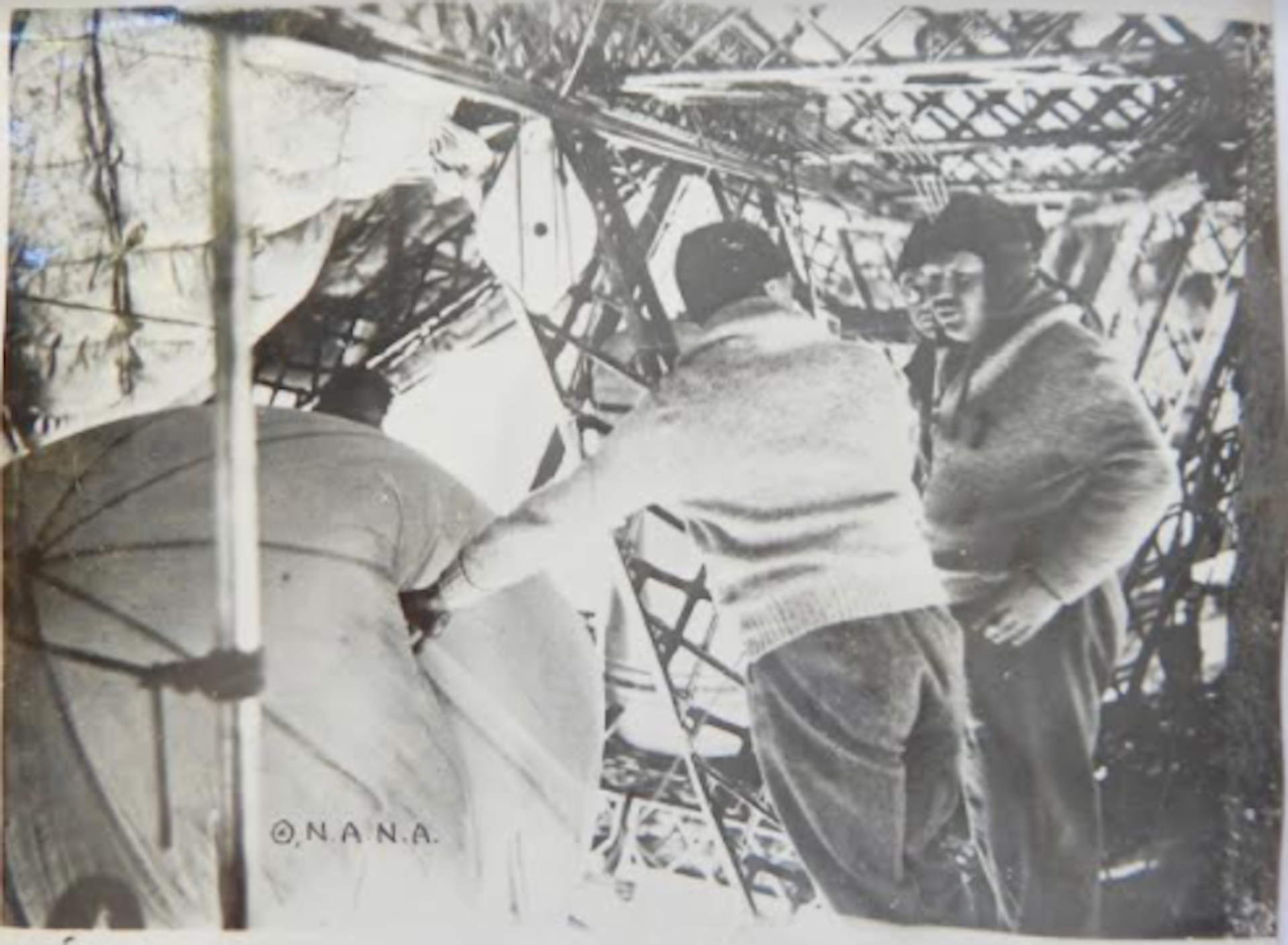 Pavel Molchanov and Ludwig Weickmann prepare to launch a weather balloon. Radiosonde Museum of North America
They used so-called registering sondes that recorded the temperature and pressure by weather balloon. A stylus would make a continuous trace on paper or some other medium, but to read it, scientists would have to find the sonde package after it dropped, and it typically drifted many miles from the launch point. This was particularly impractical in remote areas such as the Arctic.
Molchanov’s device could radio back the temperature and pressure at frequent intervals during the balloon flight. Today, balloon-borne radiosondes are launched daily at several hundred stations worldwide.
The Polarfahrt was Molchanov’s chance for a spectacular demonstration. The Graf Zeppelin generally flew in the lowest few thousand feet of the atmosphere, but could serve as a platform to release weather balloons that could ascend much higher, acting as remotely reporting “robots” in the upper atmosphere.
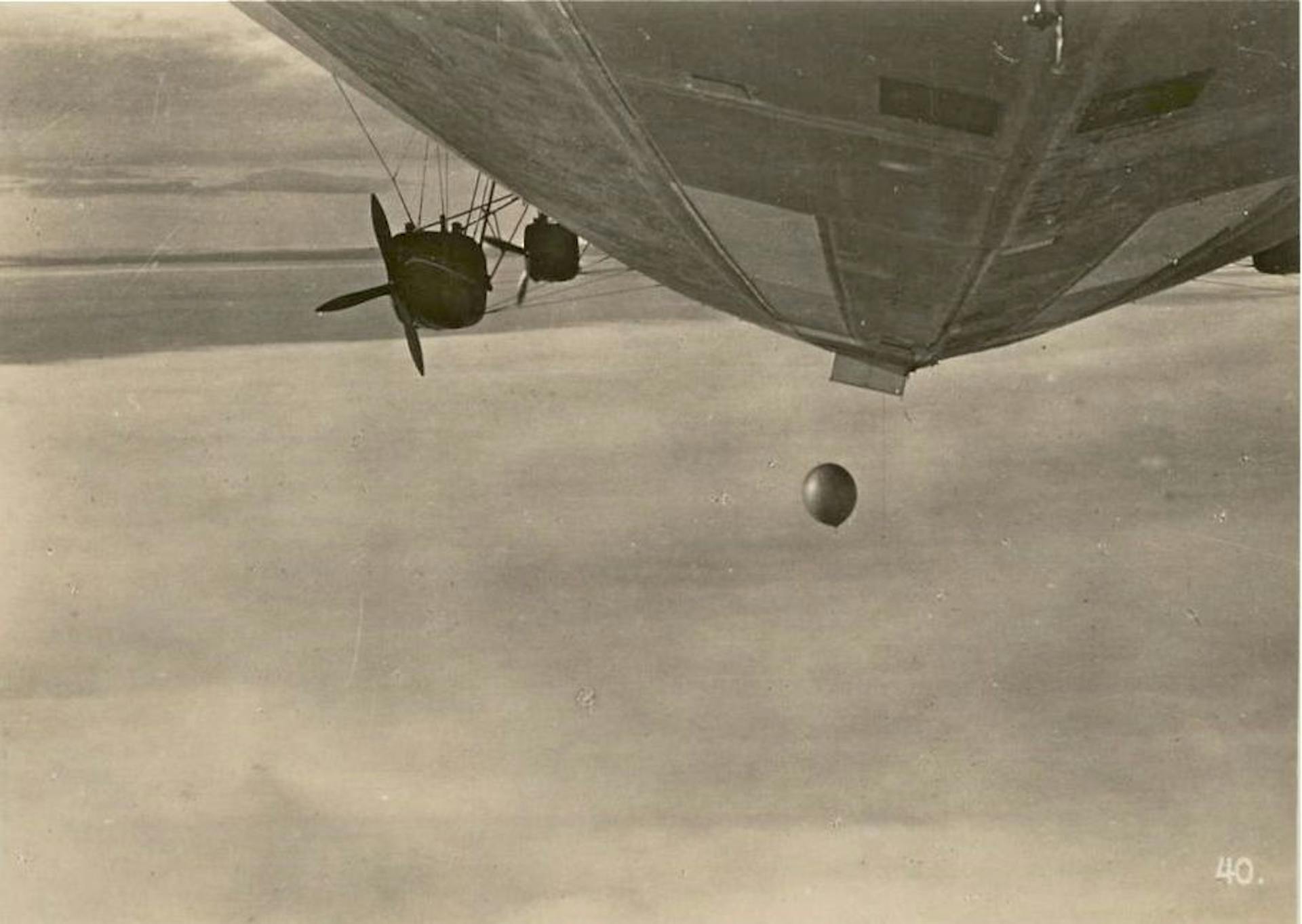 To launch radiosondes from the zeppelin, weather balloons were weighted to sink at first. The weight was designed to drop off, allowing the balloon to later rise through the atmosphere. Radiosonde Museum of North America.
Molchanov’s hydrogen-filled weather balloons provided the first observations of the stratospheric temperatures near the pole. Remarkably, he found that at heights of 10 miles the air at the pole was actually much warmer than at the equator.
Fate of the protagonists
The Polarfahrt was a final flourish of international scientific cooperation at the beginning of the 1930s, a period that saw a catastrophic rise of authoritarian politics and international conflict. By 1941, the U.S., Soviet Union and Germany would all be at war.
Molchanov and Samoylovich became victims of Stalin’s secret police. As a Hungarian Jew, Koestler would have his life and career shadowed by the politics of the age. He eventually found refuge in England, where he built a career as a novelist, essayist and historian of science.
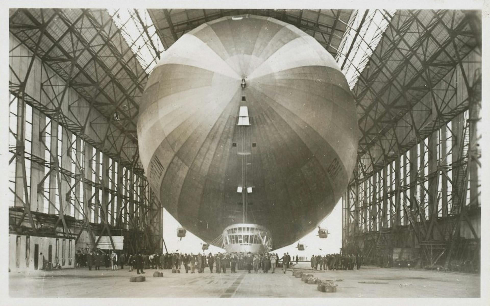 The Graf Zeppelin was designed for luxury air travel. Wikimedia
The Graf Zeppelin continued in commercial passenger service principally on trans-Atlantic flights. But one of history’s most iconic tragedies soon ended the era of zeppelin travel. In May 1937, the Graf Zeppelin’s younger sister airship, the Hindenburg, caught fire while trying to land in New Jersey. The Graf Zeppelin was dismantled in 1940 to provide scrap metal for the German war effort.
___
Kevin Hamilton does not work for, consult, own shares in or receive funding from any company or organization that would benefit from this article, and has disclosed no relevant affiliations beyond their academic appointment.
___
These cities are better at enduring extreme heat. Here's how they're doing it
Beating the heat

Blistering heat has returned to western Europe, as some countries like France enter into their third wave of the summer with temperatures expected to reach over 100 degrees Fahrenheit (37 degrees Celsius), while more than 80% of the U.S. population will experience temperatures over 90 degrees (32C) within the next week, including in the Mid-Atlantic and Northeast. Around 100 million Americans have been under heat alerts for eight of the past 16 days.
This means hundreds of millions of people living in urban areas are again desperately trying to stay cool.
Air conditioners might keep the indoors cool, but they only add to heat outdoors. And in most cases, they are adding to the climate crisis by increasing planet-warming emissions. Public transportation may be unbearable on a hot day, but driving a car that runs on gas instead just worsens traffic, also adding to heat and emissions. A lack of trees means a lack of shade, and buildings made of dark materials bring hotter interiors, which means more air conditioning.
It's a vicious cycle, but there are other solutions.
Here's how eight cities are taking some of the heat out of their summers.
Medellín, Colombia: Grow trees on the streets, not just in parks

When it gets really hot, people with air conditioning might stay indoors, but not everyone has that luxury and — well, who wants to say in all the time?
For cities that aren't on the coast, parks that offer shade are a good option. Colombia's second-largest city, Medellín, however, has created an entire metropolis of shade with its award-winning Green Corridors project.
The web-like network has transformed 18 roads and 12 waterways into lush green cycling lanes and walkways that connect the city's parks and other frequently visited sites.
Temperatures have come down in these areas and their surrounds by as much as 5.5 degrees Fahrenheit (around 3 degrees Celsius), and officials hope that before 2030, it could shave off up to 9 degrees Fahrenheit (5 Celsius).
"Urban forests are the very best thing for city heat," Kathy Baughman McLeod, director of the Adrienne Arsht-Rockefeller Foundation Resilience Center (Arsht-Rock) at the Atlantic Council, told CNN. "Medellín has dropped the city's average summer temperature, which is remarkable."
By 2019, the city had planted more than 8,000 trees and over 350,000 shrubs. It also uses an area beneath a raised Metro line to collect rainwater that flows down from the bridge, capturing it in a system of pipes to help water the green belts.
Vienna: Splish, splash, splosh

Like in much of Europe, many in Vienna don't have air conditioning, so water is a big part of how the Austrian capital keeps cool.
For those who don't have time for a dip in the Danube, the city offers cooling parks with mist-spraying "trees" that people can either "shower" in, or just sit near to enjoy the cooler temperatures they bring their surrounds.
Children, who are generally more vulnerable to extreme heat than adults, are often seen playing in the city's splash pools or running around in pop-up water features — typically hosepipes with holes punched in them — that the city government brings out on the hottest of days, including in areas like Karlsplatz, a popular city square.
Vienna also has a huge number of water fountains for drinking to keep people hydrated — more than 1,100 for its population of 1.9 million — which is important in preventing heat-related illness.
"Air conditioning in homes may sound like a quick and easy solution. But it's not a long-term sustainable solution because of the source of the power and the waste heat that comes off the unit," McLeod said. "So thinking about how to get more airflow, use water features and get windows to open in some of the oldest buildings is key. The nature-based solutions are the best for extreme heat."
Paris: Get really organized

The French capital gets seriously hot.
Temperatures there have surpassed 104 degrees Fahrenheit (40 Celsius) this summer, but the combination of high-rise buildings, limestone monuments and busy asphalt roads means it can feel even hotter.
The city has a strong urban heat island effect, where it is often 18 degrees hotter in the city center on a summer's day than it is in the Parisian hinterlands.
But Paris Mayor Anne Hidalgo has been credited with putting in place some of the world's most innovative measures to combat heat, and the city's heat plan is truly comprehensive.
The main result is a city full of "cool islands." Parisians can use an app called EXTREMA to guide them to more than 800 cool spots — parks, water fountains and air-conditioned museums, for example — and get there via a naturally cooled walkway. The idea is that a cool island is always a maximum seven minutes' walk away for everyone.
Like Vienna, Paris uses mist machines on hot days. It also has dozens of new "splash fountains," in addition to its many traditional fountains, which are very shallow pools with fountain-like effects.
Paris' heat plan involves a register that identifies the most vulnerable, so officials can check up on them by phone and offer advice on staying cool. Kindergartens get temporary air conditioners in their classrooms, and public parks and pools stay open for longer hours into the night. And like LA, Paris is trying to take the heat out of its roads and sidewalks by "demineralizing them," using more porous materials. Now that sounds like a plan.


