

Look up: rocks. • Look down: rocks. • Look far and wide: rocks. • Are you sensing a pattern here? • Rocks — of just about every conceivable size and shape — are the stars of the superscenic show at this national monument southeast of Willcox. • The site is best known for its shapely stone formations, but its other attractions include lush forests, abundant wildlife and a beckoning network of hiking trails. • Spring and summer are good seasons for a visit to the monument, which is perched more than a mile above sea level. Lots of Tucsonans take in the basic sights in a long day trip. For a more leisurely visit, you might stay a night in Willcox or at the monument campground. • See the cover story inside for more photos and a guide to Chiricahua's wonders.
Doug Kreutz
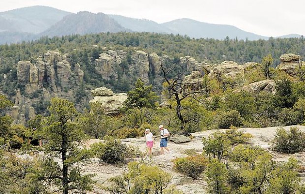
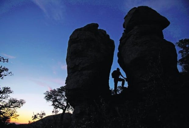
Here is what struck hiker Jim Haas when he paused high on a trail and peered down at grand gardens of stone. • "Every single rock formation out there is different!" Haas observed with obvious awe. "So many amazing rocks. It's an incredible experience!" • Countless others have felt similar amazement when touring this 11,985-acre national monument southeast of Willcox. • It's a geologic wonderland where visitors just can't seem to find enough words to describe all the varied, wondrous heaps of stone. • People have variously referred to them as pinnacles, pillars, spires, towers, turrets, columns, hoodoos, monoliths, megaliths, obelisks — and on and on. • In the end, it was the Chiricahua Apaches who came up with a pretty good overall description. They called this place the "land of the standing-up rocks."
People are also reading…
Come here and you'll be pleasantly surprised to learn that the rock formations aren't the only attractions. You'll also find hiking trails; a visitor center and campground; a historic ranch house; beckoning forests of oak, juniper and pine; and wildlife ranging from wild turkeys to deer and coati-mundi.
Get an early start for the drive of about 120 miles from Tucson and you can get a good overview of the monument in a day trip. If you want to delve deeper, consider an overnight excursion or a longer stay.
Glance around this page for a quick-look guide to this literally rockin' destination.
How the rocks came to be
It all started, according to the National Park Service, when a volcano blew its top 27 million years ago.
The eruption spread ash over a vast area — about 1,200 square miles — and the ash particles fused together to form a type of rock known as rhyolite.
Uplifting and other geologic forces later created joints and cracks in the rhyolite. Then, over the eons, the erosive forces of water, ice and wind slowly sculpted the rock into the formations we see today.
A scenic drive
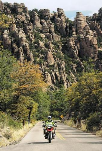
Visitors seeking a dramatic introduction to the monument's wonders will find it on the eight-mile Bonita Canyon Drive. The paved route is also an excellent quick-look option for those who have only a short time for a visit.
The drive winds past the monument visitor center and campground and then ascends through spectacular, crane-your-neck scenery en route to vista-rich Massai Point at the end of the road.
"The rock formations along this drive are outstanding," motorcyclist John Waite said during a pause along the route. "It's a wonder I don't fall off my motorcycle, I'm looking at so much stuff.
"You just cruise along, watching the shadows change from moment to moment," Waite said.
Elsewhere along the road, Mike and Sue Byrne, visitors from Massachusetts, savored the sights with their 11-year-old son, Nathan.
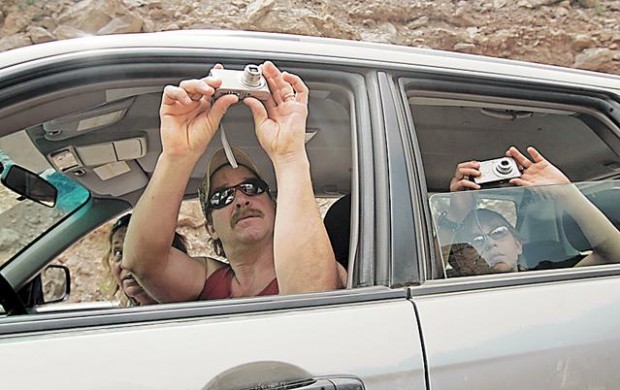
"It's awesome," Mike Byrne said as he snapped photos of rhyolite spires stabbing toward the sky. "These rocks are something to behold."
The drive passes trailheads and rock formations with whimsical names such as the Sea Captain before reaching its grand finale at Massai Point.
The point — with a parking area, restrooms and picnic tables — is a splendid spot for a late-in-the-day view of low-angled sunlight painting sheer stone towers, balanced rocks and those mysterious, slightly haunting formations known as hoodoos.
"You don't find views like this out your window at home, or many other places in the world," said Terry Fenninger, a visitor from Florida who used a high-definition video camera to capture some of the splendor.
Visitor center
A stop at the center, along the lower part of the Bonita Canyon Drive, is a good way to get your bearings and take a sort of short course on the monument's history and attractions.
Watch a free orientation video, check out an extensive stock of books and maps, and get answers to your questions from staff at the center.
Displays focus on birds and other wildlife, geology, forest ecology and human history in the area — including an exhibit on the Chiricahua Apaches.
Camping out
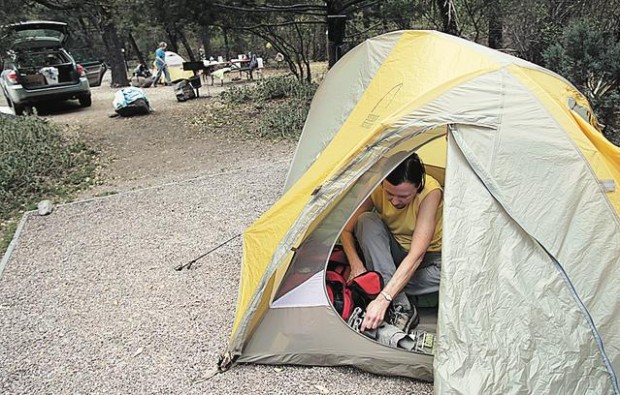
The Bonita Canyon Campground, less than a mile past the visitor center on the scenic drive, has sites for tents, trailers and recreational vehicles up to 29 feet long. The sites are available on a first-come, first-served basis.
The campground has tables, grills and restrooms but no hookups or showers.
Fees are $12 per night.
"It's a very nice campground with flush toilets and running water," Marisa Wampler said as she and Marcia Locke took down their tent after a night of camping.
Trails to try
You'll get a good overview of the monument's natural wonders from the scenic drive and overlooks. But a hike on one of the site's well-maintained trails will get you into the heart of the rocky landscape. Here's a sampling:
• For an easy stroll, try the 0.4-mile Visitor Center to Campground Trail. Watch for acorn woodpeckers and hummingbirds.
• A moderate hike with superlative scenic rewards is the 3.3-mile Echo Canyon Loop. Made up of segments of the Echo Canyon, Hailstone and Ed Riggs trails, the loop takes hikers to dramatic rock formations, including an area known as the Grottoes. Pick up the loop by way of a short connecting trail beginning at Massai Point, or at the Echo Canyon Trailhead and Picnic Area. The sites are marked on a map in a brochure visitors receive at the monument entrance station.
• For a more challenging trek, avid hikers might try the 7.3-mile Visitor Center to Heart of Rocks and Return Trail. The route links the Lower Rhyolite Canyon, Sarah Deming and Heart of Rocks Loop trails into a sort of grand tour of big-rock country.
Hikers on the trails often share the reaction of Sandy Poinsett, a visitor from Oregon who summed up her trek on the Heart of Rocks Loop in a single word: "Incredible!"
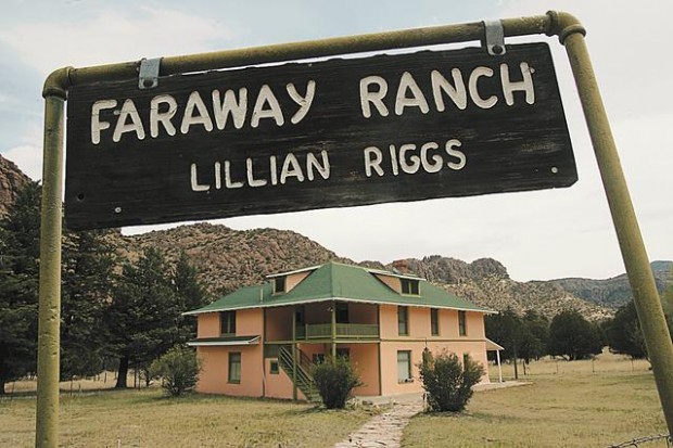
Faraway Ranch
To catch a glimpse of life in the area long before the monument was established in 1924, you might visit the Faraway Ranch site. It's a short distance off the road between the monument entrance and the visitor center.
The ranch was the home of people who settled in Bonita Canyon in the late 1880s. The site grew from a simple homestead to a guest ranch that was in operation from 1917 to 1972.
Today, visitors can take a self-guided walk around the grounds or check at the monument visitor center to learn about tours of the house.
Critters
Visitors to Chiricahua Monument often see birds and other wildlife along the Bonita Canyon Drive or on hiking trails.
In addition to abundant bird life, animals in the area include white-tailed deer, bobcats, coati-mundi, black bears, wild turkeys, mountain lions, snakes and lizards.
Did you know
Most of Chiricahua National Monument — 86 percent of the land — is designated as wilderness.
On StarNet: To tour through Chiricahua National Monument without leaving home, go to videos.azstarnet.com
If you go
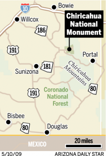
• Drive: From Tucson, drive east on Interstate 10 to Willcox and proceed southeast on Arizona 186 to a junction with Arizona 181. Turn east at this junction and drive four miles to the monument entrance.
• Cost: Admission fees are $5 for visitors 16 and older. Youths 15 and younger get in free.
• Hours: The monument is always open. Visitor center hours are 8 a.m. to 4:30 p.m. daily. The center is closed on Thanksgiving and Christmas days.
• An important note: You won't find a gas station, cafeteria, lodge or other such amenities at the visitor center or elsewhere in the monument. The nearest sizable community is Willcox, about 35 miles to the northwest. Be sure your vehicle has plenty of gas and bring along any food or other supplies you'll need.
• Information: Go online to www.nps.gov/chir or call 1-520-824-3560.