The scenes of destruction from the recent landslide and floods in Nepal are hard to comprehend, even for an expert like University of Arizona research scientist Gregory Leonard.
For years, he studied glaciers, glacial lakes and mountain hazards across the Nepalese Himalayas, including a half-dozen field expeditions to investigate previous disasters and assess future risks.
But none of that work prepared him for the footage from Aug. 26.
“It's absolutely stunning. It's sobering. It's devastating,” he said. “I have never seen such a large flood of this nature in Nepal.”
As of Thursday, the death toll stood at more than 1,250, with several thousand more still unaccounted for across a path of destruction more than 60 miles long.
People are also reading…
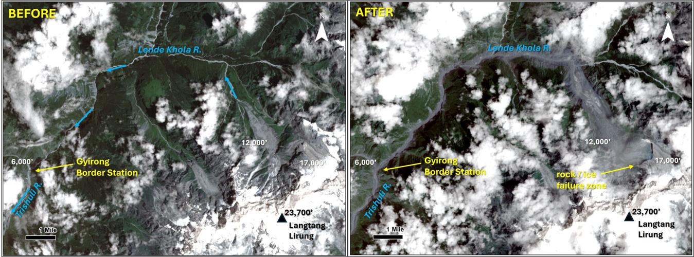
Scientists are still trying to piece together exactly what happened, but the evidence so far points to the sudden collapse of a section of bedrock and glacier roughly a mile long and two-thirds of a mile wide on the northern flank of 23,000-foot Langtang Lirung Peak.

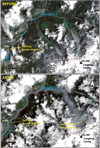
Annotated before and after satellite images show the origin and magnitude of the Aug. 26 landslide in the Himalaya Mountains that caused catastrophic flooding and more than 1,250 deaths in Nepal and neighboring Tibet.
Leonard said the slope failure occurred at roughly 17,000 feet above sea level, triggering its own 5.2-magnitude earthquake as it sent an estimated 7 billion cubic feet of rock and ice plunging thousands of feet down the mountain.
As it went, the landslide collected more debris and melted more glacial ice with its incredible frictional heat until it crashed into the Lende Khola River channel and raged downstream.
The first significant human structure in its path was 14 miles away: the Gyirong border crossing between Tibet and Nepal, where the Lende Khola empties into the Trishuli River at a cluster of multistory buildings connected by the “Friendship Bridge.”
See the devastating moment mudslide slams into Nepal-Tibet border post
“It took 7 minutes, so you're looking at speeds of over 100 miles per hour,” Leonard said. “It's just mind boggling to think about that mass of material and water moving at that speed.”
Video captured by a surveillance camera high above the border crossing shows people fleeing in terror before the entire site is erased in an instant by a wall of dust and debris.
For Leonard, it’s impossible to see something like that without thinking of the people he has met and the villages he has visited in that part of the world over the years.
“It just took away my breath and my spirit when I saw the aftermath of that border station in particular,” he said. “It's a very, very difficult video to watch.”
Crashing plates
Nepal’s mountainous terrain is the result of an ongoing collision between two tectonic plates. The Indian subcontinent has been slamming into the rest of Asia for “many millions of years, like a slow train wreck in progress” that is gradually thrusting the Himalayas higher and higher into the sky, Leonard said.
The result is a dangerous mix of incredibly steep terrain and high-elevation glaciers in an active earthquake zone.

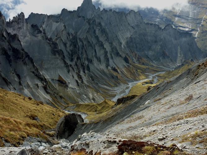
The dramatic landscape of the upper Seti River Basin in the Nepalese Himalayas in 2013.
And global warming is only making the problem worse. As the glaciers melt and recede, they leave behind destabilized ground and piles of rocks and dirt known as moraines that can collect water behind them, creating the risk of massive floods and landslides.
“There's been an increasing number of glacial-lake outburst floods and rock-ice avalanches that have produced some very deadly and damaging natural disasters in Nepal over the last couple decades,” Leonard said.

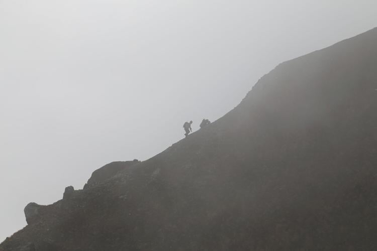
University of Arizona research scientist Gregory Leonard explores ancient glacial lake sediments in the Upper Seti River Basin high in the Nepalese Himalayas in 2013.
“It is currently difficult to attribute any given disaster to climate change, but taken as an ensemble of events across multiple years, multiple decades now, we are certainly witnessing an increase in the frequency and size of glacier and mountain related hazards. We expect that to continue and maybe accelerate into the century.”

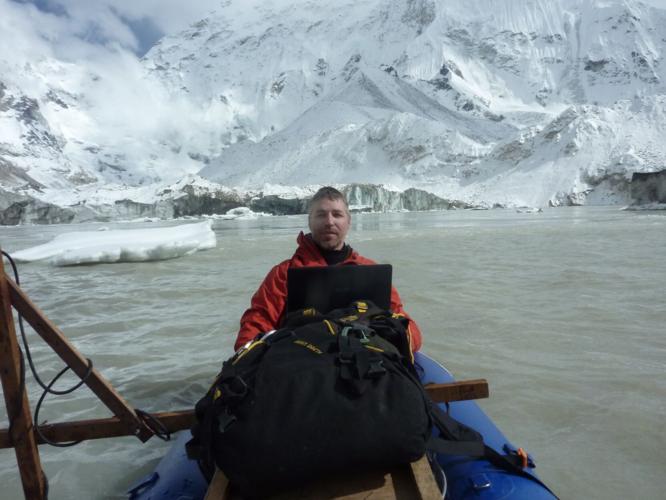
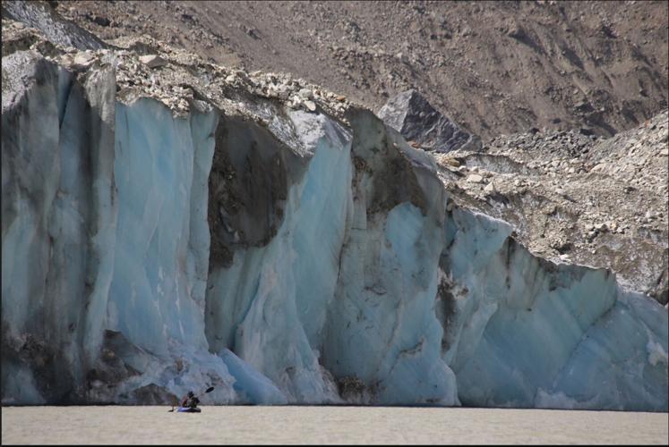
University of Arizona research scientist Gregory Leonard floats in an inflatable kayak while collecting measurements of Imja Lake, 16,400 feet above sea level on the southern flank of Mount Everest, as part of a study of potential flooding and landslide hazards in the Nepalese Himalayas in 2014.
Danger zone
It was hazards like these that lured Leonard to Nepal more than a decade ago.
“We were looking at quantifying the size, the shape, the depth and the volume of some of the most dangerous glacial lakes in the high altitude Nepalese Himalaya,” he explained.
Starting in 2013, Leonard teamed up with fellow researcher Jeffrey Kargel — his boss at the time in the U of A’s Department of Hydrology — for three expeditions to collect so-called bathymetric data from these lakes using sonar instruments.

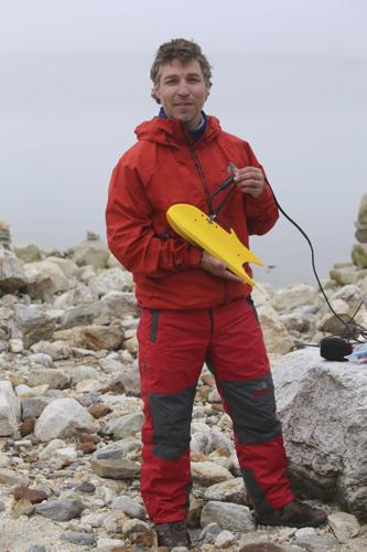
University of Arizona research scientist Gregory Leonard conducts a sonar survey of Thulagi Lake in Nepal in 2013.
Their research was largely funded by NASA, though they also received support from the United Nations Development Program and the U.S. Agency for International Development, or USAID, the humanitarian assistance agency that was dismantled by the Trump administration last year.
The work was grueling and sometimes dangerous, requiring them to trek for up to a week at a time through rugged, high-altitude terrain to reach deep lakes of lethally cold water surrounded by steep cliffs.
Leonard loved every minute of it.
“I'm an adventure-oriented person, so, yeah, sign me up,” he said. “If you're asking who wants to volunteer, I'm the first one.”
During one such trip, while camped next to a glacial lake near Makalu, the world’s fifth tallest peak, Leonard heard rumbling from inside his tent. He peeked outside just in time to see an avalanche crashing down into the water where he had been floating in an inflatable kayak full of scientific equipment the day before.

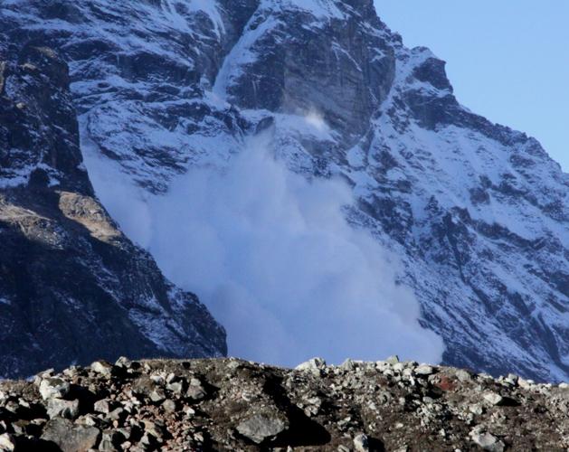
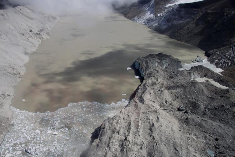
An avalanche of ice crashes down into Lower Barun Lake from Makalu Mountain in the Nepalese Himalays in 2015. University of Arizona researcher Gregory Leonard snapped the picture after hearing the rumble from inside his tent. He had been out on the lake taking measurements the previous day.
On another trip, their small research team had to shelter at their campsite near Mount Everest during a cyclone-fueled blizzard, then wait for the ice to melt on the lake they were surveying so they could safely collect their data.
Those measurements were later used by others to engineer and build a small spillway that safely lowers the level of Lake Imja to relieve the pressure on its natural moraine dam, which perches high above a valley that’s home to about 100,000 people along a major tourist corridor leading to Everest.
“That was really meaningful work,” Leonard said.
Mountain man
He and Kargel have also conducted field-based investigations of two earlier disasters in Nepal, including a 2012 flood on the Seti River that killed 72 people.
“That was not too dissimilar from this recent event we just witnessed,” Leonard said. “Except, of course, in terms of size.”
Beyond his scientific work, Leonard has also explored the world’s tallest mountain range as a tourist, both in India and Nepal, where he has climbed several peaks as tall as 23,000 feet. He’s planning to head back to the region next year for his latest mountaineering adventure not far from Mount Everest.
“The Himalayas have really been an important part of my professional and personal life, and I just treasure the mountains themselves, as well as the culture and the people in Nepal and India,” he said. “It's just been a blessing to have spent a lot of time there.”
University of Arizona research scientist Gregory Leonard explores ancient glacial lake sediments in the Upper Seti River Basin high in the Nepalese Himalayas in 2013.
One place he hasn’t yet seen in person is the area around Langtang Lirung, where last month’s terrible landslide originated.
But he knows that region well from all the satellite images he stared at in 2015 as part of a global humanitarian effort by scientific experts to remotely identify landslides and other potential hazards left behind by the deadly Gorkha earthquake.
That 7.8-magnitude quake on April 25, 2015, claimed the lives of nearly 9,000 people and caused severe damage across more than 42,000 square miles of Nepal, India, China and Bangladesh.
“We all spent many, many sleepless nights poring over all the imagery and trying to assist the Nepali government and emergency authorities to help them triage where they needed to send resources and whatnot,” Leonard said.
The team ended up mapping more than 4,300 different slope failures triggered during and after the quake, using data collected from orbit above the vast disaster zone by one of the largest NASA-led imaging campaigns of its kind.
Rocks in space
Leonard returned to Nepal later that year with Kargel for another round of glacier-lake survey work, and they used some of their helicopter time during the trip to get a closer look at a number of those landslides.
“We also interviewed people in some mountain areas about their experiences with the earthquake in particular,” Leonard said.
The two researchers would document their findings in the journal Science in late 2015 with a paper co-written by more than 60 other scientists from nine countries.
“That was a unique, very large and successful international collaboration,” Leonard said.
Something similar is now being done in the wake of the Aug. 26 disaster, with glacier researchers around the world studying the latest satellite images for signs of new trouble spots.
Officially, though, Leonard has moved on to other things.
The geologist by training said glaciers were the main focus of his research for about eight years, but when the funding dried up for the work he was doing in 2016, he took a hard right turn into planetary science.
For the past decade, his work has taken him to the far more modest summit of Mount Lemmon, where he has discovered about 2,400 near-Earth asteroids and more than 20 comets as a member of the U of A’s NASA-funded Catalina Sky Survey.
But the Himalayas haven’t lost their hold on him.

Gregory Leonard collects bathymetric measurements on Lower Barun Lake, 15,000 feet above sea level in the Nepalese Himalayas, in 2015.
“I'm still assisting with various glacier and mountain-hazard related projects,” Leonard said, some of it related to last month’s landslide and flood. “I'm sort of doing it on my own dime and my own time.”
There’s even talk of a return trip to Nepal this fall to assist a colleague with some technical work related to the Aug. 26 tragedy.
“The hazard work is challenging, and it's meaningful,” Leonard said. “I really just love being up there and helping out if I can. That's the skills that I suppose I was born with, so I'll put them to the best use I can.”



 Scientist finds perfect spot in Tucson to study glaciers