Meteorologists on Monday said a series of significant weather events during an unusual spring season created water levels "never ... observed before" in high mountain areas that translated to destructive flooding around Montana.
As officials evacuated Red Lodge residents and Yellowstone National Park closed its entrances due to extreme flooding, forecasters with the National Weather Service said larger towns downriver were set to see peak river flows starting Monday evening.
People are also reading…
In neighboring southwest Montana, Jim Brusda, lead meteorologist for the National Weather Service in Great Falls, says three contributing factors lead to rivers rapidly rising.
First, the unseasonably cool April and May held mountain snowpack up high and late spring snowstorms considerably added to the snowpack.
Second, the temperature of the existing snowpack, measured by satellite, sat right at 32 degrees due to the sun angle this late in the year.
Third, Montana saw multiple days of considerable rainfall at higher elevations.
The three factors combining, Brusda said, caused the snowpack to “wash out rapidly versus melting out more gradually.”
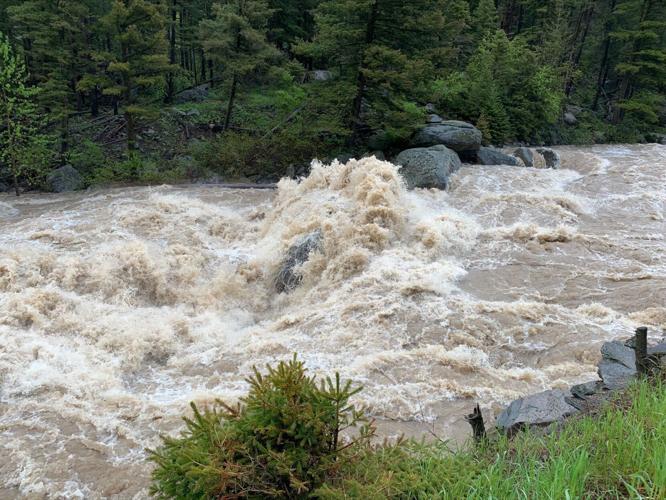
“This is causing the Gallatin River to go above (minor) flood stage as we speak near the city of Logan,” Brusda said Monday afternoon. “But we are not expecting major flooding on the Gallatin.”
Brusda forecasted the Gallatin River flooding to last a couple days with the situation starting to improve on Thursday.

Water rushes over House Rock as the Gallatin River reaches flood stage on Monday.
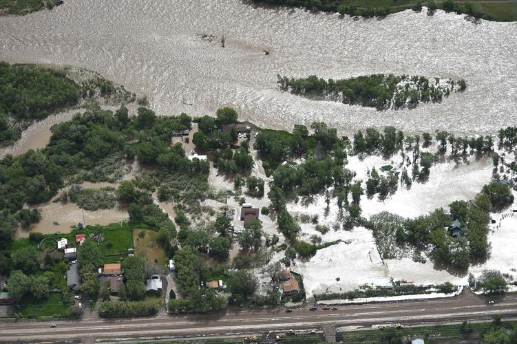
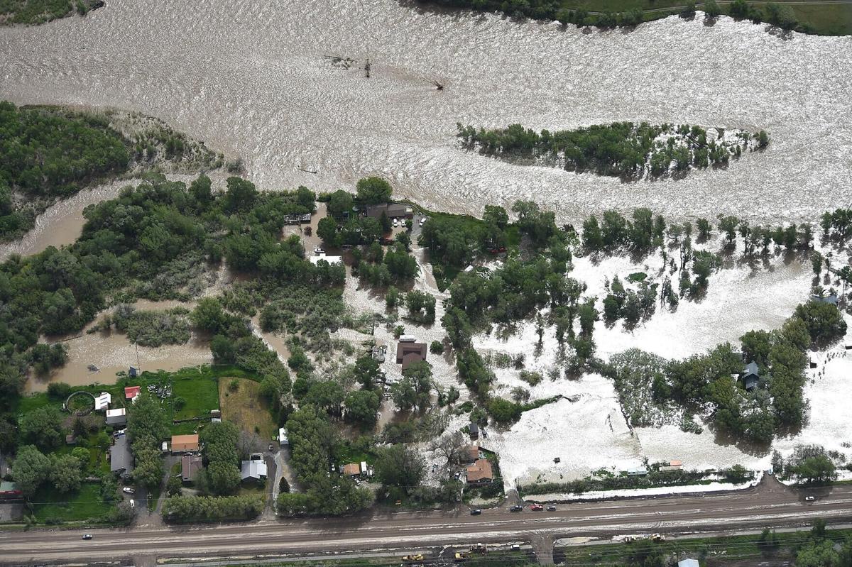
Dan Borsum, senior forecaster with the Billings National Weather Service office, similarly described "really significant" events that touched off the flooding in south-central Montana drainages: a snowstorm over Memorial Day that deposited moisture in the mountains and the recent series of rain episodes that dropped 2 to 3 inches in some areas.
Much of the heavy rain and snow fell on the southside of the Absaroka-Beartooth area, Borsum said, but that moisture drains to the north and into drainages like the Paradise Valley and Clarks Fork of the Yellowstone River. Soda Butte Creek near Cooke City and Silvergate have reported water levels 4 feet over the bridges there, Borsum said.
"You don't normally think of flooding that high up in the mountains," Borsum said. "… The levels that have been observed at these upstream locations have never been observed before."
Forecasts
South-central Montana:
Water levels were cresting Monday afternoon in the upper regions of rivers in that part of the state, Borsum said. The next question is what happens with downriver towns including Livingston, Laurel, Columbus and Billings. According to Borsum, the river levels are expected to peak in:
- Livingston by Monday evening;
- Columbus between 4 a.m. and 7 a.m. Tuesday;
- Laurel around noon on Tuesday; and
- Billings between 2 p.m. and 6 p.m. Tuesday.
"Laurel and Billings, in particular, may see their high water sustained for longer periods of time," Borsum said. "We're still trying to get a feel for that."
Looking ahead, temperatures in south-central Montana are expected to reach the 90-100 degree range in the coming days, with temperatures in the mountains holding in the 70s, Borsum said. Temperatures Monday had cooled enough to adequately slow the snow melt, he said, but when those highs come later this week the melting will accelerate once again.
"It should not be as high as it has been," Borsum said. "But with any efforts to repair infrastructure, people need to know that a ton of water is still yet poised to come down in the area."
Southwest Montana:
Excess water in the Gallatin and the emergency release of water from Hebgen Dam into the Madison River have put the Missouri River near Toston in a flood watch.
Operators of Hebgen Dam are releasing more water than usual as they try to limit the amount of pressure on the dam as crews work to repair parts of the dam that failed in November 2021. This water is headed for Ennis, which is also in a flood watch, before it reaches the Missouri River.
“The Toston area should just see minor flooding for about the next day or two,” Brusda said. “The flooding should be confined to the edges of the Missouri River in that area.”
No flooding is expected any further downstream as Canyon Ferry Reservoir collects all the runoff.
North-central Montana:
The National Weather Service in Great Falls is watching the Glacier area and Rocky Mountain Front as up to 2 inches of rain is forecast to fall below 5,000 feet and 3-4 inches of snow above 6,000 feet over the next day or two.
As long as the higher-elevation precipitation falls as snow, as forecasted, flooding should remain minor along the eastern front of the Northern Rockies. But if the precipitation falls as rain it could mean more significant flooding in that area.
Brusda urged people not to recreate on rivers right now as the rivers "flush out" debris remaining from last year's low water.
"Anybody recreating on the river right now should know it's not a good situation," Brusda said. "There’s a lot of debris in the river and they are running too high and very fast."