


What city officials do to restore a dead river, an old landfill can take away.
Reclaimed water releases into the Santa Cruz River have been slashed for the second time this year to ensure rising water levels in the underlying aquifer don’t leach out contaminants from a neighboring landfill.
The cutback of nearly 60% in releases that started early this month leaves the much-heralded Santa Cruz River Heritage Project with an uncertain future.
The effluent releases into the river, which started nearly 15 months ago, have fluctuated a number of times since then for various reasons. Today, it’s not clear what the long-term river flow will be or even what city utility officials want it to be.
These alternating cuts and restorations of river flows have happened at the same time the public has flocked to the once-dead river to see water where it hadn’t run for 70 years except after floods.
People are also reading…
The revived river has drawn walkers and bicyclists to the neighboring, concrete Loop path in larger numbers than before. Birds, toads, coyotes, dragonflies and other wildlife also have gathered, restoring a bit of the Santa Cruz’s riparian setting that had disappeared when groundwater pumping dried the river up three generations ago.
But there is at least a possibility that water flows in the river will not again attain — at least not for the long term — the levels released into the river when the project was launched with considerable public fanfare in June 2019.
The reason is that despite prevention efforts, the underlying aquifer north of 22nd Street has risen again to a point raising concerns that recharged river water could undercut the old “A” Mountain Landfill.
That could release chemical contaminants into the environment. The old landfill lies immediately west of the river, between West Cushing and West 22nd streets.
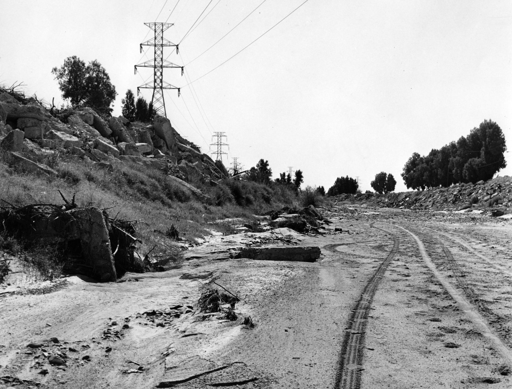
Northbound river now peters out sooner
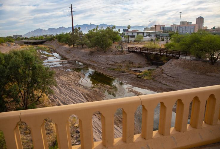
Tucson Water officials reduced reclaimed water releases into the river on Sept. 3 because of the rising levels, said utility spokesman Fernando Molina.
The amount of water gushing into the river through a pipe just north of 29th Street has now dropped from about 1,900 cubic feet per second during most of the summer to around 800 cubic feet per second. The northbound river was running to almost halfway between Speedway and Grant Road but now peters out between Congress Street and St. Mary’s Road.
Water releases were cut to 500 gallons per minute in late February for the same reason. They were eliminated in the spring for a county sediment removal project and restored to their original level in early June when that project was finished.
Now, utility officials say they will continue to monitor groundwater levels under the river and adjust releases accordingly. They are otherwise vague about future release levels.
A retired federal engineer who has long been a critic of this project, Eric Holler, praises the utility’s action as “prudent” but says it shows the project’s original planning was flawed.
Retired engineer long warned of issue
It’s unlikely the city will ever be able to restore releases to their original levels for an extended period, said Holler, who had warned from the start that the landfill could pose a problem.
While one of the project’s prime purposes was recharging water into the aquifer, the recharge occurring at 800 gallons per minute is “inconsequential,” Holler said.
The Heritage Project “is a great vision, but it’s in the wrong location,” he said.
Tucson Water, however, doesn’t view this cutback as a problem.
“We monitor and make adjustments at Heritage just like we do at all other recharge projects we operate,” Molina said. “This project has always been about multiple benefits, with recharge being one of them. The environmental/ecological benefit was another.
“We believe we have accomplished what we set out to achieve,” Molina said.
A University of Arizona biologist who has monitored wildlife’s return to the river, Michael Bogan, says this project still can be an ecological success. Even now, the river runs farther north than officials had hoped for in June 2019 when the releases started, he noted.
Since releases resumed this June, the number of dragonfly and damselfly species seen along the river hit about the same level — 29 — as in summer 2019, Bogan said.
Today birds such as herons, egrets and sandpipers keep flocking to areas where water still runs, said Bogan, an assistant professor of natural resources.
“I would love to see as much water as possible going down the river, but I know they are operating within the constraints of the landfill. There’s not much they can do about it,” Bogan said of Tucson Water officials.
Old landfill has toxins
Tucson’s dilemma with the Santa Cruz River Heritage Project involves the landfill operated well over a half-century ago by the city itself.
From 1953 to 1962, the “A” Mountain Landfill received mainly residential garbage, said a 2015 report on the dump written for the Rio Nuevo redevelopment project that now owns it.
“There were no site restrictions and so-called “wildcat” dumping of hazardous materials may have occurred,” the report said.
A survey conducted in 2000 found that refuse was “prominent” over an area of 31.4 acres, going as deep as 45 feet thick underground, the report said. The deepest and thickest sections of trash were in areas of the landfill lying very close to the river.
Groundwater monitoring under the landfill since 2000 has found many toxic chemicals there. None were at levels exceeding state standards for aquatic water quality, the report said.
Tetrachloroethene, a common dry cleaning compound commonly called PCE, is one carbon-based chemical found under the landfill. Others include 1,4-dichlorobenzene, cis-1,2-dichlorethene, methylene chloride and toluene. Nitrates, commonly linked to wastewater discharges and agriculture, have also been found at low levels there.
The risk is that if river water reaches as high as the trash, that could mobilize pollutants there, sending higher levels into the groundwater or river, said Holler, a retired U.S. Bureau of Reclamation engineer.
“I was shocked at how close the landfill is to the river and the monitoring well that the city is concerned about,” he said.
Well levels there are governed by the city’s permit to operate the Heritage Project. Granted by the Arizona Department of Water Resources, the permit requires water levels in the underlying aquifer to rise no higher than 10 feet below the landfill, or about 50 feet underground.
Last winter, the water level reached 61 feet below ground. On Sept. 3, the day releases were cut again, it reached 63 feet and 8 inches below ground.
At the time Tucson Water first cut its reclaimed water releases, utility officials said they hoped the rising water would be eased by the county’s sediment removal work.
First, they pointed to plans by the county to build notches in several major, concrete-grade control structures that try to prevent river flooding — notches that would allow the water to flow faster and not form ponds. Second, they hoped the county’s plan to slant the river channel to force water into the center would let it run more smoothly, reducing infiltration.
But Holler warned back then that removing the sediment would clear a path for the river water to seep into the aquifer more quickly, increasing the risk of undercutting the landfill.
Asked whether the rising water levels showed Holler was right, Tucson Water’s Molina said: “There has always been a presumption that sediment removal would impact infiltration rates.
“Only three months have passed since that work has been completed, and we will need more time to assess the impacts that longer-term seasonal flows might have on … the channel,” Molina said.
Split verdicts on the project
Asked about the city’s plan for future releases, Molina said the original plan for the project was always “to have generally continuous, but certainly variable, flow.”
Holler, however, said that three years ago, during the planning stages, “we asked Tucson Water about those landfills, their response was ‘Hey, it’s not a problem.’ They blew us off.”
He likened efforts to keep the aquifer under the river from rising too high to “threading a needle, figuring out how many angels can you draw on the head of a pin with a laser.”
But UA’s Bogan says the downtown was a fabulous place to run reclaimed water because historically, the river long had a naturally perennial reach there.
Holler and Bogan are both right, said local environmentalist Christina McVie, who has long favored river restoration and calls this an excellent test case.
“Anytime you have habitat enhancement, that is not ever a bad thing,” McVie said.
30+ historic photos of the Santa Cruz River through Tucson
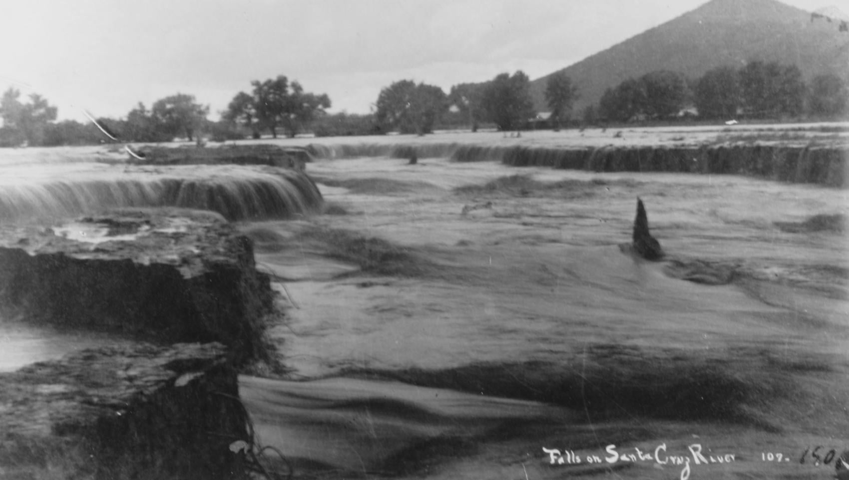
Waterfalls on the Santa Cruz River in 1889 near Sentinel Peak in Tucson.

Girls in Santa Cruz River,1889-1890.
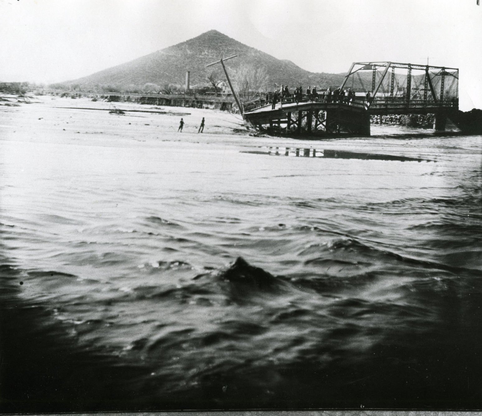
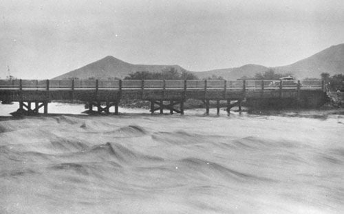
A bridge over the Santa Cruz River near Sentinel Peak in Tucson washed out during flooding in 1915.
Santa Cruz River at St. Mary's Road bridge in 1931.
The Santa Cruz River flows north as seen from Sentinel Peak in Tucson in the early 1900's.
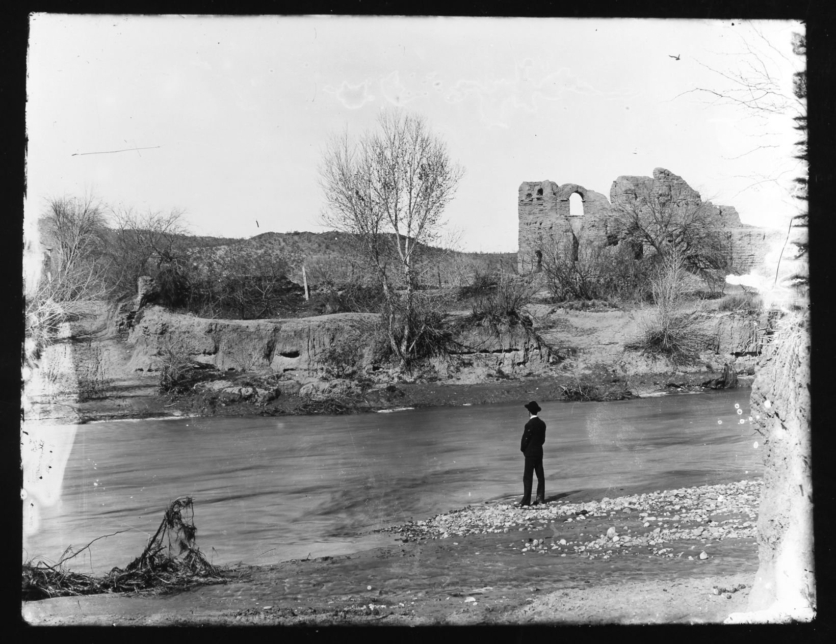
Ruins of El Convento along the Santa Cruz River, circa 1910. The adobe structure was part of a Franciscan mission complex built here at the end of the 18th century.
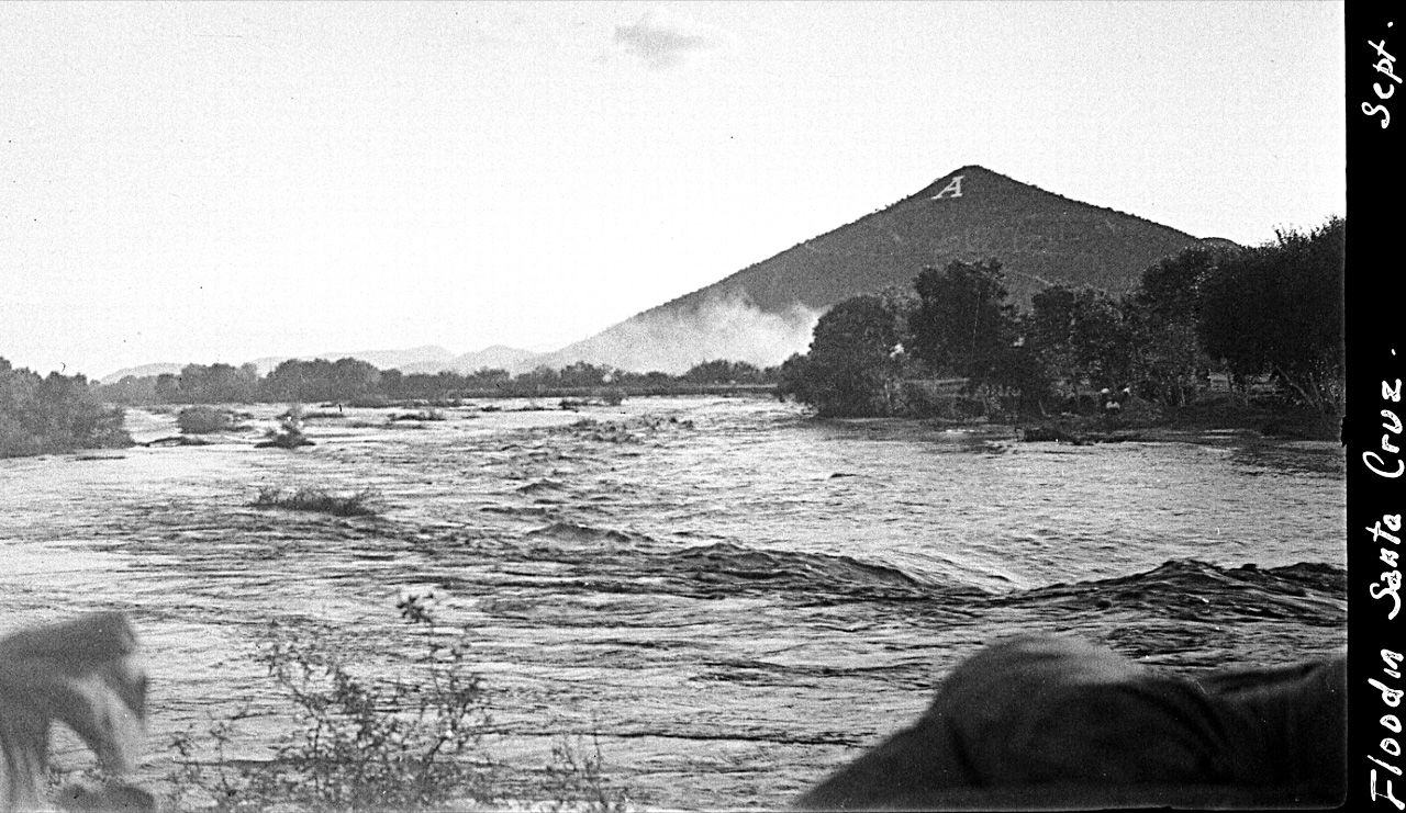
Flooding of the Santa Cruz River, Tucson, in September, 1926, from “Letters from Tucson, 1925-1927” by Ethel Stiffler.
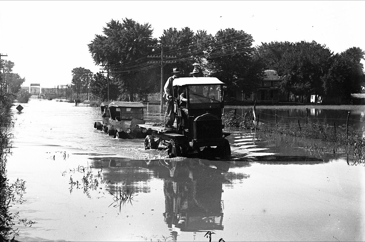
Flooding of the Santa Cruz River, Tucson, in September, 1926, from “Letters from Tucson, 1925-1927” by Ethel Stiffler.

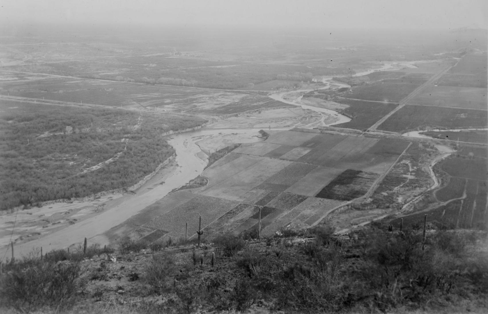
Aerial view of the Santa Cruz River as it winds its way through Pima County north of Cortaro Road in 1953. The county was considering a bridge at several locations, but had to contend with the ever-changing course of the river.

The Tucson Citizen wrote in 1970, "The Santa Cruz River is a garbage dump" and "even marijuana grows in it." City leaders were pushing to upgrade and beautify the channel. The U.S. Army Corps of Engineers was studying the possibility.
The Santa Cruz River flowing under the Congress Street bridge in August, 1952. The Garden of Gesthemane is in the background.
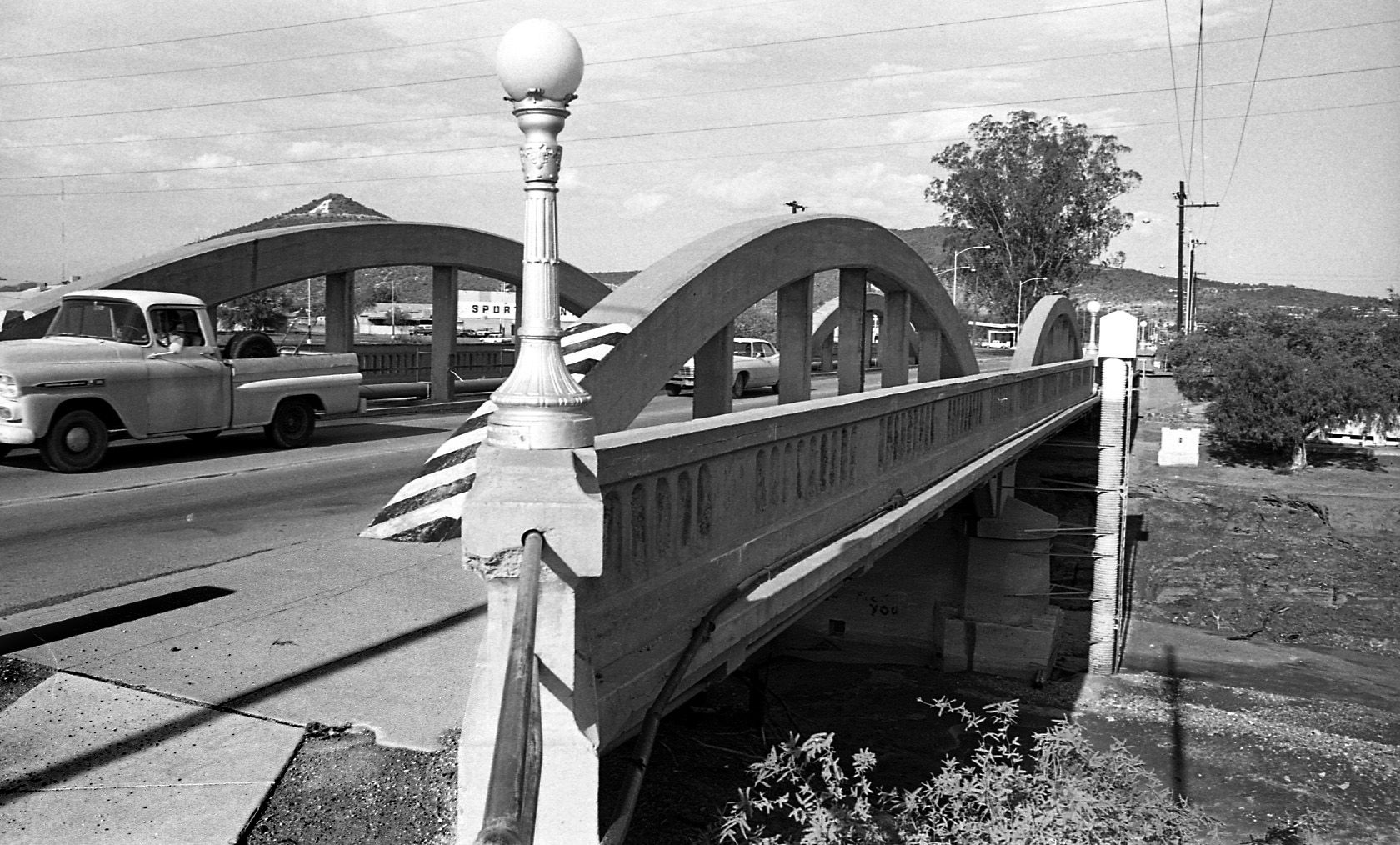
By July 24, 1970 the old bridge on West Congress over the Santa Cruz River had to go and be replaced by a new bridge.

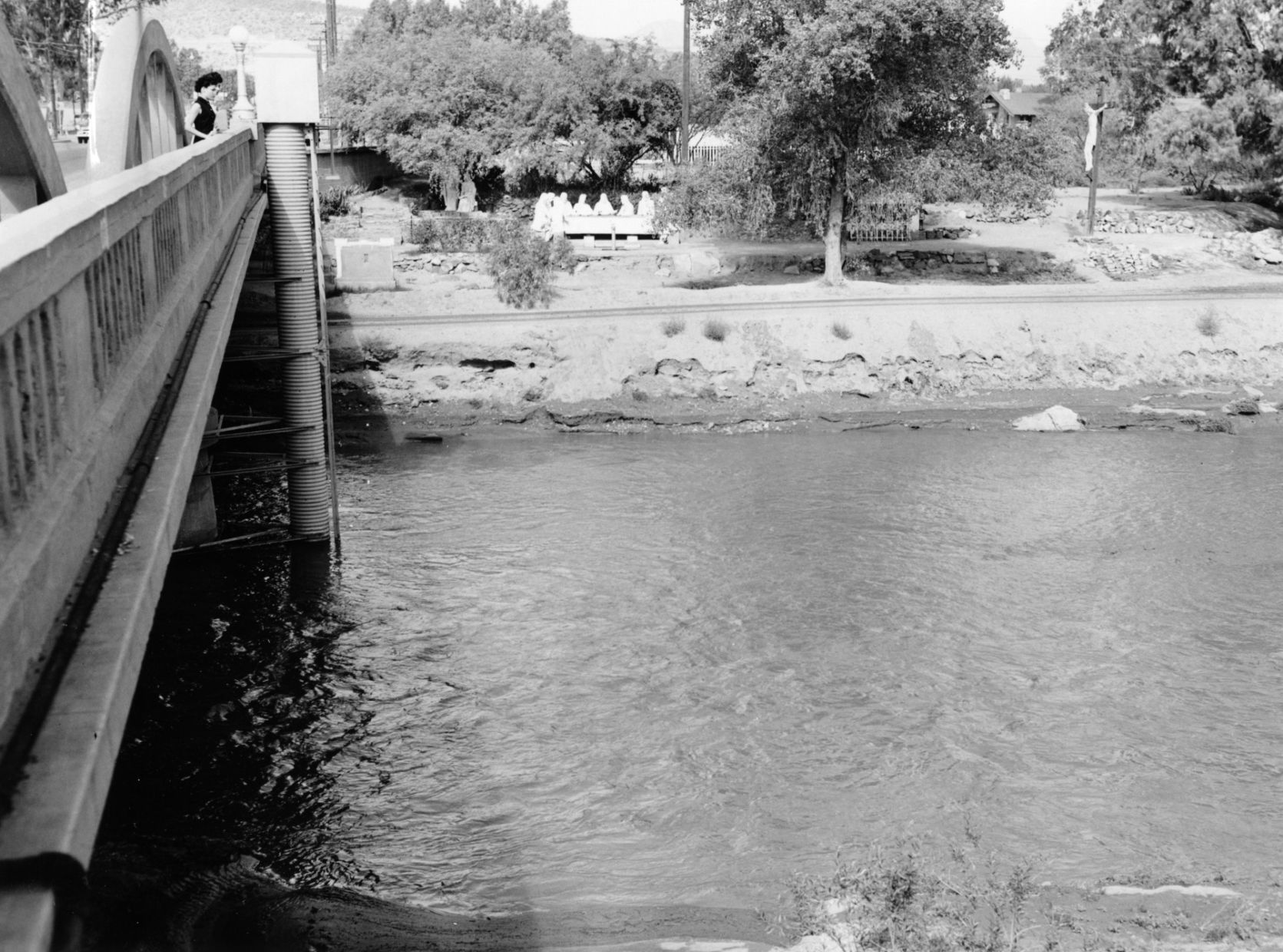
By July 24, 1970 the figures from Felix Lucero's Last Supper had been on the west side of the Santa Cruz River for more than 20 years. City authorities had decided to leave it in place while a new bridge on West Congress Street was to be replaced.
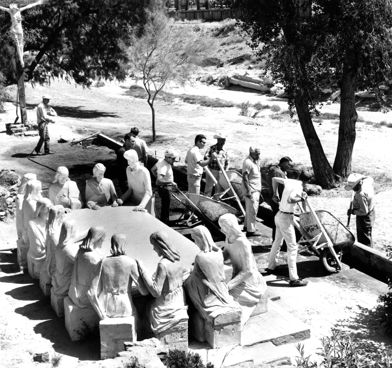
Volunteers from the Tucson Jaycees and Junior Chamber of Commerce finish restoration of the statues and grounds of the Garden of Gethsemane along the Santa Cruz River in May, 1964. The statues were ravaged by vandals and weather. The city parks and recreation department worked with the volunteers. Artist Felix Lucero began sculpture project in 1938 and finished it nine years later.

Drought in June, 1974, turned the Santa Cruz riverbed into crunchy chunks of dried mud.

The Santa Cruz River flowing under Silverlake Road in August, 1970.

Children play in the Santa Cruz River near Speedway Blvd in August, 1970.
The Santa Cruz riverbed at Congress Street in November, 1967.

After years of waiting, crews began clearing debris and channeling the Santa Cruz River in November, 1977, and constructing what would become a 14-mile river park. The Speedway Blvd. bridge is in the background.

After years of waiting, crews began clearing debris and channeling the Santa Cruz River in November, 1977, and constructing what would become a 14-mile river park.

The Santa Cruz River looks peaceful flowing underneath Speedway Road after days of flooding in October, 1977.

Adalberto Ballesteros rides along the Santa Cruz River west of downtown Tucson in 1980.

The Santa Cruz River looking north from Valencia Road in July, 1974.

Junked cars and trash spill into the Santa Cruz River, looking south, just south of Grant Road in July, 1974.

Road graders scrape the Santa Cruz River channel between Speedway and Grant roads during bank stabilization construction in May, 1991.
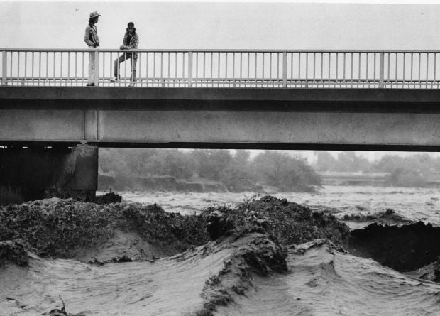
Water surges in the Santa Cruz River at the St. Mary’s Road bridge on Oct. 2, 1983.

Flooding in Marana after the Santa Cruz River overflowed its banks in Oct. 1983.

A bridge on the Santa Cruz River northwest of Tucson washed out during flooding in October 1983.

Residents watch the surging Santa Cruz River rush past West St. Mary's Road on January 19, 1993.

Tucson firefighters are standing by and waiting for two kids floating in the Santa Cruz River on some type of object during flooding in July, 1996.

As the Tucson Modern Streetcar rumbles across the Luis G. Gutierrez Bridge, water flows bank to bank along the Santa Cruz River after a morning monsoon storm on July 15, 2014.

Johnny Dearmore skips a rock in the Santa Cruz River as reclaimed water is released into the channel at 29th Street as part of the Santa Cruz River Heritage Project on June 24, 2019. The release of effluent is the city’s first effort to restore a fraction of the river’s flow since groundwater pumping dried it up in the 1940s.

The Santa Cruz River flows Friday morning July 23, 2021 after an overnight monsoon storm passed over in Tucson, Ariz.

Betsy Grube, center, with Arizona Game and Fish Department, releases longfin dace fish into the Santa Cruz River at Starr Pass Boulevard on March 23, 2022, as Mark Hart, right, takes a video and Michael Bogan, a professor in aquatic ecology at the University of Arizona, picks up more fish to release. The 600 fish were captured from Cienega Creek in Vail.