Lightning-sparked wildfires are expanding across eastern Washington, eastern Oregon and Idaho as persistent heat and drought fuel dangerous fire conditions. AccuWeather reports that more than 8,300 lightning strikes were detected in Oregon between July 22 and July 23, igniting numerous new fires. Smoke from dozens of large wildfires is spreading across southern Canada and parts of the northern United States, with hazy skies reaching the Great Lakes and Northeast. Forecasts indicate continued heat and additional dry thunderstorms could increase wildfire activity later this week. Disclosure: This video contains stock footage and content created or enhanced using AI-assisted tools. WooGlobe Ref : WGA464834
Dangerously hot conditions will move west across the U.S. this week with temperatures surging to triple digits and an increased risk of wildfires and their accompanying toxic smoke.
"A heat dome over the Texas Panhandle will push into the Southwest U.S. late this week," said Chad Merrill, senior meteorologist for AccuWeather. "High temperatures from the Southwest into Oklahoma and Texas will be between 100-111 degrees."
As the dome pushes west, the temps will follow. "On Thursday, highs in the lower 100s will expand through California's San Joaquin and Sacramento valleys with 110-120 degrees for southern California's deserts," said Merrill.
AccuWeather expects temperatures to surge well above normal across much of the Southwest and interior California, where many communities could see their hottest weather of the year so far.
People are also reading…
What does the heat dome mean for US weather?
A heat dome acts like a lid on the atmosphere, trapping heat over the same region for an extended period. "Heat domes are caused by a strong high pressure that extends over a large area and feeds on the heat and even expands a bit," said AccuWeather Senior Meteorologist Alan Reppert. These large zones of hot air result in a combination of blistering temperatures, devastating wildfires and drought conditions. Here's how the weather is expected to change this week:

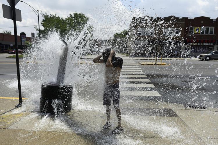
A person cools off with water from an open fire hydrant during a July 2 heat wave on the West Side of Chicago.
High temperatures and winds increase wildfire risk
With the high temperatures and dry air from the heat dome, the risks of wildfires increase.
"The risk will be very high the rest of the week into the weekend east of the Cascades in Washington and Oregon, north into British Columbia, Canada, where several large wildfires are currently burning," said Merrill. "The risk will also be higher in the Sierras, Great Basin, through much of the hills and mountains in southern California and northern part of the Rockies," said Merrill.
Into the weekend, Northwest fires could spread into Idaho and Montana as the winds pick up substantially, Merrill said.
Where wildfire smoke will be the worst
Wildfire smoke will be the most intense in the Northwest into the Dakotas and Northeast into August, according to AccuWeather.
Air quality concerns will be most pronounced in the Northwest, said Merrill, but also localized smoke could develop from new fires in the Sierra, Great Basin, southern California's mountains and northern part of the Rockies late this week into the weekend.
"The Northeast saw some relief from smoke thanks to rainfall in Ontario, Canada, but we expect these fires will continue unabated for the next few weeks and based on our forecast for the jet stream pattern, the smoke will push across these areas."

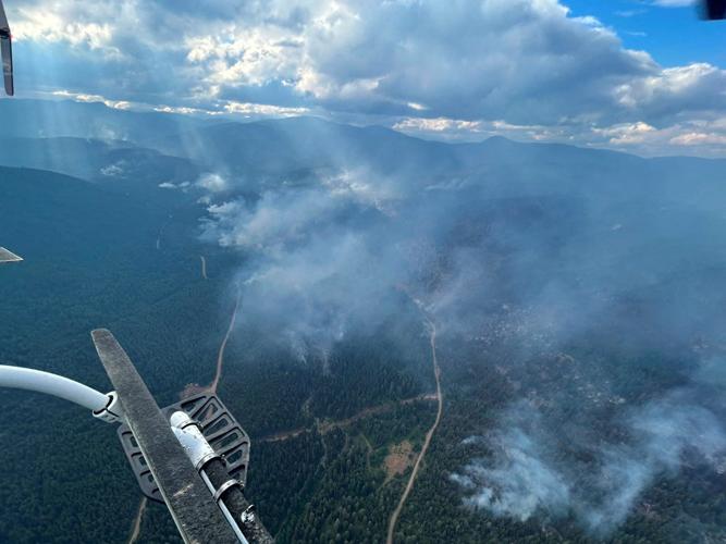
An aerial view shows smoke rising Monday from the Ainslie Creek wildfire near Boston Bar, British Columbia, Canada.
Where Canadian fires are located
This week's heat dome will likely intensify wildfire activity in the Northwest and Canada, said Merrill.
Where the US is impacted by wildfire smoke
The fires continue to expand, putting nearby communities at risk and sending smoke across portions of the United States and Canada, where air quality is expected to deteriorate, according to AccuWeather.
"Many of the lightning-caused fires were sparked during the North American monsoon thunderstorms that were most active over the past week," AccuWeather Meteorologist Brandon Buckingham said.
According to the National Weather Service’s Weather Prediction Center, a large area of high pressure will keep temperatures well above normal across the Plains, Mississippi Valley and Southeast. Afternoon highs will climb into the upper 90s and low 100s, with some parts of the Desert Southwest potentially reaching 115 to 120 degrees.
Hot, humid conditions make it difficult for the body to regulate its temperature.