7 Day Forecast
The polar vortex is taking shape over the North Pole, and it is starting the season stronger than normal, based on the latest sub-seasonal forecasts from the European Centre for Medium-Range Weather Forecasts.
That might sound like a recipe for a brutally cold winter, but it isn't that simple.
The latest models show the zonal winds surrounding the polar vortex strengthening through October, while the National Oceanic and Atmospheric Administration forecasts a very strong El Niño developing in the tropical Pacific, and the two atmospheric patterns could play a role in how the winter unfolds.
![Ice formations seen on the North Pier Outer Light lighthouse in St. Joseph, Mich., Sunday, Jan. 4, 2026. [Matthew Dae Smith/USA Today Network]](https://bloximages.chicago2.vip.townnews.com/tucson.com/content/tncms/assets/v3/editorial/c/f2/cf2f4479-fe5b-5048-9948-9fea330751d0/6aba6dbdb97d3.image.jpg?resize=1700%2C1133)
Ice formations seen Jan. 4 on the North Pier Outer Light lighthouse in St. Joseph, Mich.
What is it?
The polar vortex is a large-scale circulation of cold air and strong winds that forms over the Arctic, according to the NOAA. When it is strong and stable, it can help keep the coldest Arctic air bottled up near the pole. When it weakens or becomes disrupted, some of that cold air can move south.
People are also reading…
A disrupted polar vortex does not mean every part of the United States will turn colder, and a strong vortex does not mean the country will stay warm.
The stratospheric polar vortex is currently somewhat stronger than average, according to recent atmospheric data. The bigger question is whether that will change later in the season.
Long-range forecasts show the vortex could weaken later in the winter, particularly around January and February. That potential shift is what meteorologists will be watching.
How does it form?
The polar vortex naturally develops during late summer and fall as sunlight decreases over the Arctic and the stratosphere begins to cool.
As that happens, strong winds circulate around the polar region from west to east. These are called zonal winds, located about 10 to 30 miles above the North Pole, and they are one of the key measurements meteorologists use to track the strength and organization of the polar vortex.
Recent observations show the 2026-27 vortex strengthening as that seasonal cooling gets underway. NASA data analyzed in mid-September showed winds around 60 degrees north in the lower stratosphere running above their long-term average for the date. The return and strengthening of those west-to-east winds are part of the normal seasonal development of the vortex.
The latest European Centre for Medium-Range Weather Forecasts forecast shows the same general trend.
A reversal of those winds can be associated with a sudden stratospheric warming, a major disruption of the polar vortex.
For now, the important signal is that the vortex is strengthening as it normally does during the fall.

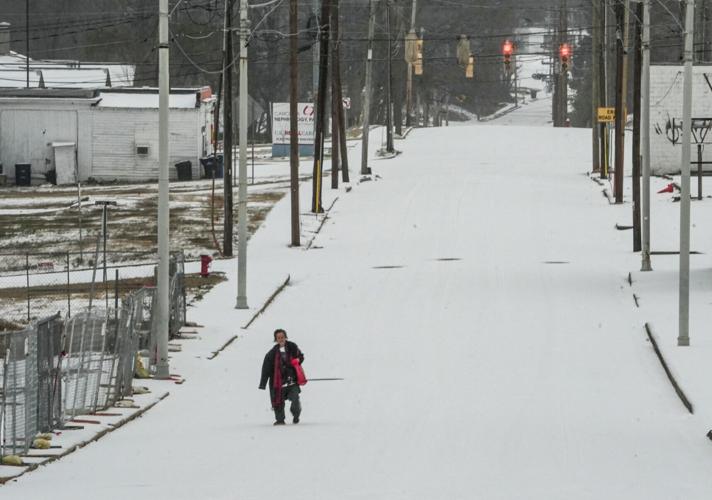
Marni Hoffman walks through a winter mix Jan. 25 on Whitner Street in Anderson, S.C.
What if it weakens?
The latest ECMWF seasonal forecast shows the polar vortex potentially weakening as winter progresses.
The model's average forecast has the winds surrounding the vortex strengthening through December before weakening substantially in January. By late January, the average winds fall to about 17 to 20 meters per second and then generally remain around 10 to 15 meters per second through February.
Some individual forecasts show an even greater weakening, with winds approaching or dropping below zero. That could signal a more significant disruption of the polar vortex, but the wide range of forecasts also shows how uncertain the winter outlook becomes.
Even if the polar vortex is disrupted, that does not automatically mean Arctic air will reach the U.S. The effects have to work their way through the atmosphere, and the resulting weather depends on where the larger atmospheric patterns set up.
A Sudden Stratospheric Warming is one of the most significant ways the polar vortex can be disrupted. Temperatures high in the stratosphere can rise by several tens of degrees in just a few days. The warming can weaken the vortex, displace it or split it into separate pieces.
Stratospheric disturbances can take days to weeks to propagate downward into the lower atmosphere. If the disturbance couples with the tropospheric circulation, it can help create a pattern that allows colder Arctic air to move farther south.
What’s El Nino’s role?
This winter has another major atmospheric player: El Niño.
NOAA's Climate Prediction Center said Sept. 10 that El Niño is strengthening, with a greater than 90% chance of a very strong event during the Northern Hemisphere fall and winter of 2026-27. NOAA also said there is a 75% chance that the October-December period will reach the threshold for a historic-strength event based on records dating to 1950.
When Arctic air meets a moisture-rich storm system, the combination can produce snowstorms and blizzards. This year, El Niño can help supply that moisture by strengthening the southern jet stream and steering more Pacific moisture into the U.S.


![Ice formations seen on the North Pier Outer Light lighthouse in St. Joseph, Mich., Sunday, Jan. 4, 2026. [Matthew Dae Smith/USA Today Network]](https://bloximages.chicago2.vip.townnews.com/tucson.com/content/tncms/assets/v3/editorial/c/f2/cf2f4479-fe5b-5048-9948-9fea330751d0/6aba6dbdb97d3.image.jpg?resize=750%2C500)