

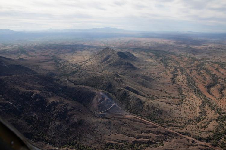
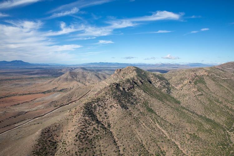
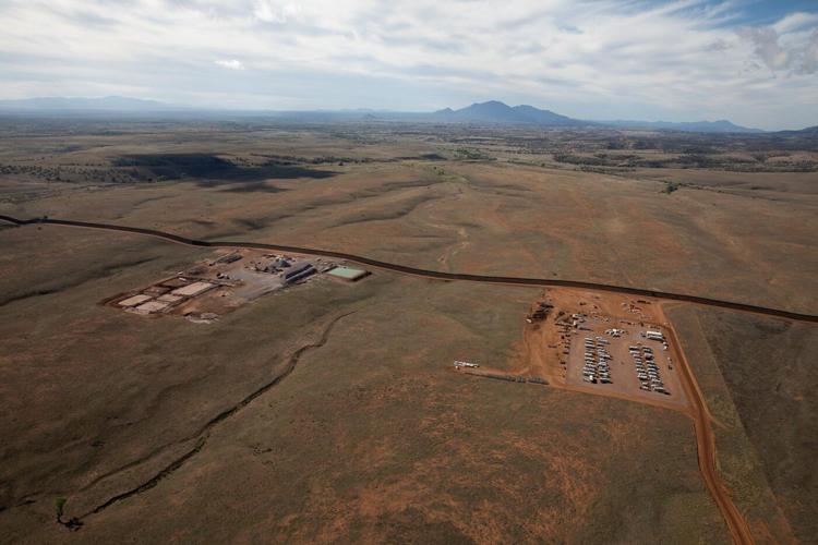
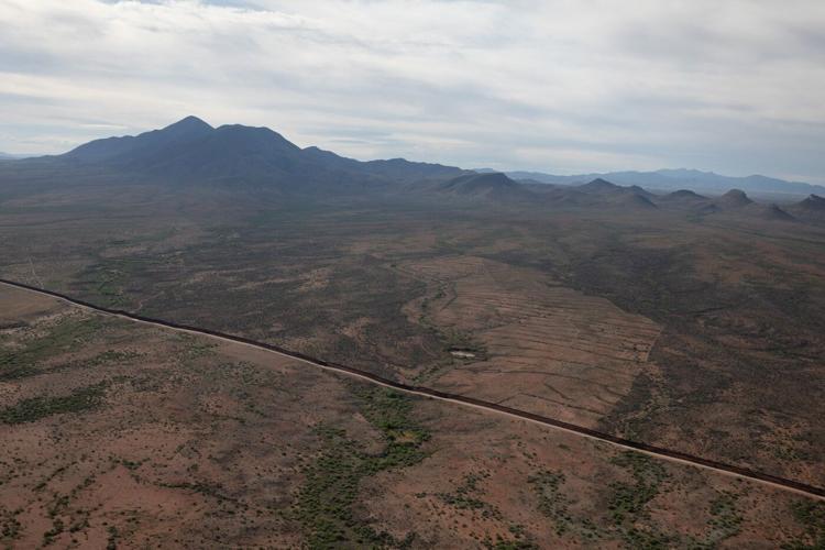
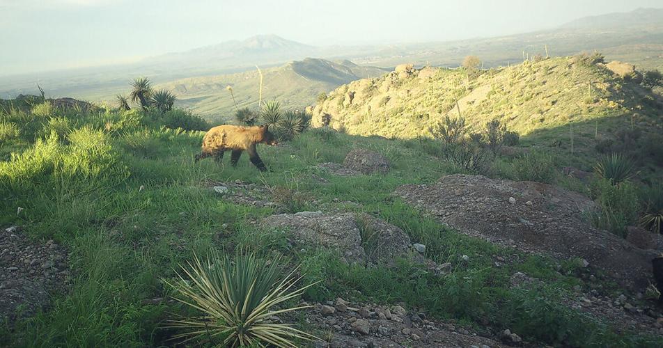
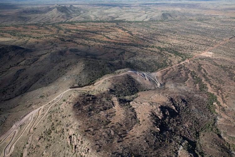
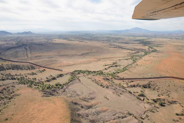
The border as we know it is changing daily as the Trump administration moves forward with its plans for more steel wall. Important wildlife corridors are being severed, creating major challenges for conservation in the years ahead. But at Sky Island Alliance we are resolute in our dedication to protecting our region’s 7,000+ species, bringing people together, and finding creative solutions using science and advocacy.
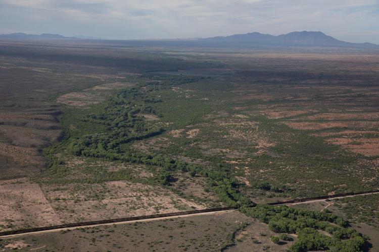
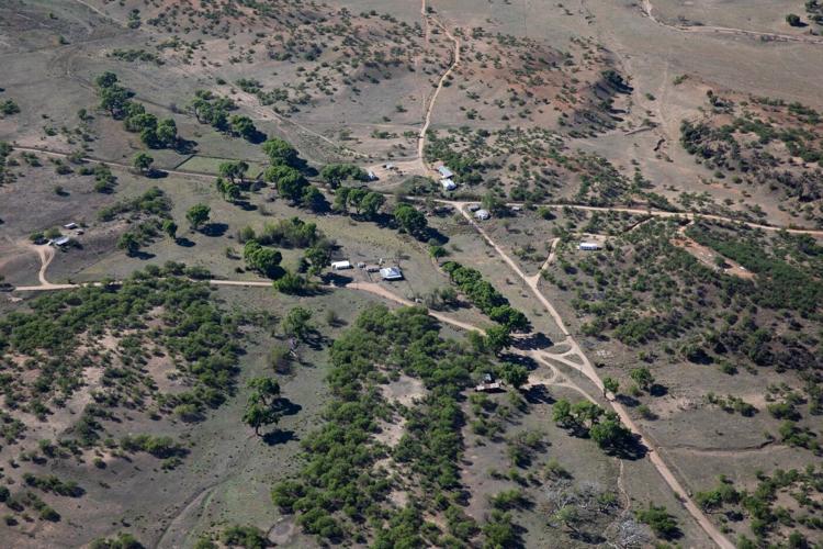
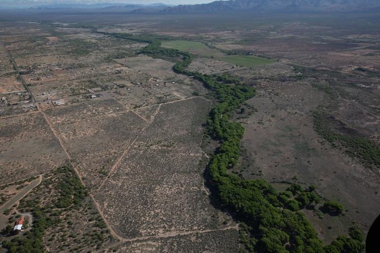
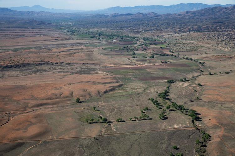
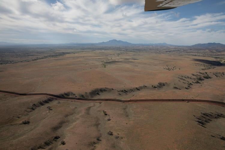
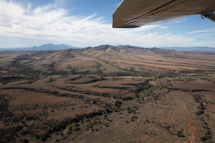
Below is a set of aerial photos taken on April 14, 2026, by photographer Greg Bedinger in partnership with Lighthawk. They flew east to west from Bisbee to Nogales to document these changes along our border.
The San Pedro River, which plays a crucial role in the survival and migration of wildlife across the Southwest, supports more than 250 bird species, 14 fish species, 84 mammal species, and 41 reptile and amphibian species in the valley. The river originates in Sonora and then winds its way into southeastern Arizona, forming one of the last large, undammed riparian ecosystems in the region.
People are also reading…
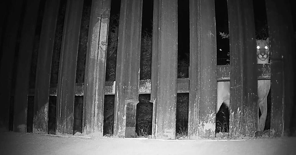
Near the San José Mountains by Naco, Sonora, a 30-foot-tall steel wall now bisects the landscape. Sky Island Alliance’s Border Wildlife Study has shown that this kind of pedestrian barrier stops 86% of wildlife crossings. Animals rely on these movements to find food, water, shelter, and mates. In the Huachuca Mountains, the wall approaches a rise in the terrain, and there is staging for more wall near the southern end of the Arizona National Scenic Trail. Looking back from this area offers a view southeast into Mexico.
Farther west in the San Rafael Valley, new wall construction is advancing. The Trump administration plans to add a second “double wall” along all but 38 miles of Arizona’s 373-mile boundary with Mexico, equipped with stadium lighting, fiber-optic cables, and surveillance cameras. Staging areas for border wall construction crews have been bulldozed on public land that is part of the Coronado National Forest.
In April 2026, sections of the peaceful San Rafael Valley looking southeast into Mexico still had only vehicle barriers, which allow wildlife to move freely through. Years of remote camera data from Sky Island Alliance’s Border Wildlife Study showed just a few people per month in the valley, including birders, bikers, hikers, hunters, border patrol, and potential migrants. Gray foxes were 10 times more prevalent than human pedestrians.
The Santa Cruz River, visible from the air as a ribbon of green, forms in the San Rafael Valley in Arizona, then flows south into Mexico before looping back north into the United States and proceeding to Tucson and beyond. In the quiet border town of Lochiel in April 2026, vehicle barriers were still in place. Three months later, border wall construction crews widened the border road and cut down three of four ancient cottonwood trees to make way for the 30-foot-tall steel walls. Protesters staging a tree-sit have so far delayed the felling of the fourth cottonwood, estimated to be 250 years old and home to threatened yellow-billed cuckoos.
Further resources
- Learn more about our Border Wildlife Study and help us keep the cameras running.
- Watch a series of interviews with SIA’s Eamon Harrity talking about the wall in the San Rafael Valley.
- Watch “A Week at the Border” to see wildlife’s natural movements in the San Rafael Valley in 2024.
- For the latest updates, follow us on social media and sign up for our e-news.


