
A lot's happened in the Tucson area over the past three decades or so: The University of Arizona's football stadium underwent multiple stages of expansion; Pima County built a trail system of more than 100 miles along major washes; and One South Church became Tucson's tallest building.
The Star is interested in tracking physical changes to the metro and surrounding area's landscape — with your help — by looking at over-time satellite images of the city through Carnegie Mellon University's time machine library.
The tool gives an interactive aerial tour of the world over a span of 33 years, using Google Earth Engine's collection of cloud-free mosaics gathered from five different satellites orbiting the planet.
Explore the birds-eye-view time lapse of Tucson and surrounding areas and tell us about the most noticeable changes.
People are also reading…
How to use the time lapse tool
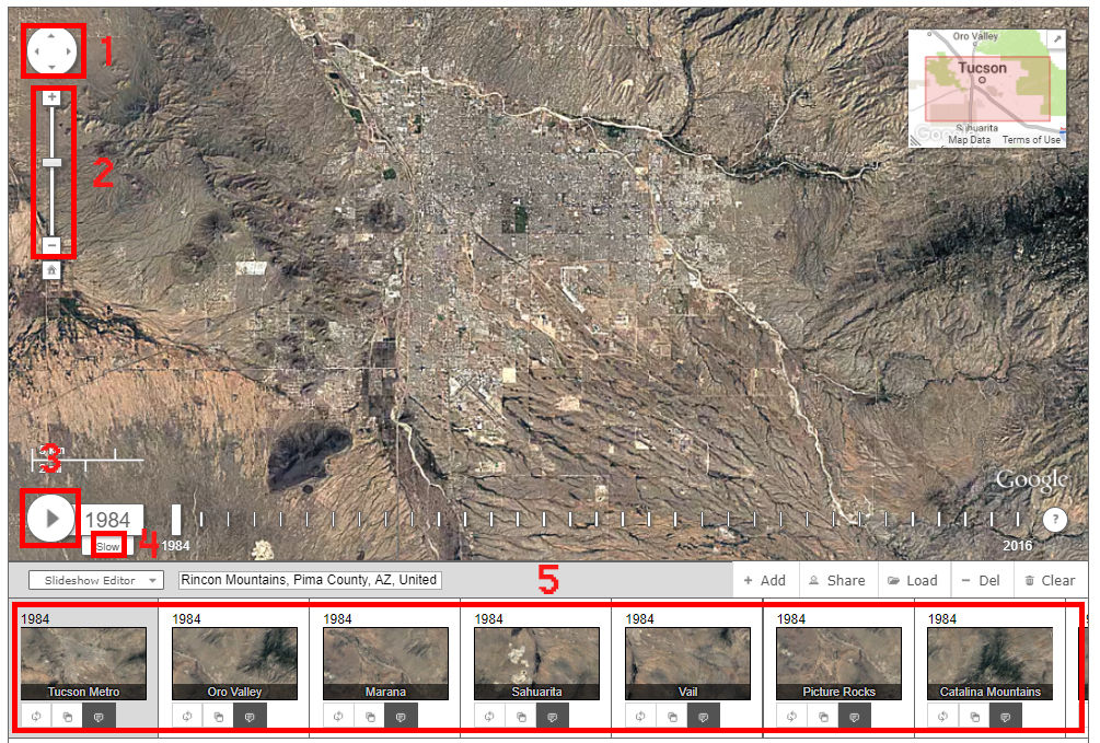
The tour does not work on mobile phones. You'll need to get to a computer.
Having trouble using the time lapse tool? Here are a few tips:
No. 1 allows you to move up and down, and left to right within the map.
No. 2 lets you zoom in and out.
No. 3 plays or pauses the motion of skipping through each year.
No. 4 adjusts the speed -- fast, medium or slow.
By clicking the tiles in No. 5, you can focus in on different areas.
How you can help
The Star is looking for observable changes that have drastically impacted the landscape of Tucson and surrounding areas that could turn into story ideas.
They could be environmental changes, large-scale developments or land use changes. For example, you can see that the Santa Catalina Mountains have become much less green over the last three decades.
See something interesting? Send an email to Star reporter Yoohyun Jung at yjung@tucson.com.
Contact reporter Yoohyun Jung at yjung@tucson.com or 520-573-4243. On Twitter: @yoohyun_jung

Yoohyun Jung
Data reporter