

Let's continue our time travel journey through the history of the Catalina Foothills and the Tanque Verde Valley. Last time we covered access to natural recreation areas.
Time-machine clock: AD 1933
First subdivisions
You noticed that in the late 1920s, Tucson developer John W. Murphey purchased nearly 8,000 acres of federal and state property in the Catalina Foothills.
In 1929 Murphey built an elite college preparatory boarding school for girls, right in the center of the Foothills, off today's North Hacienda del Sol Road.
A sufficient number of people lived in the Foothills near East River Road by 1931 that the Catalina Foothills School District was formed. Nine students attended classes in a garage. In 1939 Murphey will sell the district its first land for a school just north of East River Road.
People are also reading…
In the early 1930s Murphey teams up with Swiss-born architect Josias Joesler to begin development of what today we would call a master-planned community in the Catalina Foothills.
Their objective is to attract wealthy Easterners seeking a winter residence in the desert. Joesler designs large, luxurious Southwestern and Mexican-style homes on substantial lots, many with views of Tucson.
Construction starts in 1935 on Catalina Foothills Estates, just northeast of the intersection of North Campbell Avenue and East River Road.
For more than two decades Murphey and Joesler will collaborate on hundreds of buildings as Catalina Estates extends north, up the Foothills on both sides of today's North Campbell Avenue, and east along the mountains. There will eventually be 10 Catalina Foothills Estates subdivisions.
Roads and traffic
You watch as a series of bridges are built across the Rillito River and a network of roads is completed in the Foothills, enabling further housing development.
In the mid 1930s, you see North Sabino Canyon Road completed to provide access to the Sabino Canyon Recreation Area. By 1940 East River Road will extend along the Rillito River and Tanque Verde Wash all the way to North Sabino Canyon Road.
Also by 1940, North Campbell Avenue will reach northward into the Foothills. You will see North Hacienda del Sol Road and North Pontatoc Road by 1950, North Swan Road by 1960 and North First Avenue and North Craycroft Road by 1965.
East Ina Road will extend along the mountains from the west almost to North Campbell Avenue by 1955 and further east via East Skyline Drive to North Swan Road by 1965. East Sunrise Drive will be completed across the northeastern Foothills to North Sabino Canyon Road by 1975.
Traffic in the Catalina Foothills will increase rapidly. Over the years you will see road-improvement programs, such as the widening of North Swan Road, that will cause dissension from opponents who will derisively call them "freeway" projects.
The idea of a crosstown freeway through the Catalina Foothills will come up again and again, but will be beat back by proponents of "protecting" the Foothills.
Development expands
Residential expansion will generally be toward the east. By 2009 the Catalina Foothills will have more than 20 gated communities such as Skyline Country Club Estates, starting in the early 1960s. The private Skyline Country Club, together with a golf course, will open in 1963.
Rancho Sin Vacas will start development in the late 1970s, La Paloma Estates and Ventana Canyon Estates in the 1980s, Cobblestone in the 1990s and Sabino Mountain and Pima Canyon in the 2000s.
Several large non-gated subdivisions will also appear. They include Alta Vista, Cimarron Estates and Fairfield, starting in the 1970s and 1980s.
Apartments, townhomes and patio homes will be built in addition to single-family homes. Not all these developments will be greeted with happiness by longtime residents.
Some developments will support the increasing number of residents. Catalina Foothills High School will open in 1992.
Retirement and nursing facilities will be built to serve the older population — Santa Catalina Villas in 1988 and Freedom Inn at Ventana Canyon in 1998.
Two recreational parks will open on East River Road — George Mehl Foothills District Park in 1989, opposite North Pontatoc Road, and Brandi Fenton Memorial Park near North Dodge Blvd in 2005. La Paloma Urgent Care and Physicians Offices will start operating on East Sunrise Drive in late 2008.
Landmarks
Four Foothills landmarks will catch your attention: the familiar three radio transmission towers constructed just off North Swan Road (the dirt road extension, before paving) in 1951; the DeGrazia Gallery in the Sun built in 1965 on North Swan Road, north of East Sunrise Drive; the dramatic Rancho Sin Vacas entry portico, the former entrance arch from the El Conquistador Hotel on East Broadway Blvd, where the El Con shopping center sits now; and Anthony's in the Catalinas restaurant that will open in 1989 on the northeast corner of East Skyline Drive and North Campbell Avenue.
Businesses too!
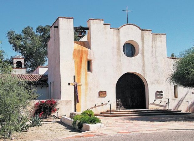
Commercial development in the Catalina Foothills will parallel residential development. By 2009 businesses will populate all but the northeast corner of the intersection of East River Road and North Campbell Avenue. On the northeast corner will still reside St. Philip's in the Hills Episcopal Church, designed by Joesler.
Shopping centers too will populate the Catalina Foothills — at East Sunrise Drive and North Swan Road, at East Sunrise Drive and North Kolb Road and at East River Road and North Craycroft Road.
The Dusenberry-River Library will open at East River Road and North Craycroft Road in 1991.
The largest Foothills shopping center, La Encantada, at East Skyline Drive and North Campbell Avenue, where you started your time-travel journey in Part 1 of this series, will open in 2004.
Are we done yet?
The Catalina Foothills' population grows rapidly. In 1997 you will see voters reject an attempt to incorporate the area as a separate city. The 2000 census will count more than 51,000 residents in ZIP codes 85718 and 85750.
By 2009 development is dense; little land is left for future building. In fact, you will see new housing start to creep higher onto the steeper slopes of the Foothills, at the edge of the Coronado National Forest, and you will wonder if this practice will continue unabated.
Next time: Development of the Tanque Verde Valley
Sources: Arizona Historical Society; Pima County Natural Resources, Parks and Recreation department; Long Realty Co.; RE/Max Majestic; and the 2000 U.S. Census. Special thanks to Sherie Broekema and Earl Wettstein.
About this series
This is the fourth in a five-part series on the history of the Catalina Foothills and the Tanque Verde Valley. Author Bob Ring has spent years collecting facts about the area. This series pulls together those tidbits along with information yielded from three months of intensive research.
Part 1: Formation and early history
Part 2: Exploration and initial settlement
Part 3: Access to natural recreation areas
Today, Part 4: Development of the Catalina Foothills
Part 5: Development of the Tanque Verde Valley
On StarNet: Read the series so far at www.azstarnet.com/ special/foothillshistory


