The cuts in Colorado River water use just approved by the U.S. government will not be as big as they seem — because in some cases Arizona, Nevada and California will still be allowed to use more water than they actually did in four of the last five years.
Some outside experts are concerned this means the cuts won't be enough to save the ailing river or to prevent its large lakes, Powell and Mead, from falling to critically low levels.
This is even though the 10-year plan the Bureau of Reclamation approved late last month ultimately could reduce river use enough to put the Central Arizona Project canal system out of business. It still won't save enough water to end the river's chronic shortfalls between use and supply.
People are also reading…
And the two-year plan also approved by the bureau, aimed at stabilizing Lakes Powell and Mead, still won't save enough water to keep river flows or the lakes from declining further, some experts say.
The 10-year plan will give Reclamation the legal ability to curb river water use in the river's Lower Basin — Arizona, Nevada and California — by up to 3 million acre-feet a year, if river conditions are bad enough to warrant cuts of that size. The two-year plan would curb the three states' water use by 1.25 million acre-feet a year and allow for more cuts if water users are willing to step up to the plate and take them in return for some federal money.
But in both cases, the cuts are structured in such a way that they won't reduce actual use of river water as much as the plans indicate. That's because the starting point for the reductions is the amount of water the three states are legally entitled to — an amount higher than they've used since 2014.

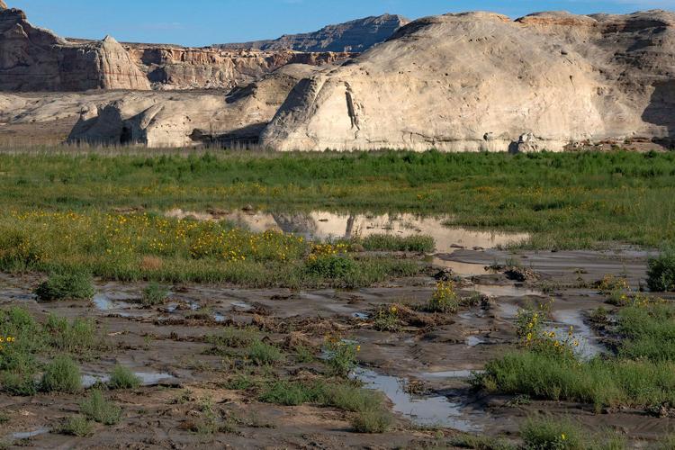
Wildflowers grow beside a puddle at the popular recreation area Lone Rock Beach on Lake Powell, which sits at its lowest-ever recorded water level, in Utah just over the state line from Page, Arizona.
Professor Jack Schmidt of Utah State University, a longtime river researcher, said of the plan for the Lower Basin's states to cut their use by 1.25 million acre-feet: "That’s a proposal which essentially prays for lots of snow."
"This is business as usual that isn't going to get us out of the existing crisis," said Schmidt.
If the coming winter only yields average or slightly below average runoff into the river from melting snows, the initial cuts "will not be sufficient to significantly alleviate anything, any aspect of the problem," said Schmidt, a senior research scientist and former director of the university's Center for Colorado River Studies.
Water researcher Brad Udall of Colorado State University noted grimly that Reclamation has issued two sets of highly unfavorable forecasts for how Lake Mead will fare over the next two years, based on two different scenarios for how much water the agency will release from Lake Powell at the Arizona-Utah border to Arizona, California and Nevada.
One forecast shows Lake Mead falling to 1,018 feet by next April from a current level of 1,038 feet. The other shows it falling to 1,006 feet by next June. Both those levels are well below 1,035 feet, the lowest level at which the vast majority of Hoover Dam's turbines can generate electricity.
Regardless of the savings achieved by the Lower Basin plan in either case, said Udall, "We are living very close to the edge of the cliff. The fires get hotter by the day under both these scenarios. The question is, how comfortable are we to living this close to the edge of the cliff?"
As the cuts are now structured, they will only improve conditions next year on the river and its big reservoirs "if we get better weather," said David Wegner, a retired Bureau of Reclamation official and a member of a National Academy of Sciences water advisory board. The past two years, river flows have declined significantly and Lakes Mead and Powell have fallen significantly due to hot, dry weather.
The Lower Basin states deserve credit for agreeing to cuts that reduce the amounts of river water they can legally use, Wegner said. But right now, "I think we're at more risk than we were last year. We're starting at lower elevation in both Lake Powell and Lake Mead."
Not all share their concerns
Their opinions aren't unanimous among outside Colorado River experts. Some say the impact of these plans on actual river flows is highly uncertain right now because weather conditions are so erratic.
And Arizona officials say, that for a number of reasons, they believe the cuts are still real, compared to historic levels of Lower Basin water use.
But looking strictly at the Lower Basin's current uses of the river and the expected reductions, the cuts aren't likely to be as big as they sound in both the short-term and the long-term. They will be subtracted from legally authorized water allocations for the three states — not from the states' current water uses. The authorized allocations are much higher than the current uses.
That is what the U.S. government in particular is legally required to do when making cuts affecting the Lower Basin states, said Eric Kuhn, a longtime Colorado River researcher and historian. The requirement dates back to the federal decree handed down in 1964 for river management that came as part of the landmark Arizona vs. California Supreme Court decision that gave this state a clear legal grip on its current Colorado River allocation, Kuhn said.
This disparity between stated cuts and actual cuts is particularly acute for the Lower Basin plan, in part because its impacts — or lack thereof — will be so immediate, coming when Lakes Powell and Mead are already at record low water levels.
Another factor reducing the immediate impact of these cuts is that in recent years, the three Lower Basin states have already cut their water use significantly.
The previous cuts were made first in response to a 2019 basin-wide agreement to reduce water use under a drought contingency plan. In just the past few years, additional cuts have been made by various entities, including Tucson Water, for which the water users received compensation payments appropriated by the federal Inflation Reduction Act.
The three states have cut their use so much that the cuts now approved under the two-year Lower Basin plan won't reduce their actual use below their annual average use over the past five years. But because many of the earlier cuts would have gone away next year, the water use in the Lower Basin would have been much higher next year without the cuts imposed by the new Lower Basin plan, Arizona water officials say.
Overall, the Lower Basin states haven't used their full allocation of 7.5 million acre-feet a year of river water — which is the starting point for the new cuts — since 2014, when they used 7.649 million, Bureau of Reclamation records show. (In 2015, the three states came very close to using that much, finishing the year with 7.448 million acre-feet used.)
The most relevant question about the plan's Lower Basin cuts is "will they be enough?" agreed Kathryn Sorensen, a senior researcher for Arizona State University's Kyl Center for Water Policy.

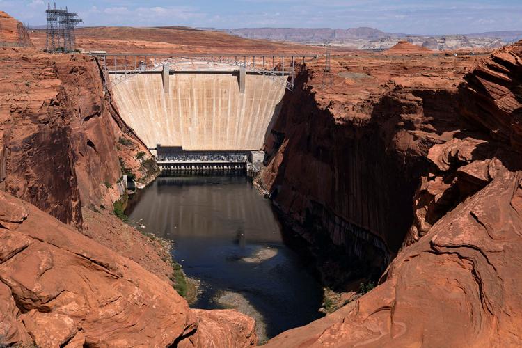
A view of Glen Canyon Dam as the critical reservoir Lake Powell sits at its lowest-ever recorded water level, in Glen Canyon National Recreation Area near Page, Arizona, on Aug. 30.
"We don’t know what the snowpack is going to be. if El Niño delivers it’s probably fine. If it doesn’t it’s probably not enough," said Sorensen, referring to the natural climate pattern coming this fall and winter that typically brings more rainfall to the Southwest but has an unpredictable effect on Colorado River Basin snowpack.
What the numbers show
Here are specifics on how the new cuts will work, both in the short and long terms:
The bureau's 10-year plan would slash the Lower Basin's share of the Colorado River by up to 3 million acre-feet a year, if water levels at Lakes Mead and Powell fall low enough to threaten their ability to generate electricity or to risk damaging crucial infrastructure.
Three million acre-feet a year — equivalent to about 30 years' worth of CAP water use by Tucson Water customers — would cut the Lower Basin's authorized take from the Colorado from 7.5 million acre-feet to 4.5 million acre-feet a year, or 40%.
At a public meeting in Phoenix late last month, Arizona Department of Water Resources Director Tom Buschatzke said a cut of that size would wipe out around 66% of Arizona's entire 2.8 million acre-feet Colorado River allocation. That's an allocation it secured by fighting California in court during the 1950s and 1960s.
A cut that size likely would force cancellation of all CAP water deliveries to the Tucson and Phoenix metro areas as well as to tribes and farmers who use that water, state and CAP officials have said. They have called such a cut "devastating" to Arizona, one that would seriously damage its economy.
But the fact remains that in the past few years, the Lower Basin states, and Arizona in particular, have used far less river water than they are legally entitled to use.
From 2021 through 2025, the Lower Basin states used an annual average of about 6.2 million acre-feet. From 2022 through 2026, including forecasted water use for 2026, the average annual use has been 6 million.
When the 6.2 million figure is used as a baseline, the 4.5 million acre-feet the Lower Basin will get will represent only a 27% cut from the basin's current use, not the 40% cut that would be triggered by a 3 million acre-foot cut from 7.5 million to 4.5 million acre-feet.
Reclamation said last week that the entire Lower Basin will get 6.25 million acre-feet a year in both 2027 and 2028. That's 1.25 million acre-feet a year less than its legally authorized use of 7.5 million acre-feet a year.
But again, the 6.25 million acre-feet is actually a little more water than what the Lower Basin states have used on average over the past five years through 2026, which is about 6.04 million acre-feet a year.
The Lower Basin plan also calls for Arizona, California and Nevada to come up with additional water conservation measures, to save another 700,000 acre-feet over two years on top of the 2.5 million in cut they've already agreed to take. So far, six entities including the city of Tucson have agreed to take nearly 25% of those 700,000 acre-feet in cuts.
But even if the three states find another 700,000 acre-feet total in water savings over two years, that would still amount to barely 10% of the annual gap between the river's natural supply and people's demands for the water.
Still, ASU's Sorensen said she thinks the additional 700,000 acre-feet in cuts on top of the plan's original cuts will benefit the reservoirs in the short term.
"It’s just not much more than what the basin has been doing in the last couple years, and in the last couple years, what we've been doing hasn’t been enough," she said.
Arizona officials say the cuts are real
In response to questions about the Lower Basin plan, specifically, some Arizona officials have strongly defended the plan and said they believe its cuts will make a difference.
ADWR Director Buschatzke, for instance, said he believes the cuts will still be real cuts because the programs under which the basin states and CAP in particular have previously cut their use will be going away starting next year, once Reclamation's new operating guidelines for the river kick in.
"The agreements under which conservation has been done will be gone. They're from the past. We'll be cutting from actual use. (Without the new cuts) we would be doing actual use as if the cuts haven’t been made," Buschatzke said.

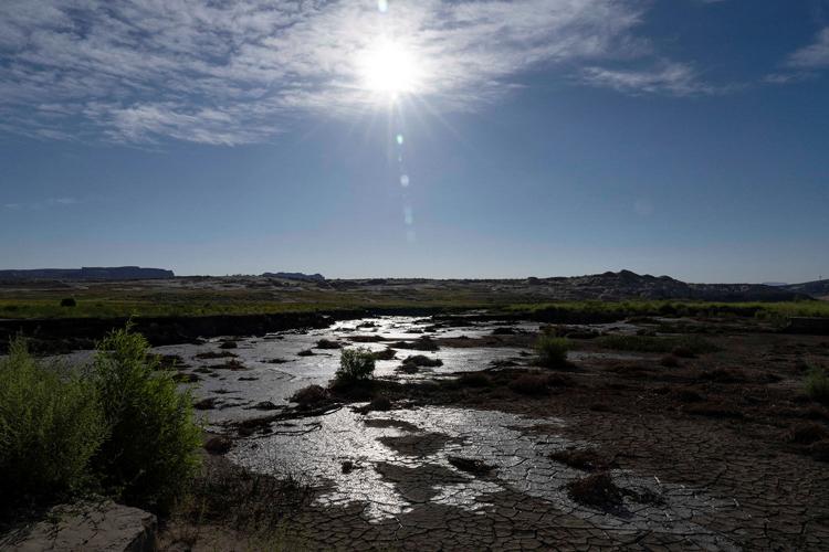
A section of lake bed dries out as Lake Powell, the critical reservoir, sits at its lowest-ever recorded water level in Utah, just over the state line from Page, Arizona, on Aug. 30.
Terry Goddard, president of CAP's governing board, noted that while some of the past cuts were voluntary, the 1.25 million acre-feet under the Lower Basin plan will be mandatory.
The 760,000 acre-feet cuts for Arizona, California and Nevada under the Lower Basin plan are 250,000 acre-feet more than the cuts they have been taking in recent years due to the drought contingency plan approved in 2019, he noted.
"Our clear understanding is we are looking to take significant cuts," said Goddard, a former Arizona attorney general. "We understand in terms of the emergency we're in, you have to take very strong measures."
'Can't keep doing it the easy way'
But Wegner said the federal government's approval of the two-year Lower Basin plan shows what it's trying to do is take easy steps, without ordering large cuts.
Wegner said that what researchers Schmidt, Kuhn and others are saying "is that we can't keep doing it the easy way. That point is very hard to sell to the general public because people don't understand what you are talking about."
The numbers show that the cuts approved so far won't be enough to adequately protect the river and its reservoirs, he said.
"But this is difficult stuff for people to not only understand but to embrace (by) taking action," he said.
Sharon Megdal, the University of Arizona's top water researcher, said she believes the cuts could have turned out much worse for Arizona, based on Reclamation's initial blueprint and framework for how the reductions could be achieved.
At the same time, Megdal said she too doesn't know if the current cuts will be enough to keep the two lakes from falling so low that Hoover and Glen Canyon dams will no longer be able to generate electricity.
"I think that these new cuts are based on some optimism about not having as bad (natural flows into the river) as last year," said Megdal, director of UA's Water Resources Research Center. If federal officials are wrong, "It’s going to be a tough year. 2028 is going to be a very tough year," she said.
Asked how successful he thinks the Lower Basin plan will be at protecting the reservoirs, Buschatzke said, "There’s no definitive answer. We can’t predict Mother Nature."
But if you look at past records of how the river and its reservoirs have behaved, in 90% of weather scenarios, the plan will be enough to protect the river, he said.
But if the weather is drier than 90% of past weather records, he and several researchers noted that the bureau may well have to take additional actions to cut water use further.
In an email to the Star, the bureau held out the possibility of making deeper cuts should reservoir levels keep falling.
Under its new operating guidelines, if any of the bureau's monthly forecasts show the most likely scenario is for Lake Mead to fall below 1,010 feet within 12 months, the Interior secretary "shall consult and coordinate with" the seven river basin states, its 30 tribes and other affected parties to consider additional actions to address bad river conditions.
Summing up the river's current situation, Udall said, "If we have an El Niño that brings us big runoff, it buys us a year."
But based on Reclamation's own forecasts, the water use cuts planned for the coming year "don’t stop the bleeding" after that, he said.
"The patient is going to die if we don’t stop the bleeding. At some point, we are going to have to look at big, more serious cuts to stabilize these reservoirs."
Contact Tony Davis at 520-349-0350 or tdavis@tucson.com. Follow Davis on Twitter@tonydavis987.

Tony Davis
Reporter


 Collapse of Colorado River reservoirs: A wake-up call and a flashing red light