The city is in the beginning stages of making a plan for a swath of undeveloped state trust land on the south side of Tucson's city limits.
Right now, the Southlands area lacks a cohesive land use plan, Planning and Development Services Director Koren Manning told the council Wednesday. Without a vision for what kind of housing, businesses and infrastructure can exist there, the city risks giving up control of the region as part of the city’s bigger infrastructure and climate goals, she said.
Notably, the area includes the development of the Beale Infrastructure data center known as Project Blue. The controversy over its’ approval led to wider city conversations over land use in the region, according to city documents.
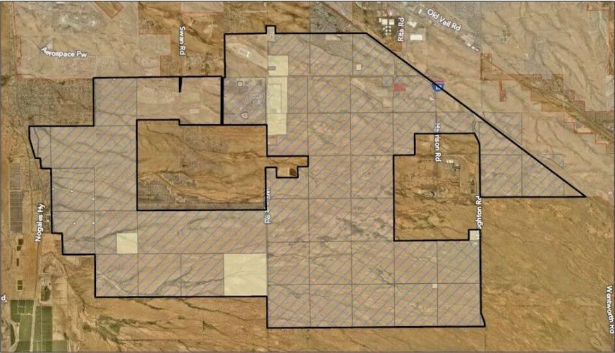
The area roughly spans from South Nogales Highway east to the Houghton Road alignment, and from Interstate 10 south to about Pima Mine Road.
People are also reading…

Tucson is in early planning stages to develop a region of the southernmost city limits known as the Southlands.
A freeway connection between I-10 and Interstate 19 called the Sonoran Corridor is also in early planning stages and will also shape development, Manning said.
The first stage of planning, including the formation of a stakeholder group, is expected to take at least two years.