

The barrage of numbers and statistics can get overwhelming, but fundamentally, a busy Atlantic hurricane season is expected. Public and private organizations have developed methods to determine how busy a season will be. There are nuances in all of them, but there are two overwhelming reasons why the season may be busy.
First is the transition to La Niña — think of it like an ignition switch. This is a periodic cooling of the water in the central and eastern Pacific Ocean near the equator. That correlates to a decrease in wind shear across the Atlantic Ocean, meaning there is less of a change in wind speed and direction through the depth of the atmosphere in the area where hurricanes form.
Less wind shear keeps clusters of showers and thunderstorms more concentrated as they move over the warm Atlantic waters, allowing areas of low pressure to form. These areas of low pressure can grow to become full tropical storms and hurricanes. When the shear is higher, the storms are vertically torn apart due to the differing wind speeds and directions.
People are also reading…

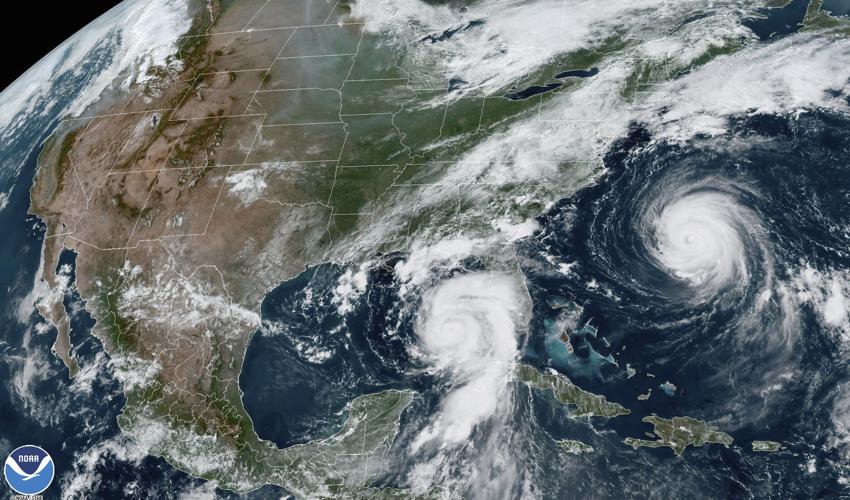
Hurricane Idalia, center, approaches Florida's Gulf Coast Aug. 29, 2023, as Hurricane Franklin, right, moves along the East coast of the United States, southwest of Bermuda.
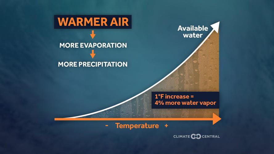
The second reason is the exceptionally warm water now in the North Atlantic — think of it as the fuel. Since consistent satellite records began in 1981 and up until 2022, the average water temperature range had been consistently between 69 and 71 degrees Fahrenheit at the start of the hurricane season.
Last year it was 71.6, and this year, it is almost 72. A degree may not seem like much, but given the previous consistency averaged over such a large area and over such a long time, the jump over the last two years is startling, and this one of the fingerprints of the warming climate.

Using an average from 1991 to 2020, about 14 systems each season get strong enough to become a tropical storm and take on a name. The National Oceanic and Atmospheric Administration, the parent organization of the National Weather Service, expects between 17-25 such storms this year. The Tropical Meteorology Project at Colorado State University, which has been issuing these outlooks for 40 years, expects 23 storms this year.
Both organizations expect about half of those named storms to further strengthen into hurricanes.
From a historical perspective, a hurricane season has produced more than 20 named storms only three times since records began in 1851: 2005, 2020 and 2021. Last year produced 20 storms, and that was not a La Niña year. Quite the opposite, there was an El Niño, meaning more wind shear across the Atlantic.

A destroyed home is destroyed Aug. 30, 2023, in Keaton Beach, Fla., following the passage of Hurricane Idalia.
Unfortunately, we can have a good overview of a season, but there is still very limited, if any, skill in knowing where a place will get hit later in the season. That will depend on relatively smaller things that change more quickly during the season.
In terms of storm location, steering winds can drive storms to move in a broad direction during a season, but the precise nature of those winds typically will not be known more than one or two weeks in advance. With regard to storm strength — and genesis — winds from the east periodically bring large amounts of dust from the Sahara Desert and send it into the atmosphere over the Atlantic. This dust dries out the middle levels of the atmosphere, making it more difficult for storms to form.

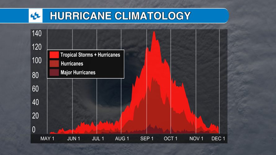
Although the season starts June 1, the most active part of the season is mid-August through mid-October. So if the season seems quiet through the end of July, do not be surprised.
The best thing to do is simply be aware that the season is going to be especially busy. But also remember that storm impacts go far from the immediate coastline. There is emerging evidence suggesting the average forward speed of storms is slowing down as the climate warms. Plus, warmer air and water that come with the warming climate lead to more intense precipitation.

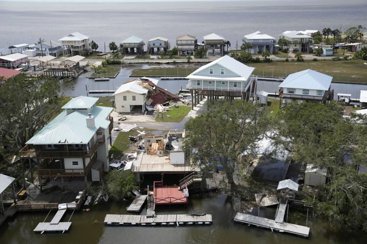
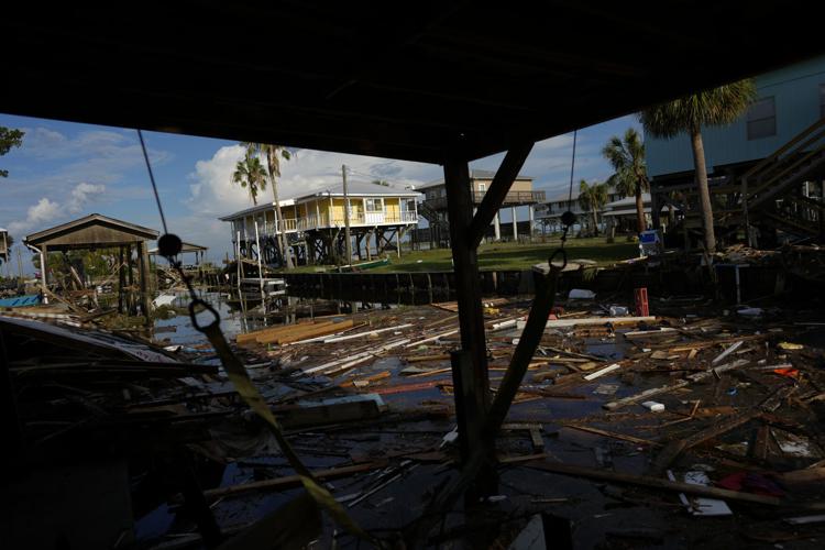
Heavy rain that lasts longer over one location raises the risk of flooding, and this is true for all storms regardless of their category. Because most storms do not attain wind speeds sending them into the Category 4 and 5 realm, flooding is more of a long term threat from tropical systems. For sure, wind damage is devastating, but it is more concentrated in the eyewall — the area of most intense winds encircling the calmer eye.
No matter the total storms by the end of the season, it only takes one storm to make it a bad season — which ends on Nov. 30.
Sean Sublette is the chief meteorologist for the Richmond Times-Dispatch in Virginia.

Debris from destroyed homes and structures float in a canal Aug. 31, 2023, in Horseshoe Beach, Fla., one day after Hurricane Idalia passed through.


