

A rather long duration lake-effect event will be unfolding Wednesday night into Thursday night. Moderate to heavy snow will be coming down in the lake band. One of the forecast problems is the movement, or oscillation, of the band once it develops Wednesday evening.

As Buffalo and the eastern suburbs continue to dig out today, a winter weather advisory remains in effect until 7 a.m. Saturday for southern Erie, Chautauqua and Cattaraugus counties.
The 2014 November storm had something this lake storm won’t have: “stationarity.” It’s what made the November 2014 band so paralyzing from South Buffalo into central Erie County. The incredibly intense band just stayed in place, hour after hour, resulting in accumulations as deep as 7 feet in some places south of the city. The stationarity, which was modeled well in advance, made the forecasting of the huge event, an easier call, compared to what will be a lake-effect event of less (but still substantial) impact.
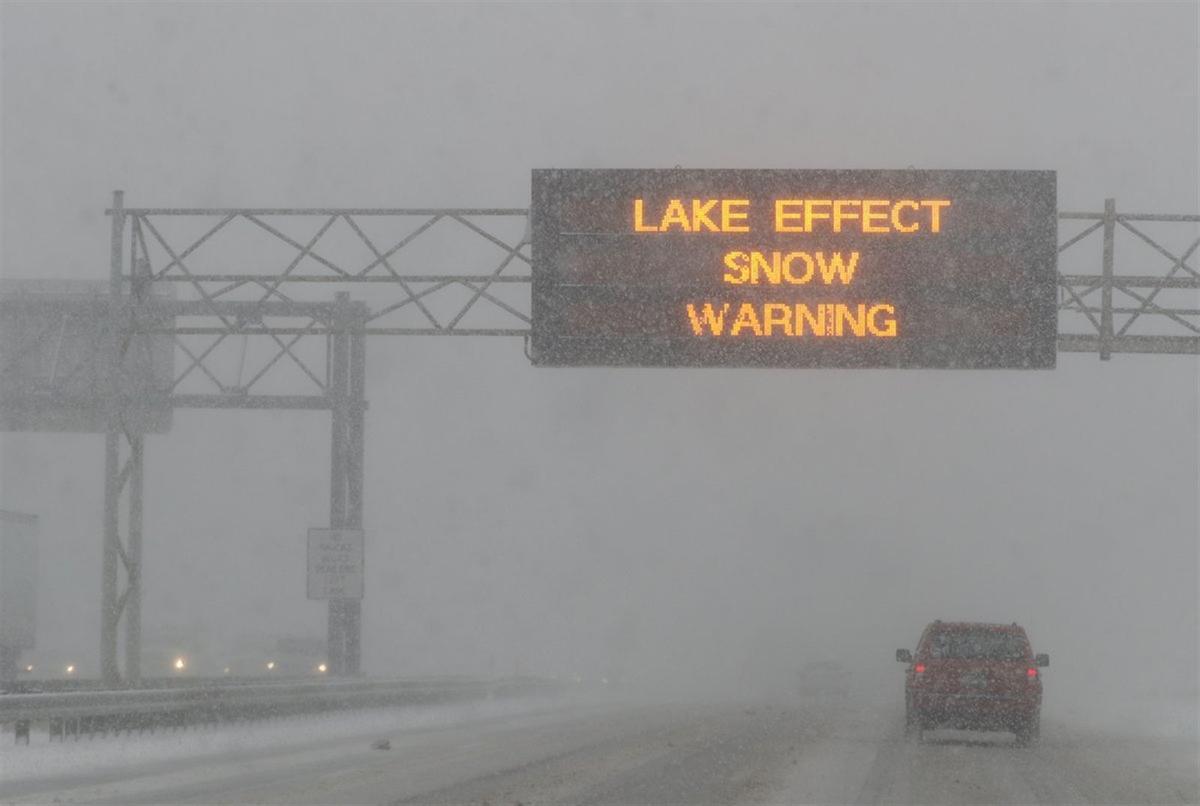
What had been a winter storm watch was elevated early Wednesday to a lake-effect snow warning for Erie and Genesee counties, meaning confidence had finally grown high enough to raise the flag from 7 p.m. Wednesday to 1 a.m. Friday. A lesser winter weather advisory has been issued for Wyoming County. Southwest winds will also grow strong enough behind a cold front to produce some modest Lake Erie shoreline flooding from Chautauqua to northern Erie counties overnight.
People are also reading…
Let’s get down to details. A vigorous low pressure system will push its cold front across our region late Wednesday afternoon. A warming brisk southerly flow ahead of the front will give way to strengthening southwest winds behind the front, ushering in much colder air and putting the lake-effect machine into operation.
Once the lake snow starts to organize, the precise direction of low level winds’ orientation is critical to the forecasting of targeted areas, as shown in a document written long ago by the then-Buffalo National Weather Service’s Tom Niziol.
Just look at the difference of a mere 5 degrees on the compass between 250 and 255 degrees. A separate 100,000-plus people are involved in that differentiation, which can be brought on by an error of only 5 degrees in wind direction.
Most of the models late Wednesday morning indicate the lake band will be slow to organize this evening, probably intensifying between 10 p.m. and midnight, starting out near or just north of Buffalo.
But an oscillation to the south of Buffalo occurs overnight in short order from a temporary subtle wind shift to more west-southwest.
If this small shift occurs, it lessens the total overnight accumulation in any one location in the warning area, with a maximum of 4-7 inches in a smaller area closer to Buffalo and immediate suburbs northeast, east and just south of the city by dawn.
This moderate overnight accumulation will be complicated by stronger winds at 20-30 mph with a few gusts of 40, which may produce near whiteouts before and into the morning drive. Snowfall rates will be moderate to occasionally heavy within the band, and there may be a rumble of thunder.
During the morning, the band will trek northward again, with southwest winds coming down a tad to 15-25 mph, still causing blowing and drifting within the band.
By around 4 p.m., this model has the band near Buffalo and the northern and northeastern suburbs, although other models have the band about 7-10 miles farther south than this depiction, which is the one I favor.
Fortunately, winds will gradually diminish to 10-20 mph Thursday afternoon, mitigating the blowing snow for the evening commute. Some additional accumulating lake snow will persist into Thursday evening, with a lighter wind. This lake snow has a chance of intermingling with some light synoptic snow from a developing storm well to our south, headed toward the Atlantic Coast.
On Friday, a northwest flow will bring lake snow showers from Lakes Huron, Erie and Ontario, which may help out the ski resorts and occasionally keep travel tricky on the Niagara Frontier.
Thursday daytime and nighttime additional snow totals may be in the range of 6-8 inches, as seen by Buffalo NWS, with which I am in agreement.
By the time we get into Friday, a small area will have a maximum range of 8-15 inch totals.
The snowfall rates will generally be moderate to occasionally heavy in the band. With lessening winds by Thursday afternoon, the snow should be more manageable for the commute home. Barring any jackknifed tractor trailer incidents, this storm will have a disruptive impact, but it should not be a paralyzing event.
After a mostly sunny Saturday with readings edging up from Thursday’s upper 20s and Friday’s low 20s to the low 30s, Sunday will bring occasional rain showers and windy conditions, with a game-time temperature near 40.
However, you’ll have to factor in a wind chill with west-southwest winds of 20-30 mph and a few stronger gusts.
Another surge of arctic air will arrive early next week behind a late Sunday cold front. A northwest flow will again bring scattered lake snow showers from the three lakes Monday, with some additional help for the ski resorts. High temps will reach only 17-20 both Monday and Tuesday, accompanied by a nasty wind chill on Monday.
Some moderation back to the low 30s will arrive by Wednesday. Climate Prediction Center temperature probabilities still favor below-average readings in our region most days in the six- to 10-day outlook.

